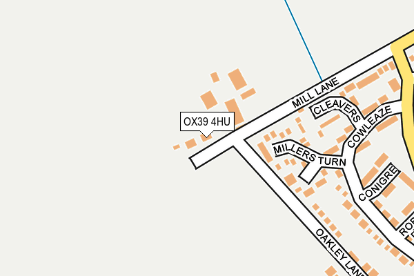
OX39 4HU is located in the Chinnor electoral ward, within the local authority district of South Oxfordshire and the English Parliamentary constituency of Henley. The Sub Integrated Care Board (ICB) Location is NHS Buckinghamshire, Oxfordshire and Berkshire West ICB - 14Y and the police force is Thames Valley. This postcode has been in use since October 2000.


GetTheData
Source: OS OpenMap – Local (Ordnance Survey)
Source: OS VectorMap District (Ordnance Survey)
Licence: Open Government Licence (requires attribution)
| Easting | 474519 |
| Northing | 200834 |
| Latitude | 51.701312 |
| Longitude | -0.923095 |
GetTheData
Source: Open Postcode Geo
Licence: Open Government Licence
| Country | England |
| Postcode District | OX39 |
➜ See where OX39 is on a map ➜ Where is Chinnor? | |
GetTheData
Source: Land Registry Price Paid Data
Licence: Open Government Licence
Elevation or altitude of OX39 4HU as distance above sea level:
| Metres | Feet | |
|---|---|---|
| Elevation | 110m | 361ft |
Elevation is measured from the approximate centre of the postcode, to the nearest point on an OS contour line from OS Terrain 50, which has contour spacing of ten vertical metres.
➜ How high above sea level am I? Find the elevation of your current position using your device's GPS.
GetTheData
Source: Open Postcode Elevation
Licence: Open Government Licence
| Ward | Chinnor |
| Constituency | Henley |
GetTheData
Source: ONS Postcode Database
Licence: Open Government Licence
| Hailey Croft (Estover Way) | Chinnor | 286m |
| Hailey Croft (Estover Way) | Chinnor | 298m |
| Estover Way (Mill Lane) | Chinnor | 357m |
| Estover Way (Mill Lane) | Chinnor | 357m |
| Cowleaze (Estover Way) | Chinnor | 463m |
GetTheData
Source: NaPTAN
Licence: Open Government Licence
GetTheData
Source: ONS Postcode Database
Licence: Open Government Licence


➜ Get more ratings from the Food Standards Agency
GetTheData
Source: Food Standards Agency
Licence: FSA terms & conditions
| Last Collection | |||
|---|---|---|---|
| Location | Mon-Fri | Sat | Distance |
| Middle Way | 16:00 | 09:00 | 482m |
| Oakley Road | 16:30 | 10:00 | 619m |
| Crossroads Lower Road | 16:15 | 08:30 | 874m |
GetTheData
Source: Dracos
Licence: Creative Commons Attribution-ShareAlike
The below table lists the International Territorial Level (ITL) codes (formerly Nomenclature of Territorial Units for Statistics (NUTS) codes) and Local Administrative Units (LAU) codes for OX39 4HU:
| ITL 1 Code | Name |
|---|---|
| TLJ | South East (England) |
| ITL 2 Code | Name |
| TLJ1 | Berkshire, Buckinghamshire and Oxfordshire |
| ITL 3 Code | Name |
| TLJ14 | Oxfordshire CC |
| LAU 1 Code | Name |
| E07000179 | South Oxfordshire |
GetTheData
Source: ONS Postcode Directory
Licence: Open Government Licence
The below table lists the Census Output Area (OA), Lower Layer Super Output Area (LSOA), and Middle Layer Super Output Area (MSOA) for OX39 4HU:
| Code | Name | |
|---|---|---|
| OA | E00145754 | |
| LSOA | E01028614 | South Oxfordshire 005C |
| MSOA | E02005962 | South Oxfordshire 005 |
GetTheData
Source: ONS Postcode Directory
Licence: Open Government Licence
| OX39 4JZ | Millers Turn | 130m |
| OX39 4TA | Cleavers | 176m |
| OX39 4JY | Conigre | 242m |
| OX39 4TD | Cowleaze | 250m |
| OX39 4TE | Estover Way | 315m |
| OX39 4TF | Estover Way | 316m |
| OX39 4TB | Cowleaze | 318m |
| OX39 4TS | Hailey Croft | 332m |
| OX39 4JX | Robins Platt | 335m |
| OX39 4TL | Foresters | 394m |
GetTheData
Source: Open Postcode Geo; Land Registry Price Paid Data
Licence: Open Government Licence