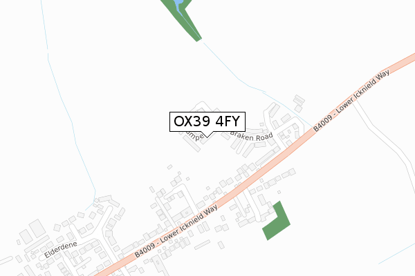
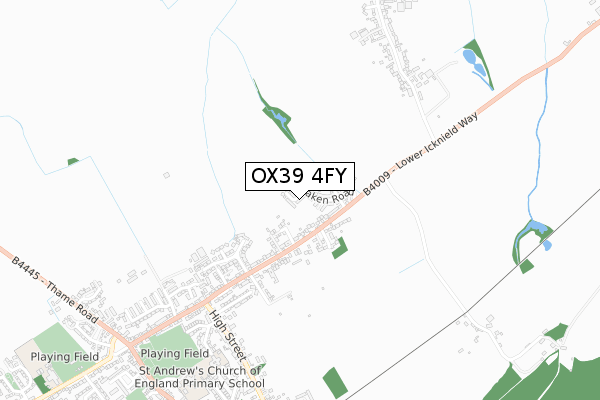
OX39 4FY is located in the Chinnor electoral ward, within the local authority district of South Oxfordshire and the English Parliamentary constituency of Henley. The Sub Integrated Care Board (ICB) Location is NHS Buckinghamshire, Oxfordshire and Berkshire West ICB - 14Y and the police force is Thames Valley. This postcode has been in use since December 2019.


GetTheData
Source: OS Open Zoomstack (Ordnance Survey)
Licence: Open Government Licence (requires attribution)
Attribution: Contains OS data © Crown copyright and database right 2024
Source: Open Postcode Geo
Licence: Open Government Licence (requires attribution)
Attribution: Contains OS data © Crown copyright and database right 2024; Contains Royal Mail data © Royal Mail copyright and database right 2024; Source: Office for National Statistics licensed under the Open Government Licence v.3.0
| Easting | 475895 |
| Northing | 201830 |
| Latitude | 51.710085 |
| Longitude | -0.902949 |
GetTheData
Source: Open Postcode Geo
Licence: Open Government Licence
| Country | England |
| Postcode District | OX39 |
➜ See where OX39 is on a map ➜ Where is Chinnor? | |
GetTheData
Source: Land Registry Price Paid Data
Licence: Open Government Licence
| Ward | Chinnor |
| Constituency | Henley |
GetTheData
Source: ONS Postcode Database
Licence: Open Government Licence
15, RUMPENNY, CHINNOR, OX39 4FY 2021 4 FEB £740,000 |
5, RUMPENNY, CHINNOR, OX39 4FY 2021 22 JAN £725,000 |
3, RUMPENNY, CHINNOR, OX39 4FY 2021 21 JAN £712,500 |
4, RUMPENNY, CHINNOR, OX39 4FY 2020 4 DEC £600,000 |
2, RUMPENNY, CHINNOR, OX39 4FY 2020 25 NOV £600,000 |
17, RUMPENNY, CHINNOR, OX39 4FY 2020 29 OCT £870,000 |
7, RUMPENNY, CHINNOR, OX39 4FY 2020 22 OCT £600,000 |
11, RUMPENNY, CHINNOR, OX39 4FY 2020 2 OCT £770,000 |
1, RUMPENNY, CHINNOR, OX39 4FY 2020 30 JUN £600,000 |
9, RUMPENNY, CHINNOR, OX39 4FY 2020 26 MAR £740,000 |
GetTheData
Source: HM Land Registry Price Paid Data
Licence: Contains HM Land Registry data © Crown copyright and database right 2024. This data is licensed under the Open Government Licence v3.0.
| Elderdene (Lower Icknield Way) | Chinnor | 356m |
| Elderdene (Lower Icknield Way) | Chinnor | 394m |
| The Red Lion Ph (High Street) | Chinnor | 583m |
| The Red Lion Ph (High Street) | Chinnor | 598m |
| Springfield Gardens (Lower Road) | Chinnor | 700m |
| Princes Risborough Station | 4.2km |
GetTheData
Source: NaPTAN
Licence: Open Government Licence
GetTheData
Source: ONS Postcode Database
Licence: Open Government Licence


➜ Get more ratings from the Food Standards Agency
GetTheData
Source: Food Standards Agency
Licence: FSA terms & conditions
| Last Collection | |||
|---|---|---|---|
| Location | Mon-Fri | Sat | Distance |
| Lower Icknield Way | 16:15 | 10:15 | 451m |
| Henton | 16:00 | 08:30 | 812m |
| Crossroads Lower Road | 16:15 | 08:30 | 871m |
GetTheData
Source: Dracos
Licence: Creative Commons Attribution-ShareAlike
The below table lists the International Territorial Level (ITL) codes (formerly Nomenclature of Territorial Units for Statistics (NUTS) codes) and Local Administrative Units (LAU) codes for OX39 4FY:
| ITL 1 Code | Name |
|---|---|
| TLJ | South East (England) |
| ITL 2 Code | Name |
| TLJ1 | Berkshire, Buckinghamshire and Oxfordshire |
| ITL 3 Code | Name |
| TLJ14 | Oxfordshire CC |
| LAU 1 Code | Name |
| E07000179 | South Oxfordshire |
GetTheData
Source: ONS Postcode Directory
Licence: Open Government Licence
The below table lists the Census Output Area (OA), Lower Layer Super Output Area (LSOA), and Middle Layer Super Output Area (MSOA) for OX39 4FY:
| Code | Name | |
|---|---|---|
| OA | E00145756 | |
| LSOA | E01028615 | South Oxfordshire 005D |
| MSOA | E02005962 | South Oxfordshire 005 |
GetTheData
Source: ONS Postcode Directory
Licence: Open Government Licence
| OX39 4EA | Lower Icknield Way | 189m |
| OX39 4EB | Lower Icknield Way | 238m |
| OX39 4AU | Hernes Oak | 244m |
| OX39 4DQ | Wheatfield | 258m |
| OX39 4EJ | Elderdene | 296m |
| OX39 4EE | Elderdene | 374m |
| OX39 4EQ | Elderdene | 385m |
| OX39 4EG | Elderdene | 404m |
| OX39 4EP | The Lane | 407m |
| OX39 4EN | Holland Close | 464m |
GetTheData
Source: Open Postcode Geo; Land Registry Price Paid Data
Licence: Open Government Licence