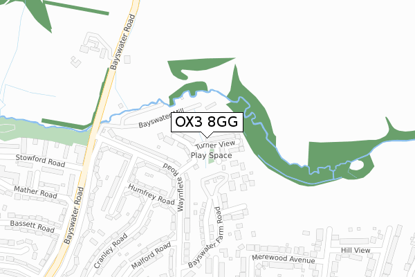
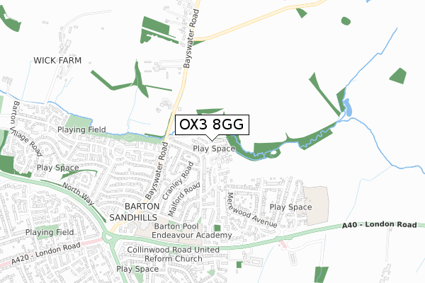
OX3 8GG is located in the Forest Hill & Holton electoral ward, within the local authority district of South Oxfordshire and the English Parliamentary constituency of Henley. The Sub Integrated Care Board (ICB) Location is NHS Buckinghamshire, Oxfordshire and Berkshire West ICB - 10Q and the police force is Thames Valley. This postcode has been in use since December 2017.


GetTheData
Source: OS Open Zoomstack (Ordnance Survey)
Licence: Open Government Licence (requires attribution)
Attribution: Contains OS data © Crown copyright and database right 2024
Source: Open Postcode Geo
Licence: Open Government Licence (requires attribution)
Attribution: Contains OS data © Crown copyright and database right 2024; Contains Royal Mail data © Royal Mail copyright and database right 2024; Source: Office for National Statistics licensed under the Open Government Licence v.3.0
| Easting | 456139 |
| Northing | 208006 |
| Latitude | 51.767931 |
| Longitude | -1.187850 |
GetTheData
Source: Open Postcode Geo
Licence: Open Government Licence
| Country | England |
| Postcode District | OX3 |
➜ See where OX3 is on a map ➜ Where is Oxford? | |
GetTheData
Source: Land Registry Price Paid Data
Licence: Open Government Licence
| Ward | Forest Hill & Holton |
| Constituency | Henley |
GetTheData
Source: ONS Postcode Database
Licence: Open Government Licence
2022 18 NOV £625,000 |
46, TURNER VIEW, HEADINGTON, OXFORD, OX3 8GG 2018 21 DEC £549,950 |
43, TURNER VIEW, HEADINGTON, OXFORD, OX3 8GG 2018 21 DEC £499,950 |
24, TURNER VIEW, HEADINGTON, OXFORD, OX3 8GG 2018 28 JUN £549,950 |
23, TURNER VIEW, HEADINGTON, OXFORD, OX3 8GG 2018 31 MAY £524,950 |
2018 31 MAY £499,950 |
GetTheData
Source: HM Land Registry Price Paid Data
Licence: Contains HM Land Registry data © Crown copyright and database right 2024. This data is licensed under the Open Government Licence v3.0.
| Humfrey Road (Waynflete Road) | Barton | 185m |
| Routh Road (Waynflete Road) | Barton | 205m |
| Stowford Road (Bayswater Road) | Barton | 347m |
| Hill View (Burdell Avenue) | Sandhills | 402m |
| Claymond Road (Waynflete Road) | Barton | 461m |
GetTheData
Source: NaPTAN
Licence: Open Government Licence
| Percentage of properties with Next Generation Access | 100.0% |
| Percentage of properties with Superfast Broadband | 100.0% |
| Percentage of properties with Ultrafast Broadband | 100.0% |
| Percentage of properties with Full Fibre Broadband | 100.0% |
Superfast Broadband is between 30Mbps and 300Mbps
Ultrafast Broadband is > 300Mbps
| Percentage of properties unable to receive 2Mbps | 0.0% |
| Percentage of properties unable to receive 5Mbps | 0.0% |
| Percentage of properties unable to receive 10Mbps | 0.0% |
| Percentage of properties unable to receive 30Mbps | 0.0% |
GetTheData
Source: Ofcom
Licence: Ofcom Terms of Use (requires attribution)
GetTheData
Source: ONS Postcode Database
Licence: Open Government Licence


➜ Get more ratings from the Food Standards Agency
GetTheData
Source: Food Standards Agency
Licence: FSA terms & conditions
| Last Collection | |||
|---|---|---|---|
| Location | Mon-Fri | Sat | Distance |
| Humfrey Road | 17:00 | 12:00 | 177m |
| Green Ridges | 17:00 | 12:00 | 385m |
| Merewood Avenue | 17:00 | 12:00 | 500m |
GetTheData
Source: Dracos
Licence: Creative Commons Attribution-ShareAlike
The below table lists the International Territorial Level (ITL) codes (formerly Nomenclature of Territorial Units for Statistics (NUTS) codes) and Local Administrative Units (LAU) codes for OX3 8GG:
| ITL 1 Code | Name |
|---|---|
| TLJ | South East (England) |
| ITL 2 Code | Name |
| TLJ1 | Berkshire, Buckinghamshire and Oxfordshire |
| ITL 3 Code | Name |
| TLJ14 | Oxfordshire CC |
| LAU 1 Code | Name |
| E07000179 | South Oxfordshire |
GetTheData
Source: ONS Postcode Directory
Licence: Open Government Licence
The below table lists the Census Output Area (OA), Lower Layer Super Output Area (LSOA), and Middle Layer Super Output Area (MSOA) for OX3 8GG:
| Code | Name | |
|---|---|---|
| OA | E00145875 | |
| LSOA | E01028638 | South Oxfordshire 002A |
| MSOA | E02005959 | South Oxfordshire 002 |
GetTheData
Source: ONS Postcode Directory
Licence: Open Government Licence
| OX3 8BY | Bayswater Court | 101m |
| OX3 9SB | Bayswater Mill Road | 107m |
| OX3 8BQ | Waynflete Road | 118m |
| OX3 8BG | Waynflete Road | 158m |
| OX3 8BZ | Humfrey Road | 174m |
| OX3 8BX | Bayswater Farm Road | 238m |
| OX3 8BJ | Waynflete Road | 259m |
| OX3 8DA | Routh Road | 263m |
| OX3 8BH | Waynflete Road | 283m |
| OX3 8EJ | Roberts Close | 285m |
GetTheData
Source: Open Postcode Geo; Land Registry Price Paid Data
Licence: Open Government Licence