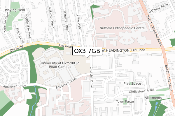
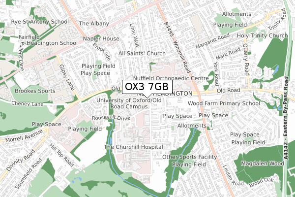
OX3 7GB is located in the Churchill electoral ward, within the local authority district of Oxford and the English Parliamentary constituency of Oxford East. The Sub Integrated Care Board (ICB) Location is NHS Buckinghamshire, Oxfordshire and Berkshire West ICB - 10Q and the police force is Thames Valley. This postcode has been in use since June 2018.


GetTheData
Source: OS Open Zoomstack (Ordnance Survey)
Licence: Open Government Licence (requires attribution)
Attribution: Contains OS data © Crown copyright and database right 2025
Source: Open Postcode Geo
Licence: Open Government Licence (requires attribution)
Attribution: Contains OS data © Crown copyright and database right 2025; Contains Royal Mail data © Royal Mail copyright and database right 2025; Source: Office for National Statistics licensed under the Open Government Licence v.3.0
| Easting | 454474 |
| Northing | 206311 |
| Latitude | 51.752856 |
| Longitude | -1.212241 |
GetTheData
Source: Open Postcode Geo
Licence: Open Government Licence
| Country | England |
| Postcode District | OX3 |
➜ See where OX3 is on a map ➜ Where is Oxford? | |
GetTheData
Source: Land Registry Price Paid Data
Licence: Open Government Licence
| Ward | Churchill |
| Constituency | Oxford East |
GetTheData
Source: ONS Postcode Database
Licence: Open Government Licence
| Boundary Brook House (Churchill Drive) | Headington | 32m |
| Boundary Brook House (Churchill Drive) | Headington | 36m |
| Lime Walk (Old Road) | Headington | 68m |
| Lime Walk (Old Road) | Headington | 106m |
| Churchill Hospital Roosevelt Drive (Old Road) | Headington | 123m |
| Oxford Station | 4km |
GetTheData
Source: NaPTAN
Licence: Open Government Licence
GetTheData
Source: ONS Postcode Database
Licence: Open Government Licence


➜ Get more ratings from the Food Standards Agency
GetTheData
Source: Food Standards Agency
Licence: FSA terms & conditions
| Last Collection | |||
|---|---|---|---|
| Location | Mon-Fri | Sat | Distance |
| Girdlestone Road | 17:15 | 12:00 | 334m |
| All Saints Road | 17:15 | 11:30 | 376m |
| Valentia Road | 17:00 | 11:30 | 438m |
GetTheData
Source: Dracos
Licence: Creative Commons Attribution-ShareAlike
The below table lists the International Territorial Level (ITL) codes (formerly Nomenclature of Territorial Units for Statistics (NUTS) codes) and Local Administrative Units (LAU) codes for OX3 7GB:
| ITL 1 Code | Name |
|---|---|
| TLJ | South East (England) |
| ITL 2 Code | Name |
| TLJ1 | Berkshire, Buckinghamshire and Oxfordshire |
| ITL 3 Code | Name |
| TLJ14 | Oxfordshire CC |
| LAU 1 Code | Name |
| E07000178 | Oxford |
GetTheData
Source: ONS Postcode Directory
Licence: Open Government Licence
The below table lists the Census Output Area (OA), Lower Layer Super Output Area (LSOA), and Middle Layer Super Output Area (MSOA) for OX3 7GB:
| Code | Name | |
|---|---|---|
| OA | E00145318 | |
| LSOA | E01028523 | Oxford 010A |
| MSOA | E02005949 | Oxford 010 |
GetTheData
Source: ONS Postcode Directory
Licence: Open Government Licence
| OX3 7LL | Old Road | 70m |
| OX3 7NP | Coolidge Close | 117m |
| OX3 7NB | Everard Close | 132m |
| OX3 7NU | Girdlestone Road | 135m |
| OX3 7LA | Old Road | 145m |
| OX3 7NS | Girdlestone Close | 169m |
| OX3 7AG | Nursery Close | 189m |
| OX3 7ND | Goslyn Close | 205m |
| OX3 7NW | Shelford Place | 218m |
| OX3 7AF | Lime Walk | 221m |
GetTheData
Source: Open Postcode Geo; Land Registry Price Paid Data
Licence: Open Government Licence