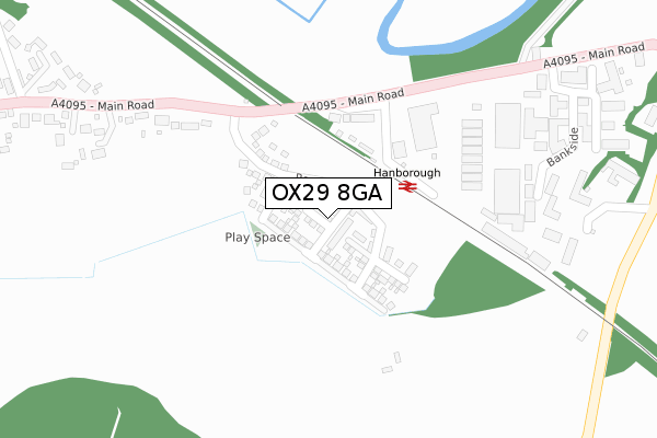
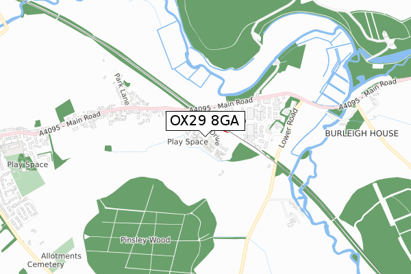
OX29 8GA is located in the Freeland and Hanborough electoral ward, within the local authority district of West Oxfordshire and the English Parliamentary constituency of Witney. The Sub Integrated Care Board (ICB) Location is NHS Buckinghamshire, Oxfordshire and Berkshire West ICB - 10Q and the police force is Thames Valley. This postcode has been in use since July 2019.


GetTheData
Source: OS Open Zoomstack (Ordnance Survey)
Licence: Open Government Licence (requires attribution)
Attribution: Contains OS data © Crown copyright and database right 2025
Source: Open Postcode Geo
Licence: Open Government Licence (requires attribution)
Attribution: Contains OS data © Crown copyright and database right 2025; Contains Royal Mail data © Royal Mail copyright and database right 2025; Source: Office for National Statistics licensed under the Open Government Licence v.3.0
| Easting | 443249 |
| Northing | 214110 |
| Latitude | 51.823951 |
| Longitude | -1.373873 |
GetTheData
Source: Open Postcode Geo
Licence: Open Government Licence
| Country | England |
| Postcode District | OX29 |
➜ See where OX29 is on a map ➜ Where is Long Hanborough? | |
GetTheData
Source: Land Registry Price Paid Data
Licence: Open Government Licence
| Ward | Freeland And Hanborough |
| Constituency | Witney |
GetTheData
Source: ONS Postcode Database
Licence: Open Government Licence
2024 11 OCT £500,000 |
2022 6 JUN £667,000 |
2020 16 OCT £560,000 |
18, RELIANCE WAY, LONG HANBOROUGH, WITNEY, OX29 8GA 2020 25 SEP £720,000 |
27, RELIANCE WAY, LONG HANBOROUGH, WITNEY, OX29 8GA 2020 17 FEB £720,000 |
25, RELIANCE WAY, LONG HANBOROUGH, WITNEY, OX29 8GA 2019 11 OCT £549,950 |
2019 30 SEP £565,000 |
2019 27 SEP £554,950 |
2019 19 JUL £400,000 |
➜ Long Hanborough house prices
GetTheData
Source: HM Land Registry Price Paid Data
Licence: Contains HM Land Registry data © Crown copyright and database right 2025. This data is licensed under the Open Government Licence v3.0.
| Hanborough Station (Main Road) | Long Hanborough | 196m |
| Hanborough Station (Main Road) | Long Hanborough | 253m |
| The Bell Ph (Main Road) | Long Hanborough | 672m |
| The Bell Ph (Main Road) | Long Hanborough | 729m |
| Wynford House (Main Road) | Long Hanborough | 1,006m |
| Hanborough Station | 0.1km |
| Combe (Oxon) Station | 1.7km |
GetTheData
Source: NaPTAN
Licence: Open Government Licence
| Percentage of properties with Next Generation Access | 100.0% |
| Percentage of properties with Superfast Broadband | 100.0% |
| Percentage of properties with Ultrafast Broadband | 100.0% |
| Percentage of properties with Full Fibre Broadband | 100.0% |
Superfast Broadband is between 30Mbps and 300Mbps
Ultrafast Broadband is > 300Mbps
| Percentage of properties unable to receive 2Mbps | 0.0% |
| Percentage of properties unable to receive 5Mbps | 0.0% |
| Percentage of properties unable to receive 10Mbps | 0.0% |
| Percentage of properties unable to receive 30Mbps | 0.0% |
GetTheData
Source: Ofcom
Licence: Ofcom Terms of Use (requires attribution)
GetTheData
Source: ONS Postcode Database
Licence: Open Government Licence


➜ Get more ratings from the Food Standards Agency
GetTheData
Source: Food Standards Agency
Licence: FSA terms & conditions
| Last Collection | |||
|---|---|---|---|
| Location | Mon-Fri | Sat | Distance |
| Station Hill | 16:15 | 08:00 | 189m |
| Witney Road | 16:15 | 09:15 | 713m |
| Long Hanborough P.o. | 16:30 | 09:30 | 719m |
GetTheData
Source: Dracos
Licence: Creative Commons Attribution-ShareAlike
The below table lists the International Territorial Level (ITL) codes (formerly Nomenclature of Territorial Units for Statistics (NUTS) codes) and Local Administrative Units (LAU) codes for OX29 8GA:
| ITL 1 Code | Name |
|---|---|
| TLJ | South East (England) |
| ITL 2 Code | Name |
| TLJ1 | Berkshire, Buckinghamshire and Oxfordshire |
| ITL 3 Code | Name |
| TLJ14 | Oxfordshire CC |
| LAU 1 Code | Name |
| E07000181 | West Oxfordshire |
GetTheData
Source: ONS Postcode Directory
Licence: Open Government Licence
The below table lists the Census Output Area (OA), Lower Layer Super Output Area (LSOA), and Middle Layer Super Output Area (MSOA) for OX29 8GA:
| Code | Name | |
|---|---|---|
| OA | E00146644 | |
| LSOA | E01028790 | West Oxfordshire 006C |
| MSOA | E02005998 | West Oxfordshire 006 |
GetTheData
Source: ONS Postcode Directory
Licence: Open Government Licence
| OX29 8LA | Main Road | 207m |
| OX29 8LN | Blenheim Office Park | 327m |
| OX29 8JZ | Main Road | 403m |
| OX29 8LH | Hanborough Business Park | 420m |
| OX29 8RD | Park Lane | 535m |
| OX29 8JU | Park Lane | 642m |
| OX29 8LW | Lower Road | 712m |
| OX29 8JY | Main Road | 738m |
| OX29 8JX | Main Road | 838m |
| OX20 1RX | Cassington Road | 931m |
GetTheData
Source: Open Postcode Geo; Land Registry Price Paid Data
Licence: Open Government Licence