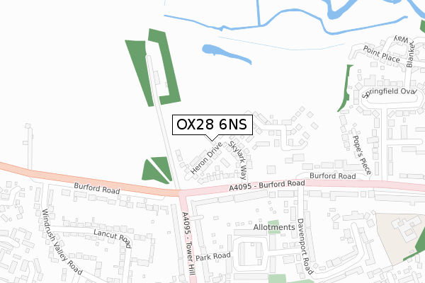
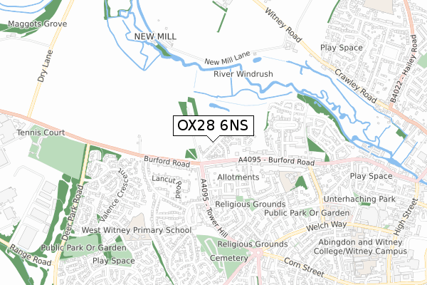
OX28 6NS is located in the Witney Central electoral ward, within the local authority district of West Oxfordshire and the English Parliamentary constituency of Witney. The Sub Integrated Care Board (ICB) Location is NHS Buckinghamshire, Oxfordshire and Berkshire West ICB - 10Q and the police force is Thames Valley. This postcode has been in use since February 2020.


GetTheData
Source: OS Open Zoomstack (Ordnance Survey)
Licence: Open Government Licence (requires attribution)
Attribution: Contains OS data © Crown copyright and database right 2025
Source: Open Postcode Geo
Licence: Open Government Licence (requires attribution)
Attribution: Contains OS data © Crown copyright and database right 2025; Contains Royal Mail data © Royal Mail copyright and database right 2025; Source: Office for National Statistics licensed under the Open Government Licence v.3.0
| Easting | 434556 |
| Northing | 210413 |
| Latitude | 51.791315 |
| Longitude | -1.500366 |
GetTheData
Source: Open Postcode Geo
Licence: Open Government Licence
| Country | England |
| Postcode District | OX28 |
➜ See where OX28 is on a map ➜ Where is Witney? | |
GetTheData
Source: Land Registry Price Paid Data
Licence: Open Government Licence
| Ward | Witney Central |
| Constituency | Witney |
GetTheData
Source: ONS Postcode Database
Licence: Open Government Licence
| Tower Hill Garage (Tower Hill) | Witney | 209m |
| Tower Hill Garage (Tower Hill) | Witney | 219m |
| Park Road | Witney | 259m |
| Davenport Road | Witney | 297m |
| Lancut Road | Witney | 307m |
GetTheData
Source: NaPTAN
Licence: Open Government Licence
GetTheData
Source: ONS Postcode Database
Licence: Open Government Licence


➜ Get more ratings from the Food Standards Agency
GetTheData
Source: Food Standards Agency
Licence: FSA terms & conditions
| Last Collection | |||
|---|---|---|---|
| Location | Mon-Fri | Sat | Distance |
| Burford Road | 16:45 | 09:30 | 718m |
| Quarry Road East | 16:45 | 08:30 | 972m |
| Corn Street | 17:00 | 12:00 | 1,147m |
GetTheData
Source: Dracos
Licence: Creative Commons Attribution-ShareAlike
The below table lists the International Territorial Level (ITL) codes (formerly Nomenclature of Territorial Units for Statistics (NUTS) codes) and Local Administrative Units (LAU) codes for OX28 6NS:
| ITL 1 Code | Name |
|---|---|
| TLJ | South East (England) |
| ITL 2 Code | Name |
| TLJ1 | Berkshire, Buckinghamshire and Oxfordshire |
| ITL 3 Code | Name |
| TLJ14 | Oxfordshire CC |
| LAU 1 Code | Name |
| E07000181 | West Oxfordshire |
GetTheData
Source: ONS Postcode Directory
Licence: Open Government Licence
The below table lists the Census Output Area (OA), Lower Layer Super Output Area (LSOA), and Middle Layer Super Output Area (MSOA) for OX28 6NS:
| Code | Name | |
|---|---|---|
| OA | E00169098 | |
| LSOA | E01028808 | West Oxfordshire 010B |
| MSOA | E02006002 | West Oxfordshire 010 |
GetTheData
Source: ONS Postcode Directory
Licence: Open Government Licence
| OX28 6DR | Burford Road | 158m |
| OX28 5EA | Tower Hill | 166m |
| OX28 6EW | Park Road | 246m |
| OX28 6ED | Burford Road | 268m |
| OX28 5ER | Tower Hill | 278m |
| OX28 6EP | Park Road | 279m |
| OX28 6DJ | Burford Road | 279m |
| OX28 6EH | Davenport Road | 284m |
| OX28 5ET | Tower Hill | 290m |
| OX28 6DT | Popes Piece | 322m |
GetTheData
Source: Open Postcode Geo; Land Registry Price Paid Data
Licence: Open Government Licence