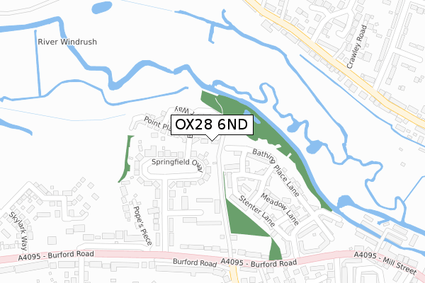
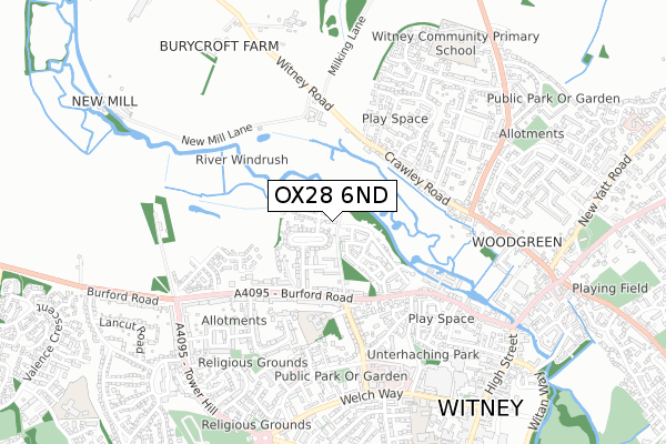
OX28 6ND is located in the Witney Central electoral ward, within the local authority district of West Oxfordshire and the English Parliamentary constituency of Witney. The Sub Integrated Care Board (ICB) Location is NHS Buckinghamshire, Oxfordshire and Berkshire West ICB - 10Q and the police force is Thames Valley. This postcode has been in use since May 2019.


GetTheData
Source: OS Open Zoomstack (Ordnance Survey)
Licence: Open Government Licence (requires attribution)
Attribution: Contains OS data © Crown copyright and database right 2025
Source: Open Postcode Geo
Licence: Open Government Licence (requires attribution)
Attribution: Contains OS data © Crown copyright and database right 2025; Contains Royal Mail data © Royal Mail copyright and database right 2025; Source: Office for National Statistics licensed under the Open Government Licence v.3.0
| Easting | 435082 |
| Northing | 210604 |
| Latitude | 51.793000 |
| Longitude | -1.492720 |
GetTheData
Source: Open Postcode Geo
Licence: Open Government Licence
| Country | England |
| Postcode District | OX28 |
➜ See where OX28 is on a map ➜ Where is Witney? | |
GetTheData
Source: Land Registry Price Paid Data
Licence: Open Government Licence
| Ward | Witney Central |
| Constituency | Witney |
GetTheData
Source: ONS Postcode Database
Licence: Open Government Licence
| Springfield Oval | Witney | 102m |
| Crawley Road | Witney | 361m |
| Crawley Road | Witney | 368m |
| Moor Avenue | Witney | 454m |
| Quarry Road | Witney | 486m |
GetTheData
Source: NaPTAN
Licence: Open Government Licence
| Percentage of properties with Next Generation Access | 100.0% |
| Percentage of properties with Superfast Broadband | 100.0% |
| Percentage of properties with Ultrafast Broadband | 40.0% |
| Percentage of properties with Full Fibre Broadband | 40.0% |
Superfast Broadband is between 30Mbps and 300Mbps
Ultrafast Broadband is > 300Mbps
| Percentage of properties unable to receive 2Mbps | 0.0% |
| Percentage of properties unable to receive 5Mbps | 0.0% |
| Percentage of properties unable to receive 10Mbps | 0.0% |
| Percentage of properties unable to receive 30Mbps | 0.0% |
GetTheData
Source: Ofcom
Licence: Ofcom Terms of Use (requires attribution)
GetTheData
Source: ONS Postcode Database
Licence: Open Government Licence


➜ Get more ratings from the Food Standards Agency
GetTheData
Source: Food Standards Agency
Licence: FSA terms & conditions
| Last Collection | |||
|---|---|---|---|
| Location | Mon-Fri | Sat | Distance |
| Burford Road | 16:45 | 09:30 | 353m |
| Quarry Road East | 16:45 | 08:30 | 432m |
| West End Post Office | 17:00 | 12:00 | 843m |
GetTheData
Source: Dracos
Licence: Creative Commons Attribution-ShareAlike
The below table lists the International Territorial Level (ITL) codes (formerly Nomenclature of Territorial Units for Statistics (NUTS) codes) and Local Administrative Units (LAU) codes for OX28 6ND:
| ITL 1 Code | Name |
|---|---|
| TLJ | South East (England) |
| ITL 2 Code | Name |
| TLJ1 | Berkshire, Buckinghamshire and Oxfordshire |
| ITL 3 Code | Name |
| TLJ14 | Oxfordshire CC |
| LAU 1 Code | Name |
| E07000181 | West Oxfordshire |
GetTheData
Source: ONS Postcode Directory
Licence: Open Government Licence
The below table lists the Census Output Area (OA), Lower Layer Super Output Area (LSOA), and Middle Layer Super Output Area (MSOA) for OX28 6ND:
| Code | Name | |
|---|---|---|
| OA | E00169098 | |
| LSOA | E01028808 | West Oxfordshire 010B |
| MSOA | E02006002 | West Oxfordshire 010 |
GetTheData
Source: ONS Postcode Directory
Licence: Open Government Licence
| OX28 6BN | Stenter Square | 103m |
| OX28 6EQ | Springfield Oval | 139m |
| OX28 6FS | Stenter Rise | 149m |
| OX28 6EG | Springfield Oval | 157m |
| OX28 6FJ | Stenter Mews | 217m |
| OX28 6AW | Stenter Lane | 223m |
| OX28 6AQ | Bathing Place Lane | 224m |
| OX28 6EF | Springfield Park | 228m |
| OX28 6DN | Meadow Lane | 259m |
| OX28 6BQ | New Mill Mews | 265m |
GetTheData
Source: Open Postcode Geo; Land Registry Price Paid Data
Licence: Open Government Licence