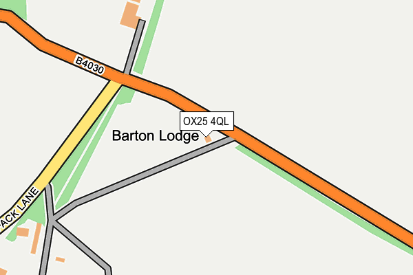
OX25 4QL is located in the The Bartons electoral ward, within the local authority district of West Oxfordshire and the English Parliamentary constituency of Witney. The Sub Integrated Care Board (ICB) Location is NHS Buckinghamshire, Oxfordshire and Berkshire West ICB - 10Q and the police force is Thames Valley. This postcode has been in use since October 2000.


GetTheData
Source: OS OpenMap – Local (Ordnance Survey)
Source: OS VectorMap District (Ordnance Survey)
Licence: Open Government Licence (requires attribution)
| Easting | 445555 |
| Northing | 225361 |
| Latitude | 51.924920 |
| Longitude | -1.338936 |
GetTheData
Source: Open Postcode Geo
Licence: Open Government Licence
| Country | England |
| Postcode District | OX25 |
➜ See where OX25 is on a map | |
GetTheData
Source: Land Registry Price Paid Data
Licence: Open Government Licence
Elevation or altitude of OX25 4QL as distance above sea level:
| Metres | Feet | |
|---|---|---|
| Elevation | 130m | 427ft |
Elevation is measured from the approximate centre of the postcode, to the nearest point on an OS contour line from OS Terrain 50, which has contour spacing of ten vertical metres.
➜ How high above sea level am I? Find the elevation of your current position using your device's GPS.
GetTheData
Source: Open Postcode Elevation
Licence: Open Government Licence
| Ward | The Bartons |
| Constituency | Witney |
GetTheData
Source: ONS Postcode Database
Licence: Open Government Licence
| Whistlow (North Street) | Steeple Barton | 388m |
| Whistlow (North Street) | Steeple Barton | 393m |
| Hopcrofts Holt Garage (B4030) | Hopcroft's Holt | 955m |
| Hopcrofts Holt Garage (B4030) | Hopcroft's Holt | 967m |
| Heyford Station | 2.8km |
| Tackley Station | 5.6km |
GetTheData
Source: NaPTAN
Licence: Open Government Licence
GetTheData
Source: ONS Postcode Database
Licence: Open Government Licence


➜ Get more ratings from the Food Standards Agency
GetTheData
Source: Food Standards Agency
Licence: FSA terms & conditions
| Last Collection | |||
|---|---|---|---|
| Location | Mon-Fri | Sat | Distance |
| Hopcrofts Holt | 15:45 | 09:45 | 1,022m |
| Barton Gate | 16:00 | 09:45 | 1,177m |
| South Street | 16:00 | 08:00 | 1,664m |
GetTheData
Source: Dracos
Licence: Creative Commons Attribution-ShareAlike
The below table lists the International Territorial Level (ITL) codes (formerly Nomenclature of Territorial Units for Statistics (NUTS) codes) and Local Administrative Units (LAU) codes for OX25 4QL:
| ITL 1 Code | Name |
|---|---|
| TLJ | South East (England) |
| ITL 2 Code | Name |
| TLJ1 | Berkshire, Buckinghamshire and Oxfordshire |
| ITL 3 Code | Name |
| TLJ14 | Oxfordshire CC |
| LAU 1 Code | Name |
| E07000181 | West Oxfordshire |
GetTheData
Source: ONS Postcode Directory
Licence: Open Government Licence
The below table lists the Census Output Area (OA), Lower Layer Super Output Area (LSOA), and Middle Layer Super Output Area (MSOA) for OX25 4QL:
| Code | Name | |
|---|---|---|
| OA | E00146721 | |
| LSOA | E01028806 | West Oxfordshire 002D |
| MSOA | E02005994 | West Oxfordshire 002 |
GetTheData
Source: ONS Postcode Directory
Licence: Open Government Licence
| OX25 5QQ | Hopcrofts Holt | 975m |
| OX7 7DD | Rayford Lane | 1233m |
| OX7 7DB | Old Turnpike Cottages | 1241m |
| OX7 7DA | North Street | 1549m |
| OX25 4SD | South Side | 1605m |
| OX7 7BZ | North Street | 1617m |
| OX25 4RY | South Side | 1620m |
| OX7 7BX | Church Lane | 1633m |
| OX7 7BY | Jacobs Yard | 1642m |
| OX7 7BT | Mill Lane | 1678m |
GetTheData
Source: Open Postcode Geo; Land Registry Price Paid Data
Licence: Open Government Licence