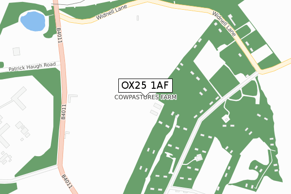
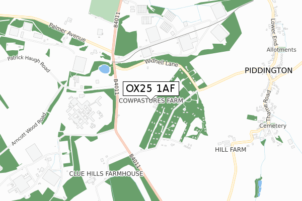
OX25 1AF is located in the Launton and Otmoor electoral ward, within the local authority district of Cherwell and the English Parliamentary constituency of Banbury. The Sub Integrated Care Board (ICB) Location is NHS Buckinghamshire, Oxfordshire and Berkshire West ICB - 10Q and the police force is Thames Valley. This postcode has been in use since February 2020.


GetTheData
Source: OS Open Zoomstack (Ordnance Survey)
Licence: Open Government Licence (requires attribution)
Attribution: Contains OS data © Crown copyright and database right 2025
Source: Open Postcode Geo
Licence: Open Government Licence (requires attribution)
Attribution: Contains OS data © Crown copyright and database right 2025; Contains Royal Mail data © Royal Mail copyright and database right 2025; Source: Office for National Statistics licensed under the Open Government Licence v.3.0
| Easting | 461152 |
| Northing | 217527 |
| Latitude | 51.853001 |
| Longitude | -1.113535 |
GetTheData
Source: Open Postcode Geo
Licence: Open Government Licence
| Country | England |
| Postcode District | OX25 |
➜ See where OX25 is on a map ➜ Where is Upper Arncott? | |
GetTheData
Source: Land Registry Price Paid Data
Licence: Open Government Licence
| Ward | Launton And Otmoor |
| Constituency | Banbury |
GetTheData
Source: ONS Postcode Database
Licence: Open Government Licence
| Green (Norris Road) | Upper Arncott | 142m |
| Green (Norris Road) | Upper Arncott | 151m |
| The Plough Ph (Ploughley Road) | Lower Arncott | 349m |
| The Plough Ph (Ploughley Road) | Lower Arncott | 351m |
| The Plough Ph (Palmer Avenue) | Lower Arncott | 395m |
| Bicester Village Station | 5.1km |
GetTheData
Source: NaPTAN
Licence: Open Government Licence
GetTheData
Source: ONS Postcode Database
Licence: Open Government Licence


➜ Get more ratings from the Food Standards Agency
GetTheData
Source: Food Standards Agency
Licence: FSA terms & conditions
| Last Collection | |||
|---|---|---|---|
| Location | Mon-Fri | Sat | Distance |
| Ambrosden Post Office | 16:30 | 09:15 | 1,990m |
| Swan Close | 16:45 | 07:30 | 2,165m |
| Willow Road | 16:30 | 09:30 | 2,302m |
GetTheData
Source: Dracos
Licence: Creative Commons Attribution-ShareAlike
The below table lists the International Territorial Level (ITL) codes (formerly Nomenclature of Territorial Units for Statistics (NUTS) codes) and Local Administrative Units (LAU) codes for OX25 1AF:
| ITL 1 Code | Name |
|---|---|
| TLJ | South East (England) |
| ITL 2 Code | Name |
| TLJ1 | Berkshire, Buckinghamshire and Oxfordshire |
| ITL 3 Code | Name |
| TLJ14 | Oxfordshire CC |
| LAU 1 Code | Name |
| E07000177 | Cherwell |
GetTheData
Source: ONS Postcode Directory
Licence: Open Government Licence
The below table lists the Census Output Area (OA), Lower Layer Super Output Area (LSOA), and Middle Layer Super Output Area (MSOA) for OX25 1AF:
| Code | Name | |
|---|---|---|
| OA | E00169030 | |
| LSOA | E01028500 | Cherwell 016D |
| MSOA | E02005936 | Cherwell 016 |
GetTheData
Source: ONS Postcode Directory
Licence: Open Government Licence
| OX25 1NZ | Norris Road | 98m |
| OX25 1PA | Green Lane | 227m |
| OX25 1QH | Murcott Road | 239m |
| OX25 1QJ | Teale Close | 260m |
| OX25 1PB | Mill Lane | 292m |
| OX25 1PF | Hillside Close | 330m |
| OX25 1QL | Hopcraft Close | 340m |
| OX25 1PG | Constables Croft | 353m |
| OX25 1PL | Murcott Road | 414m |
| OX25 1PE | Buchanan Road | 427m |
GetTheData
Source: Open Postcode Geo; Land Registry Price Paid Data
Licence: Open Government Licence