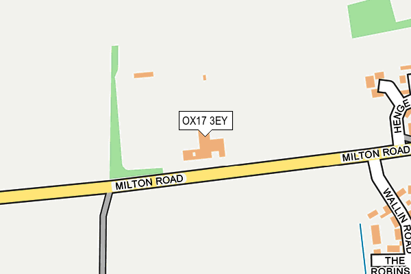
OX17 3EY is located in the Adderbury, Bloxham and Bodicote electoral ward, within the local authority district of Cherwell and the English Parliamentary constituency of Banbury. The Sub Integrated Care Board (ICB) Location is NHS Buckinghamshire, Oxfordshire and Berkshire West ICB - 10Q and the police force is Thames Valley. This postcode has been in use since January 1980.


GetTheData
Source: OS OpenMap – Local (Ordnance Survey)
Source: OS VectorMap District (Ordnance Survey)
Licence: Open Government Licence (requires attribution)
| Easting | 446147 |
| Northing | 235041 |
| Latitude | 52.011887 |
| Longitude | -1.329047 |
GetTheData
Source: Open Postcode Geo
Licence: Open Government Licence
| Country | England |
| Postcode District | OX17 |
➜ See where OX17 is on a map | |
GetTheData
Source: Land Registry Price Paid Data
Licence: Open Government Licence
Elevation or altitude of OX17 3EY as distance above sea level:
| Metres | Feet | |
|---|---|---|
| Elevation | 100m | 328ft |
Elevation is measured from the approximate centre of the postcode, to the nearest point on an OS contour line from OS Terrain 50, which has contour spacing of ten vertical metres.
➜ How high above sea level am I? Find the elevation of your current position using your device's GPS.
GetTheData
Source: Open Postcode Elevation
Licence: Open Government Licence
| Ward | Adderbury, Bloxham And Bodicote |
| Constituency | Banbury |
GetTheData
Source: ONS Postcode Database
Licence: Open Government Licence
| Oak Tree (Berry Hill Road) | West Adderbury | 444m |
| Oak Tree (Berry Hill Road) | West Adderbury | 455m |
| Old Post Office (Cross Hill Road) | West Adderbury | 811m |
| Old Post Office (Cross Hill Road) | West Adderbury | 829m |
| The Black Boy Inn (Milton Road) | Milton | 1,053m |
| Kings Sutton Station | 3.5km |
GetTheData
Source: NaPTAN
Licence: Open Government Licence
GetTheData
Source: ONS Postcode Database
Licence: Open Government Licence


➜ Get more ratings from the Food Standards Agency
GetTheData
Source: Food Standards Agency
Licence: FSA terms & conditions
| Last Collection | |||
|---|---|---|---|
| Location | Mon-Fri | Sat | Distance |
| Horn Hill | 16:45 | 08:00 | 449m |
| Round Close | 16:45 | 09:15 | 794m |
| Waters Lane | 16:45 | 08:00 | 1,100m |
GetTheData
Source: Dracos
Licence: Creative Commons Attribution-ShareAlike
The below table lists the International Territorial Level (ITL) codes (formerly Nomenclature of Territorial Units for Statistics (NUTS) codes) and Local Administrative Units (LAU) codes for OX17 3EY:
| ITL 1 Code | Name |
|---|---|
| TLJ | South East (England) |
| ITL 2 Code | Name |
| TLJ1 | Berkshire, Buckinghamshire and Oxfordshire |
| ITL 3 Code | Name |
| TLJ14 | Oxfordshire CC |
| LAU 1 Code | Name |
| E07000177 | Cherwell |
GetTheData
Source: ONS Postcode Directory
Licence: Open Government Licence
The below table lists the Census Output Area (OA), Lower Layer Super Output Area (LSOA), and Middle Layer Super Output Area (MSOA) for OX17 3EY:
| Code | Name | |
|---|---|---|
| OA | E00144835 | |
| LSOA | E01028423 | Cherwell 008B |
| MSOA | E02005928 | Cherwell 008 |
GetTheData
Source: ONS Postcode Directory
Licence: Open Government Licence
| OX17 3FN | The Robbins | 314m |
| OX17 3FA | Wallin Road | 348m |
| OX17 3HE | St Marys Road | 383m |
| OX17 3HN | Milton Road | 383m |
| OX17 3HD | Norris Close | 424m |
| OX17 3EU | Horn Hill Road | 454m |
| OX17 3EZ | St Marys Road | 458m |
| OX17 3EL | Manor Road | 472m |
| OX17 3HB | St Marys Road | 497m |
| OX17 3EJ | Manor Road | 520m |
GetTheData
Source: Open Postcode Geo; Land Registry Price Paid Data
Licence: Open Government Licence