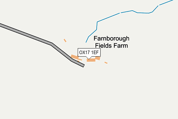
OX17 1EF is located in the Bishop's Itchington, Fenny Compton & Napton electoral ward, within the local authority district of Stratford-on-Avon and the English Parliamentary constituency of Kenilworth and Southam. The Sub Integrated Care Board (ICB) Location is NHS Coventry and Warwickshire ICB - B2M3M and the police force is Warwickshire. This postcode has been in use since January 1980.


GetTheData
Source: OS OpenMap – Local (Ordnance Survey)
Source: OS VectorMap District (Ordnance Survey)
Licence: Open Government Licence (requires attribution)
| Easting | 444574 |
| Northing | 250518 |
| Latitude | 52.151154 |
| Longitude | -1.349947 |
GetTheData
Source: Open Postcode Geo
Licence: Open Government Licence
| Country | England |
| Postcode District | OX17 |
➜ See where OX17 is on a map | |
GetTheData
Source: Land Registry Price Paid Data
Licence: Open Government Licence
Elevation or altitude of OX17 1EF as distance above sea level:
| Metres | Feet | |
|---|---|---|
| Elevation | 130m | 427ft |
Elevation is measured from the approximate centre of the postcode, to the nearest point on an OS contour line from OS Terrain 50, which has contour spacing of ten vertical metres.
➜ How high above sea level am I? Find the elevation of your current position using your device's GPS.
GetTheData
Source: Open Postcode Elevation
Licence: Open Government Licence
| Ward | Bishop's Itchington, Fenny Compton & Napton |
| Constituency | Kenilworth And Southam |
GetTheData
Source: ONS Postcode Database
Licence: Open Government Licence
| Haypool (Main Road) | Farnborough | 1,008m |
| Haypool (Main Road) | Farnborough | 1,023m |
| Manor Park (Mollington Road) | Claydon | 1,240m |
| Manor Park (Mollington Road) | Claydon | 1,248m |
| Inn (Main Road) | Farnborough | 1,387m |
GetTheData
Source: NaPTAN
Licence: Open Government Licence
GetTheData
Source: ONS Postcode Database
Licence: Open Government Licence


➜ Get more ratings from the Food Standards Agency
GetTheData
Source: Food Standards Agency
Licence: FSA terms & conditions
| Last Collection | |||
|---|---|---|---|
| Location | Mon-Fri | Sat | Distance |
| Hay Pool | 16:00 | 07:45 | 1,106m |
| Farnborough | 16:00 | 07:30 | 1,505m |
| Wormleighton | 16:00 | 09:30 | 3,090m |
GetTheData
Source: Dracos
Licence: Creative Commons Attribution-ShareAlike
The below table lists the International Territorial Level (ITL) codes (formerly Nomenclature of Territorial Units for Statistics (NUTS) codes) and Local Administrative Units (LAU) codes for OX17 1EF:
| ITL 1 Code | Name |
|---|---|
| TLG | West Midlands (England) |
| ITL 2 Code | Name |
| TLG1 | Herefordshire, Worcestershire and Warwickshire |
| ITL 3 Code | Name |
| TLG13 | Warwickshire CC |
| LAU 1 Code | Name |
| E07000221 | Stratford-on-Avon |
GetTheData
Source: ONS Postcode Directory
Licence: Open Government Licence
The below table lists the Census Output Area (OA), Lower Layer Super Output Area (LSOA), and Middle Layer Super Output Area (MSOA) for OX17 1EF:
| Code | Name | |
|---|---|---|
| OA | E00159041 | |
| LSOA | E01031198 | Stratford-on-Avon 005B |
| MSOA | E02006508 | Stratford-on-Avon 005 |
GetTheData
Source: ONS Postcode Directory
Licence: Open Government Licence
| OX17 1EE | Hay Pool | 987m |
| OX17 1EL | Southam Road | 1029m |
| OX17 1ED | Ducketts Lane | 1032m |
| OX17 1HA | Fenny Compton Road | 1084m |
| OX17 1EB | Holbech Hill | 1116m |
| OX17 1EX | Crossing Lane | 1132m |
| OX17 1HH | Manor Park | 1149m |
| OX17 1HB | Boddington Road | 1152m |
| OX17 1EW | Church Lane | 1192m |
| OX17 1EZ | 1197m |
GetTheData
Source: Open Postcode Geo; Land Registry Price Paid Data
Licence: Open Government Licence