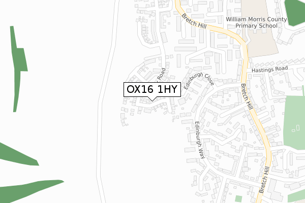
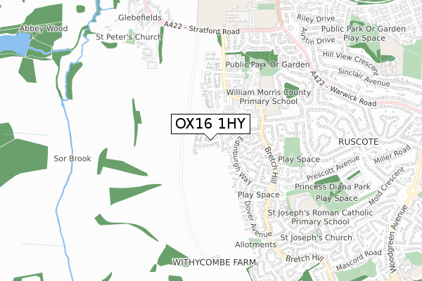
OX16 1HY is located in the Banbury Ruscote electoral ward, within the local authority district of Cherwell and the English Parliamentary constituency of Banbury. The Sub Integrated Care Board (ICB) Location is NHS Buckinghamshire, Oxfordshire and Berkshire West ICB - 10Q and the police force is Thames Valley. This postcode has been in use since November 2019.


GetTheData
Source: OS Open Zoomstack (Ordnance Survey)
Licence: Open Government Licence (requires attribution)
Attribution: Contains OS data © Crown copyright and database right 2025
Source: Open Postcode Geo
Licence: Open Government Licence (requires attribution)
Attribution: Contains OS data © Crown copyright and database right 2025; Contains Royal Mail data © Royal Mail copyright and database right 2025; Source: Office for National Statistics licensed under the Open Government Licence v.3.0
| Easting | 443319 |
| Northing | 240925 |
| Latitude | 52.065023 |
| Longitude | -1.369490 |
GetTheData
Source: Open Postcode Geo
Licence: Open Government Licence
| Country | England |
| Postcode District | OX16 |
➜ See where OX16 is on a map ➜ Where is Banbury? | |
GetTheData
Source: Land Registry Price Paid Data
Licence: Open Government Licence
| Ward | Banbury Ruscote |
| Constituency | Banbury |
GetTheData
Source: ONS Postcode Database
Licence: Open Government Licence
2, DAVIES ROAD, BANBURY, OX16 1HY 2020 29 JUN £350,000 |
1, DAVIES ROAD, BANBURY, OX16 1HY 2020 17 JUN £299,000 |
9, DAVIES ROAD, BANBURY, OX16 1HY 2020 27 MAR £280,000 |
3, DAVIES ROAD, BANBURY, OX16 1HY 2020 28 FEB £274,950 |
5, DAVIES ROAD, BANBURY, OX16 1HY 2020 28 FEB £279,950 |
8, DAVIES ROAD, BANBURY, OX16 1HY 2020 25 FEB £355,000 |
12, DAVIES ROAD, BANBURY, OX16 1HY 2020 30 JAN £339,950 |
4, DAVIES ROAD, BANBURY, OX16 1HY 2020 24 JAN £312,950 |
6, DAVIES ROAD, BANBURY, OX16 1HY 2020 20 JAN £309,950 |
10, DAVIES ROAD, BANBURY, OX16 1HY 2019 19 DEC £370,000 |
GetTheData
Source: HM Land Registry Price Paid Data
Licence: Contains HM Land Registry data © Crown copyright and database right 2025. This data is licensed under the Open Government Licence v3.0.
| Edinburgh Way (Hastings Road) | Bretch Hill | 297m |
| Edinburgh Way (Hastings Road) | Bretch Hill | 300m |
| Bradley Arcade (Bretch Hill) | Bretch Hill | 446m |
| Bradley Arcade (Prescott Avenue) | Bretch Hill | 448m |
| Bradley Arcade (Bretch Hill) | Bretch Hill | 449m |
| Banbury Station | 2.9km |
GetTheData
Source: NaPTAN
Licence: Open Government Licence
GetTheData
Source: ONS Postcode Database
Licence: Open Government Licence


➜ Get more ratings from the Food Standards Agency
GetTheData
Source: Food Standards Agency
Licence: FSA terms & conditions
| Last Collection | |||
|---|---|---|---|
| Location | Mon-Fri | Sat | Distance |
| Queens Way | 16:30 | 08:00 | 1,844m |
| Longfellow Road | 16:30 | 08:00 | 1,871m |
| Rotery Way | 16:00 | 08:30 | 2,225m |
GetTheData
Source: Dracos
Licence: Creative Commons Attribution-ShareAlike
The below table lists the International Territorial Level (ITL) codes (formerly Nomenclature of Territorial Units for Statistics (NUTS) codes) and Local Administrative Units (LAU) codes for OX16 1HY:
| ITL 1 Code | Name |
|---|---|
| TLJ | South East (England) |
| ITL 2 Code | Name |
| TLJ1 | Berkshire, Buckinghamshire and Oxfordshire |
| ITL 3 Code | Name |
| TLJ14 | Oxfordshire CC |
| LAU 1 Code | Name |
| E07000177 | Cherwell |
GetTheData
Source: ONS Postcode Directory
Licence: Open Government Licence
The below table lists the Census Output Area (OA), Lower Layer Super Output Area (LSOA), and Middle Layer Super Output Area (MSOA) for OX16 1HY:
| Code | Name | |
|---|---|---|
| OA | E00145241 | |
| LSOA | E01028509 | Cherwell 001D |
| MSOA | E02005921 | Cherwell 001 |
GetTheData
Source: ONS Postcode Directory
Licence: Open Government Licence
| OX16 0NZ | Edinburgh Way | 138m |
| OX16 0PA | Edinburgh Way | 145m |
| OX16 0NY | Edinburgh Close | 151m |
| OX16 0PB | Edinburgh Way | 159m |
| OX16 0HZ | Glamis Place | 220m |
| OX16 0UX | Appleby Close | 223m |
| OX16 0PE | Edinburgh Way | 227m |
| OX16 0NX | Edinburgh Way | 232m |
| OX16 0PD | Edinburgh Way | 258m |
| OX16 0UT | Penrhyn Close | 265m |
GetTheData
Source: Open Postcode Geo; Land Registry Price Paid Data
Licence: Open Government Licence