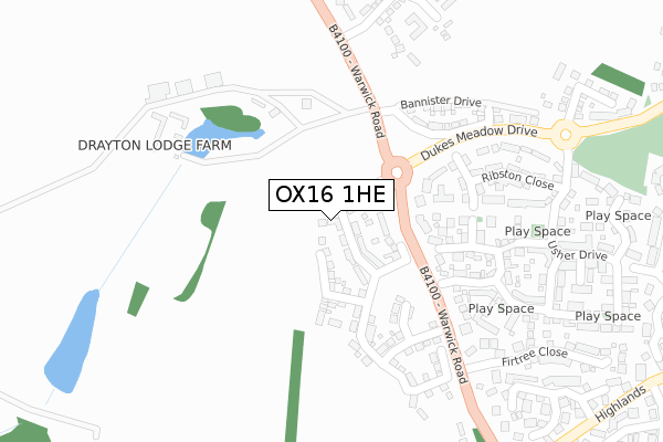
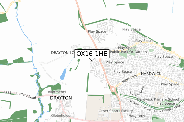
OX16 1HE is located in the Cropredy, Sibfords and Wroxton electoral ward, within the local authority district of Cherwell and the English Parliamentary constituency of Banbury. The Sub Integrated Care Board (ICB) Location is NHS Buckinghamshire, Oxfordshire and Berkshire West ICB - 10Q and the police force is Thames Valley. This postcode has been in use since April 2020.


GetTheData
Source: OS Open Zoomstack (Ordnance Survey)
Licence: Open Government Licence (requires attribution)
Attribution: Contains OS data © Crown copyright and database right 2025
Source: Open Postcode Geo
Licence: Open Government Licence (requires attribution)
Attribution: Contains OS data © Crown copyright and database right 2025; Contains Royal Mail data © Royal Mail copyright and database right 2025; Source: Office for National Statistics licensed under the Open Government Licence v.3.0
| Easting | 443346 |
| Northing | 242438 |
| Latitude | 52.078624 |
| Longitude | -1.368905 |
GetTheData
Source: Open Postcode Geo
Licence: Open Government Licence
| Country | England |
| Postcode District | OX16 |
➜ See where OX16 is on a map ➜ Where is Banbury? | |
GetTheData
Source: Land Registry Price Paid Data
Licence: Open Government Licence
| Ward | Cropredy, Sibfords And Wroxton |
| Constituency | Banbury |
GetTheData
Source: ONS Postcode Database
Licence: Open Government Licence
| Fir Tree Close (Warwick Road) | Hardwick | 131m |
| Fir Tree Close (Warwick Road) | Hardwick | 140m |
| Warwick Road (Rotary Way) | Hardwick | 173m |
| Usher Drive Park (Usher Drive) | Hardwick | 294m |
| Winchelsea Close (Rother Road) | Hardwick | 462m |
| Banbury Station | 3.5km |
GetTheData
Source: NaPTAN
Licence: Open Government Licence
GetTheData
Source: ONS Postcode Database
Licence: Open Government Licence


➜ Get more ratings from the Food Standards Agency
GetTheData
Source: Food Standards Agency
Licence: FSA terms & conditions
| Last Collection | |||
|---|---|---|---|
| Location | Mon-Fri | Sat | Distance |
| Hanwell Post Office | 16:15 | 07:00 | 1,193m |
| Rotery Way | 16:00 | 08:30 | 1,595m |
| Market Place | 18:20 | 11:00 | 2,966m |
GetTheData
Source: Dracos
Licence: Creative Commons Attribution-ShareAlike
The below table lists the International Territorial Level (ITL) codes (formerly Nomenclature of Territorial Units for Statistics (NUTS) codes) and Local Administrative Units (LAU) codes for OX16 1HE:
| ITL 1 Code | Name |
|---|---|
| TLJ | South East (England) |
| ITL 2 Code | Name |
| TLJ1 | Berkshire, Buckinghamshire and Oxfordshire |
| ITL 3 Code | Name |
| TLJ14 | Oxfordshire CC |
| LAU 1 Code | Name |
| E07000177 | Cherwell |
GetTheData
Source: ONS Postcode Directory
Licence: Open Government Licence
The below table lists the Census Output Area (OA), Lower Layer Super Output Area (LSOA), and Middle Layer Super Output Area (MSOA) for OX16 1HE:
| Code | Name | |
|---|---|---|
| OA | E00145241 | |
| LSOA | E01028509 | Cherwell 001D |
| MSOA | E02005921 | Cherwell 001 |
GetTheData
Source: ONS Postcode Directory
Licence: Open Government Licence
| OX16 1AW | Ribston Close | 172m |
| OX17 1GF | Winston Drive | 174m |
| OX17 1GG | Winston Drive | 175m |
| OX17 1GH | Ellison Drive | 221m |
| OX16 1AN | Ribston Close | 229m |
| OX17 1GJ | Laxton Way | 232m |
| OX16 1AB | Laxton Way | 253m |
| OX16 1AJ | Usher Drive | 296m |
| OX16 1AA | Ashmead Road | 319m |
| OX17 1HJ | Warwick Road | 334m |
GetTheData
Source: Open Postcode Geo; Land Registry Price Paid Data
Licence: Open Government Licence