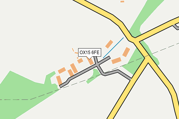
OX15 6FE is located in the Cropredy, Sibfords and Wroxton electoral ward, within the local authority district of Cherwell and the English Parliamentary constituency of Banbury. The Sub Integrated Care Board (ICB) Location is NHS Buckinghamshire, Oxfordshire and Berkshire West ICB - 10Q and the police force is Thames Valley. This postcode has been in use since June 2016.


GetTheData
Source: OS OpenMap – Local (Ordnance Survey)
Source: OS VectorMap District (Ordnance Survey)
Licence: Open Government Licence (requires attribution)
| Easting | 440579 |
| Northing | 242683 |
| Latitude | 52.081036 |
| Longitude | -1.409250 |
GetTheData
Source: Open Postcode Geo
Licence: Open Government Licence
| Country | England |
| Postcode District | OX15 |
➜ See where OX15 is on a map | |
GetTheData
Source: Land Registry Price Paid Data
Licence: Open Government Licence
Elevation or altitude of OX15 6FE as distance above sea level:
| Metres | Feet | |
|---|---|---|
| Elevation | 150m | 492ft |
Elevation is measured from the approximate centre of the postcode, to the nearest point on an OS contour line from OS Terrain 50, which has contour spacing of ten vertical metres.
➜ How high above sea level am I? Find the elevation of your current position using your device's GPS.
GetTheData
Source: Open Postcode Elevation
Licence: Open Government Licence
| Ward | Cropredy, Sibfords And Wroxton |
| Constituency | Banbury |
GetTheData
Source: ONS Postcode Database
Licence: Open Government Licence
| The Firs (Stratford Road) | Wroxton | 1,025m |
| The Firs (Stratford Road) | Wroxton | 1,026m |
| White Horse Ph (Stratford Road) | Wroxton | 1,288m |
| White Horse Ph (Stratford Road) | Wroxton | 1,296m |
| Red Lion Ph (Village Road) | Horley | 1,690m |
GetTheData
Source: NaPTAN
Licence: Open Government Licence
GetTheData
Source: ONS Postcode Database
Licence: Open Government Licence


➜ Get more ratings from the Food Standards Agency
GetTheData
Source: Food Standards Agency
Licence: FSA terms & conditions
| Last Collection | |||
|---|---|---|---|
| Location | Mon-Fri | Sat | Distance |
| Hornton Post Office | 16:00 | 08:00 | 2,601m |
| Hanwell Post Office | 16:15 | 07:00 | 3,017m |
| Shenington Post Office | 16:45 | 08:00 | 3,423m |
GetTheData
Source: Dracos
Licence: Creative Commons Attribution-ShareAlike
The below table lists the International Territorial Level (ITL) codes (formerly Nomenclature of Territorial Units for Statistics (NUTS) codes) and Local Administrative Units (LAU) codes for OX15 6FE:
| ITL 1 Code | Name |
|---|---|
| TLJ | South East (England) |
| ITL 2 Code | Name |
| TLJ1 | Berkshire, Buckinghamshire and Oxfordshire |
| ITL 3 Code | Name |
| TLJ14 | Oxfordshire CC |
| LAU 1 Code | Name |
| E07000177 | Cherwell |
GetTheData
Source: ONS Postcode Directory
Licence: Open Government Licence
The below table lists the Census Output Area (OA), Lower Layer Super Output Area (LSOA), and Middle Layer Super Output Area (MSOA) for OX15 6FE:
| Code | Name | |
|---|---|---|
| OA | E00145248 | |
| LSOA | E01028509 | Cherwell 001D |
| MSOA | E02005921 | Cherwell 001 |
GetTheData
Source: ONS Postcode Directory
Licence: Open Government Licence
| OX15 6BA | 374m | |
| OX15 6QS | Stratford Road | 970m |
| OX15 6QW | The Leys | 1017m |
| OX15 6QN | Stratford Road | 1045m |
| OX15 6QL | Main Street | 1061m |
| OX15 6QR | Stratford Road | 1064m |
| OX15 6QT | Wroxton Court | 1104m |
| OX15 6PT | Main Street | 1160m |
| OX15 6QH | Lampitts Green | 1233m |
| OX15 6PY | Mills Lane | 1249m |
GetTheData
Source: Open Postcode Geo; Land Registry Price Paid Data
Licence: Open Government Licence