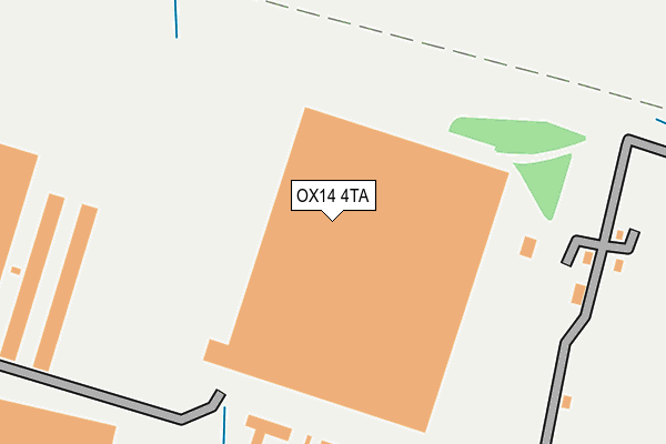
OX14 4TA is located in the Sutton Courtenay electoral ward, within the local authority district of Vale of White Horse and the English Parliamentary constituency of Wantage. The Sub Integrated Care Board (ICB) Location is NHS Buckinghamshire, Oxfordshire and Berkshire West ICB - 10Q and the police force is Thames Valley. This postcode has been in use since September 2008.


GetTheData
Source: OS OpenMap – Local (Ordnance Survey)
Source: OS VectorMap District (Ordnance Survey)
Licence: Open Government Licence (requires attribution)
| Easting | 450538 |
| Northing | 192421 |
| Latitude | 51.628342 |
| Longitude | -1.271281 |
GetTheData
Source: Open Postcode Geo
Licence: Open Government Licence
| Country | England |
| Postcode District | OX14 |
➜ See where OX14 is on a map ➜ Where is Sutton Courtenay? | |
GetTheData
Source: Land Registry Price Paid Data
Licence: Open Government Licence
Elevation or altitude of OX14 4TA as distance above sea level:
| Metres | Feet | |
|---|---|---|
| Elevation | 60m | 197ft |
Elevation is measured from the approximate centre of the postcode, to the nearest point on an OS contour line from OS Terrain 50, which has contour spacing of ten vertical metres.
➜ How high above sea level am I? Find the elevation of your current position using your device's GPS.
GetTheData
Source: Open Postcode Elevation
Licence: Open Government Licence
| Ward | Sutton Courtenay |
| Constituency | Wantage |
GetTheData
Source: ONS Postcode Database
Licence: Open Government Licence
| Harwell Road | Sutton Courtenay | 694m |
| Harwell Road | Sutton Courtenay | 696m |
| Katchside (Milton Road) | Sutton Courtenay | 818m |
| Katchside (Milton Road) | Sutton Courtenay | 827m |
| Milton Park G (Milton Park) | Milton Park | 834m |
| Appleford Station | 2.4km |
| Didcot Parkway Station | 2.8km |
| Culham Station | 3.7km |
GetTheData
Source: NaPTAN
Licence: Open Government Licence
GetTheData
Source: ONS Postcode Database
Licence: Open Government Licence


➜ Get more ratings from the Food Standards Agency
GetTheData
Source: Food Standards Agency
Licence: FSA terms & conditions
| Last Collection | |||
|---|---|---|---|
| Location | Mon-Fri | Sat | Distance |
| Milton Road | 16:00 | 09:15 | 826m |
| Milton Depot | 18:15 | 08:00 | 887m |
| Sutton Courtenay Post Office | 16:30 | 09:15 | 1,041m |
GetTheData
Source: Dracos
Licence: Creative Commons Attribution-ShareAlike
The below table lists the International Territorial Level (ITL) codes (formerly Nomenclature of Territorial Units for Statistics (NUTS) codes) and Local Administrative Units (LAU) codes for OX14 4TA:
| ITL 1 Code | Name |
|---|---|
| TLJ | South East (England) |
| ITL 2 Code | Name |
| TLJ1 | Berkshire, Buckinghamshire and Oxfordshire |
| ITL 3 Code | Name |
| TLJ14 | Oxfordshire CC |
| LAU 1 Code | Name |
| E07000180 | Vale of White Horse |
GetTheData
Source: ONS Postcode Directory
Licence: Open Government Licence
The below table lists the Census Output Area (OA), Lower Layer Super Output Area (LSOA), and Middle Layer Super Output Area (MSOA) for OX14 4TA:
| Code | Name | |
|---|---|---|
| OA | E00146452 | |
| LSOA | E01028753 | Vale of White Horse 010D |
| MSOA | E02005987 | Vale of White Horse 010 |
GetTheData
Source: ONS Postcode Directory
Licence: Open Government Licence
| OX14 4BW | Harwell Road | 622m |
| OX14 4BN | Harwell Road | 682m |
| OX14 4DA | Bradstocks Way | 728m |
| OX14 4DB | Bradstocks Way | 742m |
| OX14 4BB | Hobbyhorse Lane | 778m |
| OX14 4AZ | Frilsham Street | 811m |
| OX14 4BH | Katchside | 815m |
| OX14 4DD | Barretts Way | 833m |
| OX14 4BA | Town Close | 862m |
| OX14 4BZ | Bradstocks Way | 874m |
GetTheData
Source: Open Postcode Geo; Land Registry Price Paid Data
Licence: Open Government Licence