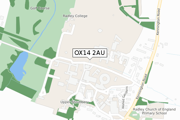
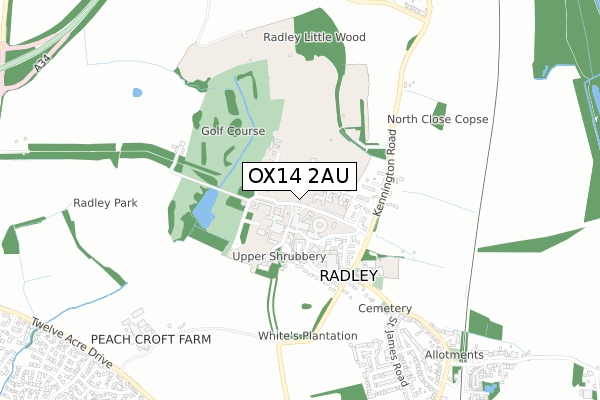
OX14 2AU is located in the Kennington & Radley electoral ward, within the local authority district of Vale of White Horse and the English Parliamentary constituency of Oxford West and Abingdon. The Sub Integrated Care Board (ICB) Location is NHS Buckinghamshire, Oxfordshire and Berkshire West ICB - 10Q and the police force is Thames Valley. This postcode has been in use since August 2018.


GetTheData
Source: OS Open Zoomstack (Ordnance Survey)
Licence: Open Government Licence (requires attribution)
Attribution: Contains OS data © Crown copyright and database right 2024
Source: Open Postcode Geo
Licence: Open Government Licence (requires attribution)
Attribution: Contains OS data © Crown copyright and database right 2024; Contains Royal Mail data © Royal Mail copyright and database right 2024; Source: Office for National Statistics licensed under the Open Government Licence v.3.0
| Easting | 451425 |
| Northing | 199902 |
| Latitude | 51.695524 |
| Longitude | -1.257352 |
GetTheData
Source: Open Postcode Geo
Licence: Open Government Licence
| Country | England |
| Postcode District | OX14 |
➜ See where OX14 is on a map | |
GetTheData
Source: Land Registry Price Paid Data
Licence: Open Government Licence
| Ward | Kennington & Radley |
| Constituency | Oxford West And Abingdon |
GetTheData
Source: ONS Postcode Database
Licence: Open Government Licence
| Lodge Hill (Oxford Road) | Abingdon | 742m |
| Lodge Hill (Oxford Road) | Abingdon | 793m |
| Radley College (Kennington Road) | Radley | 882m |
| Radley College (Kennington Road) | Radley | 899m |
| Radley Church (Church Road) | Radley | 943m |
| Radley Station | 1.6km |
| Culham Station | 4.9km |
GetTheData
Source: NaPTAN
Licence: Open Government Licence
GetTheData
Source: ONS Postcode Database
Licence: Open Government Licence


➜ Get more ratings from the Food Standards Agency
GetTheData
Source: Food Standards Agency
Licence: FSA terms & conditions
| Last Collection | |||
|---|---|---|---|
| Location | Mon-Fri | Sat | Distance |
| Sugworth Lane | 16:00 | 07:30 | 955m |
| Upper Radley | 16:30 | 09:00 | 958m |
| Charney Avenue | 16:45 | 08:30 | 1,145m |
GetTheData
Source: Dracos
Licence: Creative Commons Attribution-ShareAlike
The below table lists the International Territorial Level (ITL) codes (formerly Nomenclature of Territorial Units for Statistics (NUTS) codes) and Local Administrative Units (LAU) codes for OX14 2AU:
| ITL 1 Code | Name |
|---|---|
| TLJ | South East (England) |
| ITL 2 Code | Name |
| TLJ1 | Berkshire, Buckinghamshire and Oxfordshire |
| ITL 3 Code | Name |
| TLJ14 | Oxfordshire CC |
| LAU 1 Code | Name |
| E07000180 | Vale of White Horse |
GetTheData
Source: ONS Postcode Directory
Licence: Open Government Licence
The below table lists the Census Output Area (OA), Lower Layer Super Output Area (LSOA), and Middle Layer Super Output Area (MSOA) for OX14 2AU:
| Code | Name | |
|---|---|---|
| OA | E00146404 | |
| LSOA | E01028744 | Vale of White Horse 003D |
| MSOA | E02005980 | Vale of White Horse 003 |
GetTheData
Source: ONS Postcode Directory
Licence: Open Government Licence
| OX14 2JW | Kennington Road | 881m |
| OX14 2JD | Lodge Hill | 918m |
| OX14 2HY | Sugworth Lane | 924m |
| OX14 2JL | Whites Lane | 936m |
| OX14 2RF | Barfleur Close | 942m |
| OX14 2RQ | Pytenry Close | 960m |
| OX14 2RG | Covent Close | 964m |
| OX14 2RE | Ethelhelm Close | 966m |
| OX14 2NT | St Andrews Close | 994m |
| OX14 2JP | Kennington Road | 997m |
GetTheData
Source: Open Postcode Geo; Land Registry Price Paid Data
Licence: Open Government Licence