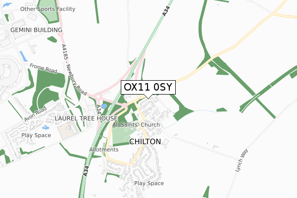
OX11 0SY is located in the Blewbury & Harwell electoral ward, within the local authority district of Vale of White Horse and the English Parliamentary constituency of Wantage. The Sub Integrated Care Board (ICB) Location is NHS Buckinghamshire, Oxfordshire and Berkshire West ICB - 10Q and the police force is Thames Valley. This postcode has been in use since June 2019.


GetTheData
Source: OS Open Zoomstack (Ordnance Survey)
Licence: Open Government Licence (requires attribution)
Attribution: Contains OS data © Crown copyright and database right 2025
Source: Open Postcode Geo
Licence: Open Government Licence (requires attribution)
Attribution: Contains OS data © Crown copyright and database right 2025; Contains Royal Mail data © Royal Mail copyright and database right 2025; Source: Office for National Statistics licensed under the Open Government Licence v.3.0
| Easting | 449060 |
| Northing | 186165 |
| Latitude | 51.572229 |
| Longitude | -1.293488 |
GetTheData
Source: Open Postcode Geo
Licence: Open Government Licence
| Country | England |
| Postcode District | OX11 |
➜ See where OX11 is on a map ➜ Where is Chilton? | |
GetTheData
Source: Land Registry Price Paid Data
Licence: Open Government Licence
| Ward | Blewbury & Harwell |
| Constituency | Wantage |
GetTheData
Source: ONS Postcode Database
Licence: Open Government Licence
15, PEGASUS CLOSE, CHILTON, DIDCOT, OX11 0SY 2021 15 DEC £460,000 |
14, PEGASUS CLOSE, CHILTON, DIDCOT, OX11 0SY 2021 30 JUL £465,000 |
2, PEGASUS CLOSE, CHILTON, DIDCOT, OX11 0SY 2020 29 SEP £450,000 |
1, PEGASUS CLOSE, CHILTON, DIDCOT, OX11 0SY 2019 4 DEC £485,000 |
GetTheData
Source: HM Land Registry Price Paid Data
Licence: Contains HM Land Registry data © Crown copyright and database right 2025. This data is licensed under the Open Government Licence v3.0.
| Latton Close (Church Hill) | Chilton | 206m |
| Latton Close (Church Hill) | Chilton | 209m |
| Old Post Office (Main Street) | Chilton | 493m |
| Old Post Office (Main Street) | Chilton | 512m |
| Chilton Garden Centre (A4185) | Chilton | 677m |
| Didcot Parkway Station | 5.6km |
GetTheData
Source: NaPTAN
Licence: Open Government Licence
| Percentage of properties with Next Generation Access | 100.0% |
| Percentage of properties with Superfast Broadband | 100.0% |
| Percentage of properties with Ultrafast Broadband | 0.0% |
| Percentage of properties with Full Fibre Broadband | 0.0% |
Superfast Broadband is between 30Mbps and 300Mbps
Ultrafast Broadband is > 300Mbps
| Percentage of properties unable to receive 2Mbps | 0.0% |
| Percentage of properties unable to receive 5Mbps | 0.0% |
| Percentage of properties unable to receive 10Mbps | 0.0% |
| Percentage of properties unable to receive 30Mbps | 0.0% |
GetTheData
Source: Ofcom
Licence: Ofcom Terms of Use (requires attribution)
GetTheData
Source: ONS Postcode Database
Licence: Open Government Licence


➜ Get more ratings from the Food Standards Agency
GetTheData
Source: Food Standards Agency
Licence: FSA terms & conditions
| Last Collection | |||
|---|---|---|---|
| Location | Mon-Fri | Sat | Distance |
| Latton Close | 16:00 | 09:15 | 178m |
| Chilton Post Office | 16:00 | 09:15 | 510m |
| Southend Icknield Way | 16:00 | 07:00 | 1,619m |
GetTheData
Source: Dracos
Licence: Creative Commons Attribution-ShareAlike
The below table lists the International Territorial Level (ITL) codes (formerly Nomenclature of Territorial Units for Statistics (NUTS) codes) and Local Administrative Units (LAU) codes for OX11 0SY:
| ITL 1 Code | Name |
|---|---|
| TLJ | South East (England) |
| ITL 2 Code | Name |
| TLJ1 | Berkshire, Buckinghamshire and Oxfordshire |
| ITL 3 Code | Name |
| TLJ14 | Oxfordshire CC |
| LAU 1 Code | Name |
| E07000180 | Vale of White Horse |
GetTheData
Source: ONS Postcode Directory
Licence: Open Government Licence
The below table lists the Census Output Area (OA), Lower Layer Super Output Area (LSOA), and Middle Layer Super Output Area (MSOA) for OX11 0SY:
| Code | Name | |
|---|---|---|
| OA | E00146321 | |
| LSOA | E01028729 | Vale of White Horse 015D |
| MSOA | E02005992 | Vale of White Horse 015 |
GetTheData
Source: ONS Postcode Directory
Licence: Open Government Licence
| OX11 0SS | Manor Close | 47m |
| OX11 0HW | Limetrees | 83m |
| OX11 0HY | Limetrees | 131m |
| OX11 0SJ | Townsend | 136m |
| OX11 0SU | Latton Close | 231m |
| OX11 0SN | Dene Hollow | 258m |
| OX11 0SE | The Lane | 264m |
| OX11 0SH | Church Hill | 303m |
| OX11 0SD | The Green | 317m |
| OX11 0RZ | Main Street | 455m |
GetTheData
Source: Open Postcode Geo; Land Registry Price Paid Data
Licence: Open Government Licence