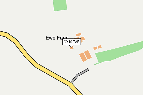
OX10 7AF is located in the Chalgrove electoral ward, within the local authority district of South Oxfordshire and the English Parliamentary constituency of Henley. The Sub Integrated Care Board (ICB) Location is NHS Buckinghamshire, Oxfordshire and Berkshire West ICB - 10Q and the police force is Thames Valley. This postcode has been in use since July 1990.


GetTheData
Source: OS OpenMap – Local (Ordnance Survey)
Source: OS VectorMap District (Ordnance Survey)
Licence: Open Government Licence (requires attribution)
| Easting | 461643 |
| Northing | 195474 |
| Latitude | 51.654684 |
| Longitude | -1.110331 |
GetTheData
Source: Open Postcode Geo
Licence: Open Government Licence
| Country | England |
| Postcode District | OX10 |
➜ See where OX10 is on a map | |
GetTheData
Source: Land Registry Price Paid Data
Licence: Open Government Licence
Elevation or altitude of OX10 7AF as distance above sea level:
| Metres | Feet | |
|---|---|---|
| Elevation | 80m | 262ft |
Elevation is measured from the approximate centre of the postcode, to the nearest point on an OS contour line from OS Terrain 50, which has contour spacing of ten vertical metres.
➜ How high above sea level am I? Find the elevation of your current position using your device's GPS.
GetTheData
Source: Open Postcode Elevation
Licence: Open Government Licence
| Ward | Chalgrove |
| Constituency | Henley |
GetTheData
Source: ONS Postcode Database
Licence: Open Government Licence
| The Lydes (A329) | Newington | 1,320m |
| The Lydes (A329) | Newington | 1,324m |
GetTheData
Source: NaPTAN
Licence: Open Government Licence
GetTheData
Source: ONS Postcode Database
Licence: Open Government Licence

➜ Get more ratings from the Food Standards Agency
GetTheData
Source: Food Standards Agency
Licence: FSA terms & conditions
| Last Collection | |||
|---|---|---|---|
| Location | Mon-Fri | Sat | Distance |
| Berrick Prior | 16:30 | 08:45 | 1,260m |
| Newington | 16:45 | 09:00 | 1,303m |
| Berrick Salome | 16:30 | 09:15 | 1,752m |
GetTheData
Source: Dracos
Licence: Creative Commons Attribution-ShareAlike
The below table lists the International Territorial Level (ITL) codes (formerly Nomenclature of Territorial Units for Statistics (NUTS) codes) and Local Administrative Units (LAU) codes for OX10 7AF:
| ITL 1 Code | Name |
|---|---|
| TLJ | South East (England) |
| ITL 2 Code | Name |
| TLJ1 | Berkshire, Buckinghamshire and Oxfordshire |
| ITL 3 Code | Name |
| TLJ14 | Oxfordshire CC |
| LAU 1 Code | Name |
| E07000179 | South Oxfordshire |
GetTheData
Source: ONS Postcode Directory
Licence: Open Government Licence
The below table lists the Census Output Area (OA), Lower Layer Super Output Area (LSOA), and Middle Layer Super Output Area (MSOA) for OX10 7AF:
| Code | Name | |
|---|---|---|
| OA | E00145716 | |
| LSOA | E01028603 | South Oxfordshire 007B |
| MSOA | E02005964 | South Oxfordshire 007 |
GetTheData
Source: ONS Postcode Directory
Licence: Open Government Licence
| OX10 6JR | 1093m | |
| OX10 6JS | 1106m | |
| OX10 6JW | Green Lane | 1127m |
| OX10 7AG | 1252m | |
| OX10 6JP | 1277m | |
| OX10 7AD | 1429m | |
| OX10 6JN | 1447m | |
| OX10 7AH | 1484m | |
| OX10 7AJ | Holcombe Lane | 1518m |
| OX10 6JT | 1692m |
GetTheData
Source: Open Postcode Geo; Land Registry Price Paid Data
Licence: Open Government Licence