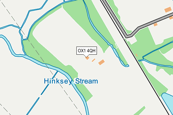
OX1 4QH is located in the Hinksey Park electoral ward, within the local authority district of Oxford and the English Parliamentary constituency of Oxford East. The Sub Integrated Care Board (ICB) Location is NHS Buckinghamshire, Oxfordshire and Berkshire West ICB - 10Q and the police force is Thames Valley. This postcode has been in use since July 1995.


GetTheData
Source: OS OpenMap – Local (Ordnance Survey)
Source: OS VectorMap District (Ordnance Survey)
Licence: Open Government Licence (requires attribution)
| Easting | 451204 |
| Northing | 205180 |
| Latitude | 51.742996 |
| Longitude | -1.259775 |
GetTheData
Source: Open Postcode Geo
Licence: Open Government Licence
| Country | England |
| Postcode District | OX1 |
➜ See where OX1 is on a map | |
GetTheData
Source: Land Registry Price Paid Data
Licence: Open Government Licence
Elevation or altitude of OX1 4QH as distance above sea level:
| Metres | Feet | |
|---|---|---|
| Elevation | 60m | 197ft |
Elevation is measured from the approximate centre of the postcode, to the nearest point on an OS contour line from OS Terrain 50, which has contour spacing of ten vertical metres.
➜ How high above sea level am I? Find the elevation of your current position using your device's GPS.
GetTheData
Source: Open Postcode Elevation
Licence: Open Government Licence
| Ward | Hinksey Park |
| Constituency | Oxford East |
GetTheData
Source: ONS Postcode Database
Licence: Open Government Licence
| Whitehouse Road (Abingdon Road) | Oxford | 277m |
| Whitehouse Road (Abingdon Road) | Oxford | 297m |
| Newton Road (Abingdon Road) | Oxford | 300m |
| Newton Road (Abingdon Road) | Oxford | 372m |
| Lake Street (Abingdon Road) | New Hinksey | 467m |
| Oxford Station | 1.4km |
GetTheData
Source: NaPTAN
Licence: Open Government Licence
GetTheData
Source: ONS Postcode Database
Licence: Open Government Licence


➜ Get more ratings from the Food Standards Agency
GetTheData
Source: Food Standards Agency
Licence: FSA terms & conditions
| Last Collection | |||
|---|---|---|---|
| Location | Mon-Fri | Sat | Distance |
| Marlborough Road | 17:15 | 12:00 | 137m |
| Grandpont Post Office | 18:30 | 12:00 | 312m |
| Lake Street | 18:30 | 12:00 | 478m |
GetTheData
Source: Dracos
Licence: Creative Commons Attribution-ShareAlike
| Risk of OX1 4QH flooding from rivers and sea | High |
| ➜ OX1 4QH flood map | |
GetTheData
Source: Open Flood Risk by Postcode
Licence: Open Government Licence
The below table lists the International Territorial Level (ITL) codes (formerly Nomenclature of Territorial Units for Statistics (NUTS) codes) and Local Administrative Units (LAU) codes for OX1 4QH:
| ITL 1 Code | Name |
|---|---|
| TLJ | South East (England) |
| ITL 2 Code | Name |
| TLJ1 | Berkshire, Buckinghamshire and Oxfordshire |
| ITL 3 Code | Name |
| TLJ14 | Oxfordshire CC |
| LAU 1 Code | Name |
| E07000178 | Oxford |
GetTheData
Source: ONS Postcode Directory
Licence: Open Government Licence
The below table lists the Census Output Area (OA), Lower Layer Super Output Area (LSOA), and Middle Layer Super Output Area (MSOA) for OX1 4QH:
| Code | Name | |
|---|---|---|
| OA | E00145406 | |
| LSOA | E01028543 | Oxford 012C |
| MSOA | E02005951 | Oxford 012 |
GetTheData
Source: ONS Postcode Directory
Licence: Open Government Licence
| OX1 4QJ | Whitehouse Road | 54m |
| OX1 4LT | Marlborough Road | 108m |
| OX1 4LZ | Marlborough Road | 109m |
| OX1 4NA | Whitehouse Road | 117m |
| OX1 4NZ | Hodges Court | 122m |
| OX1 4FS | Marlborough Road | 129m |
| OX1 4LX | Marlborough Road | 132m |
| OX1 4FR | Marlborough Road | 137m |
| OX1 4NX | Hodges Court | 146m |
| OX1 4LS | Marlborough Road | 150m |
GetTheData
Source: Open Postcode Geo; Land Registry Price Paid Data
Licence: Open Government Licence