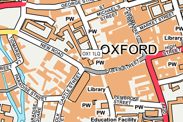
OX1 1LQ is located in the Carfax & Jericho electoral ward, within the local authority district of Oxford and the English Parliamentary constituency of Oxford East. The Sub Integrated Care Board (ICB) Location is NHS Buckinghamshire, Oxfordshire and Berkshire West ICB - 10Q and the police force is Thames Valley. This postcode has been in use since January 1983.


GetTheData
Source: OS OpenMap – Local (Ordnance Survey)
Source: OS VectorMap District (Ordnance Survey)
Licence: Open Government Licence (requires attribution)
| Easting | 451158 |
| Northing | 206170 |
| Latitude | 51.751901 |
| Longitude | -1.260296 |
GetTheData
Source: Open Postcode Geo
Licence: Open Government Licence
| Country | England |
| Postcode District | OX1 |
➜ See where OX1 is on a map ➜ Where is Oxford? | |
GetTheData
Source: Land Registry Price Paid Data
Licence: Open Government Licence
Elevation or altitude of OX1 1LQ as distance above sea level:
| Metres | Feet | |
|---|---|---|
| Elevation | 60m | 197ft |
Elevation is measured from the approximate centre of the postcode, to the nearest point on an OS contour line from OS Terrain 50, which has contour spacing of ten vertical metres.
➜ How high above sea level am I? Find the elevation of your current position using your device's GPS.
GetTheData
Source: Open Postcode Elevation
Licence: Open Government Licence
| Ward | Carfax & Jericho |
| Constituency | Oxford East |
GetTheData
Source: ONS Postcode Database
Licence: Open Government Licence
| Bonn Square | Oxford City Centre | 32m |
| Castle Street | Oxford City Centre | 55m |
| Castle Street (New Road) | Oxford City Centre | 58m |
| County Hall (New Road) | Oxford City Centre | 81m |
| Castle Street | Oxford City Centre | 82m |
| Oxford Station | 0.7km |
GetTheData
Source: NaPTAN
Licence: Open Government Licence
GetTheData
Source: ONS Postcode Database
Licence: Open Government Licence


➜ Get more ratings from the Food Standards Agency
GetTheData
Source: Food Standards Agency
Licence: FSA terms & conditions
| Last Collection | |||
|---|---|---|---|
| Location | Mon-Fri | Sat | Distance |
| Queen Street | 18:30 | 12:00 | 47m |
| Carfax | 18:30 | 12:00 | 163m |
| George Street | 18:30 | 12:00 | 202m |
GetTheData
Source: Dracos
Licence: Creative Commons Attribution-ShareAlike
The below table lists the International Territorial Level (ITL) codes (formerly Nomenclature of Territorial Units for Statistics (NUTS) codes) and Local Administrative Units (LAU) codes for OX1 1LQ:
| ITL 1 Code | Name |
|---|---|
| TLJ | South East (England) |
| ITL 2 Code | Name |
| TLJ1 | Berkshire, Buckinghamshire and Oxfordshire |
| ITL 3 Code | Name |
| TLJ14 | Oxfordshire CC |
| LAU 1 Code | Name |
| E07000178 | Oxford |
GetTheData
Source: ONS Postcode Directory
Licence: Open Government Licence
The below table lists the Census Output Area (OA), Lower Layer Super Output Area (LSOA), and Middle Layer Super Output Area (MSOA) for OX1 1LQ:
| Code | Name | |
|---|---|---|
| OA | E00172575 | |
| LSOA | E01028521 | Oxford 008A |
| MSOA | E02005947 | Oxford 008 |
GetTheData
Source: ONS Postcode Directory
Licence: Open Government Licence
| OX1 2DW | New Inn Hall Street | 52m |
| OX1 1ER | Queen Street | 76m |
| OX1 1AY | New Road | 146m |
| OX1 1EJ | Queen Street | 151m |
| OX1 2EB | St Michaels Street | 157m |
| OX1 2DE | New Inn Hall Street | 162m |
| OX1 2DU | St Michaels Street | 199m |
| OX1 1AZ | Tidmarsh Lane | 221m |
| OX1 2BJ | George Street | 222m |
| OX1 1LD | Paradise Street | 223m |
GetTheData
Source: Open Postcode Geo; Land Registry Price Paid Data
Licence: Open Government Licence