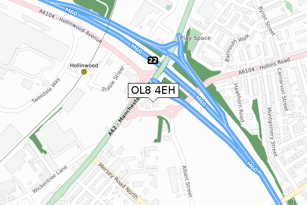
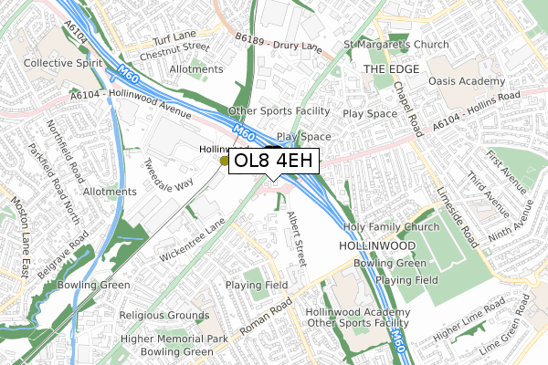
OL8 4EH is located in the Failsworth East electoral ward, within the metropolitan district of Oldham and the English Parliamentary constituency of Ashton-under-Lyne. The Sub Integrated Care Board (ICB) Location is NHS Greater Manchester ICB - 00Y and the police force is Greater Manchester. This postcode has been in use since February 2019.


GetTheData
Source: OS Open Zoomstack (Ordnance Survey)
Licence: Open Government Licence (requires attribution)
Attribution: Contains OS data © Crown copyright and database right 2024
Source: Open Postcode Geo
Licence: Open Government Licence (requires attribution)
Attribution: Contains OS data © Crown copyright and database right 2024; Contains Royal Mail data © Royal Mail copyright and database right 2024; Source: Office for National Statistics licensed under the Open Government Licence v.3.0
| Easting | 390542 |
| Northing | 402482 |
| Latitude | 53.518940 |
| Longitude | -2.144112 |
GetTheData
Source: Open Postcode Geo
Licence: Open Government Licence
| Country | England |
| Postcode District | OL8 |
➜ See where OL8 is on a map ➜ Where is Failsworth? | |
GetTheData
Source: Land Registry Price Paid Data
Licence: Open Government Licence
| Ward | Failsworth East |
| Constituency | Ashton-under-lyne |
GetTheData
Source: ONS Postcode Database
Licence: Open Government Licence
| Oldham Rd/Hollinwood (Oldham Rd) | Hollinwood | 140m |
| Railway Road | Hollinwood | 211m |
| Railway Rd/Hollinwood Tram Stop (Railway Rd) | Hollinwood | 214m |
| Oldham Rd/Hollinwood (Wickentree Ln) | Hollinwood | 224m |
| Oldham Rd/Hollinwood (Oldham Rd) | Hollinwood | 228m |
| Hollinwood (Manchester Metrolink) (Railway Road) | Hollinwood | 246m |
| South Chadderton (Manchester Metrolink) (Canal St) | White Gate | 846m |
| Failsworth (Manchester Metrolink) (Hardman Lane) | Failsworth | 1,554m |
| Moston Station | 1.9km |
| Mills Hill (Manchester) Station | 4km |
| Ashton-under-Lyne Station | 4.5km |
GetTheData
Source: NaPTAN
Licence: Open Government Licence
GetTheData
Source: ONS Postcode Database
Licence: Open Government Licence


➜ Get more ratings from the Food Standards Agency
GetTheData
Source: Food Standards Agency
Licence: FSA terms & conditions
| Last Collection | |||
|---|---|---|---|
| Location | Mon-Fri | Sat | Distance |
| Morrisons | 17:40 | 12:00 | 646m |
| Corner Of Chapel Road | 17:30 | 11:55 | 676m |
| Sycamore Avenue | 17:35 | 12:10 | 1,347m |
GetTheData
Source: Dracos
Licence: Creative Commons Attribution-ShareAlike
The below table lists the International Territorial Level (ITL) codes (formerly Nomenclature of Territorial Units for Statistics (NUTS) codes) and Local Administrative Units (LAU) codes for OL8 4EH:
| ITL 1 Code | Name |
|---|---|
| TLD | North West (England) |
| ITL 2 Code | Name |
| TLD3 | Greater Manchester |
| ITL 3 Code | Name |
| TLD37 | Greater Manchester North East |
| LAU 1 Code | Name |
| E08000004 | Oldham |
GetTheData
Source: ONS Postcode Directory
Licence: Open Government Licence
The below table lists the Census Output Area (OA), Lower Layer Super Output Area (LSOA), and Middle Layer Super Output Area (MSOA) for OL8 4EH:
| Code | Name | |
|---|---|---|
| OA | E00027159 | |
| LSOA | E01005362 | Oldham 031A |
| MSOA | E02001128 | Oldham 031 |
GetTheData
Source: ONS Postcode Directory
Licence: Open Government Licence
| OL8 3RB | Manchester Road | 116m |
| OL9 7LG | 197m | |
| OL9 7LS | Manchester Road | 202m |
| OL8 3QQ | Cardiff Close | 230m |
| OL8 4SF | Cardigan Road | 251m |
| OL8 4SE | Ruthin Close | 284m |
| OL8 3QF | Hawthorn Road | 289m |
| OL8 4RQ | Irving Street | 297m |
| M35 9FE | Oldham Road | 299m |
| OL9 7LP | Alford Street | 301m |
GetTheData
Source: Open Postcode Geo; Land Registry Price Paid Data
Licence: Open Government Licence