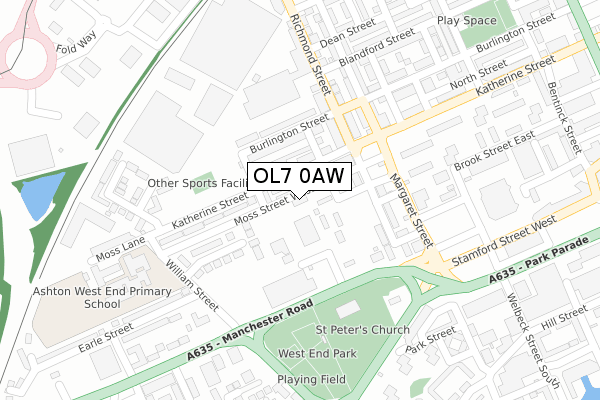
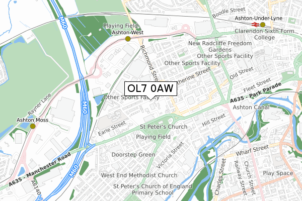
OL7 0AW is located in the St Peter's electoral ward, within the metropolitan district of Tameside and the English Parliamentary constituency of Ashton-under-Lyne. The Sub Integrated Care Board (ICB) Location is NHS Greater Manchester ICB - 01Y and the police force is Greater Manchester. This postcode has been in use since August 2018.


GetTheData
Source: OS Open Zoomstack (Ordnance Survey)
Licence: Open Government Licence (requires attribution)
Attribution: Contains OS data © Crown copyright and database right 2025
Source: Open Postcode Geo
Licence: Open Government Licence (requires attribution)
Attribution: Contains OS data © Crown copyright and database right 2025; Contains Royal Mail data © Royal Mail copyright and database right 2025; Source: Office for National Statistics licensed under the Open Government Licence v.3.0
| Easting | 392988 |
| Northing | 398768 |
| Latitude | 53.485596 |
| Longitude | -2.107139 |
GetTheData
Source: Open Postcode Geo
Licence: Open Government Licence
| Country | England |
| Postcode District | OL7 |
➜ See where OL7 is on a map ➜ Where is Ashton-under-Lyne? | |
GetTheData
Source: Land Registry Price Paid Data
Licence: Open Government Licence
| Ward | St Peter's |
| Constituency | Ashton-under-lyne |
GetTheData
Source: ONS Postcode Database
Licence: Open Government Licence
| Manchester Rd/Chester Sq (Manchester Rd) | Chester Square | 177m |
| Margaret Street | Chester Square | 186m |
| Katherine St/Margaret St (Katherine St) | Chester Square | 199m |
| Richmond St/Kenyon St (Richmond Street) | Ashton Under Lyne | 262m |
| Richmond St/Kenyon St (Richmond St) | Ashton Under Lyne | 278m |
| Ashton West (Manchester Metrolink) (Lord Sheldon Way) | Ashton Moss | 545m |
| Ashton-under-lyne (Manchester Metrolink) (Wellington Rd) | Ashton Under Lyne | 802m |
| Ashton Moss (Manchester Metrolink) (Lord Sheldon Way) | Ashton Moss | 1,010m |
| Ashton-under-Lyne Station | 1.1km |
| Guide Bridge Station | 1.3km |
| Hyde North Station | 2.7km |
GetTheData
Source: NaPTAN
Licence: Open Government Licence
GetTheData
Source: ONS Postcode Database
Licence: Open Government Licence


➜ Get more ratings from the Food Standards Agency
GetTheData
Source: Food Standards Agency
Licence: FSA terms & conditions
| Last Collection | |||
|---|---|---|---|
| Location | Mon-Fri | Sat | Distance |
| Ashton Delivery Office | 19:00 | 769m | |
| Christchurch | 17:25 | 11:50 | 1,015m |
| King Street | 17:30 | 12:00 | 1,182m |
GetTheData
Source: Dracos
Licence: Creative Commons Attribution-ShareAlike
The below table lists the International Territorial Level (ITL) codes (formerly Nomenclature of Territorial Units for Statistics (NUTS) codes) and Local Administrative Units (LAU) codes for OL7 0AW:
| ITL 1 Code | Name |
|---|---|
| TLD | North West (England) |
| ITL 2 Code | Name |
| TLD3 | Greater Manchester |
| ITL 3 Code | Name |
| TLD35 | Greater Manchester South East |
| LAU 1 Code | Name |
| E08000008 | Tameside |
GetTheData
Source: ONS Postcode Directory
Licence: Open Government Licence
The below table lists the Census Output Area (OA), Lower Layer Super Output Area (LSOA), and Middle Layer Super Output Area (MSOA) for OL7 0AW:
| Code | Name | |
|---|---|---|
| OA | E00030156 | |
| LSOA | E01005952 | Tameside 013D |
| MSOA | E02001241 | Tameside 013 |
GetTheData
Source: ONS Postcode Directory
Licence: Open Government Licence
| OL7 0AH | Hardwick Street | 55m |
| OL7 0AN | Mowbray Street | 61m |
| OL7 0AL | Katherine Street | 62m |
| OL7 0AJ | Hardwick Street | 94m |
| OL7 0AE | Burlington Street | 124m |
| OL6 7TX | Richmond Street | 128m |
| OL7 0AR | Richmond Street | 129m |
| OL7 0AQ | Katherine Street | 157m |
| OL6 7BE | Margaret Street | 175m |
| OL6 7BG | Burlington Street | 176m |
GetTheData
Source: Open Postcode Geo; Land Registry Price Paid Data
Licence: Open Government Licence