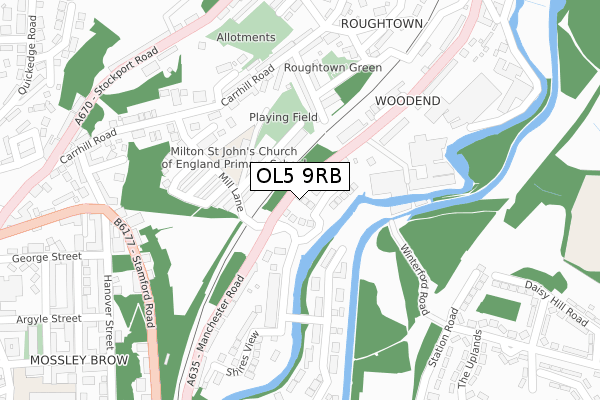
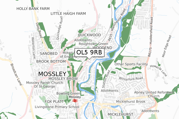
OL5 9RB is located in the Mossley electoral ward, within the metropolitan district of Tameside and the English Parliamentary constituency of Stalybridge and Hyde. The Sub Integrated Care Board (ICB) Location is NHS Greater Manchester ICB - 01Y and the police force is Greater Manchester. This postcode has been in use since January 2019.


GetTheData
Source: OS Open Zoomstack (Ordnance Survey)
Licence: Open Government Licence (requires attribution)
Attribution: Contains OS data © Crown copyright and database right 2025
Source: Open Postcode Geo
Licence: Open Government Licence (requires attribution)
Attribution: Contains OS data © Crown copyright and database right 2025; Contains Royal Mail data © Royal Mail copyright and database right 2025; Source: Office for National Statistics licensed under the Open Government Licence v.3.0
| Easting | 397552 |
| Northing | 402592 |
| Latitude | 53.520010 |
| Longitude | -2.038389 |
GetTheData
Source: Open Postcode Geo
Licence: Open Government Licence
| Country | England |
| Postcode District | OL5 |
➜ See where OL5 is on a map ➜ Where is Mossley? | |
GetTheData
Source: Land Registry Price Paid Data
Licence: Open Government Licence
| Ward | Mossley |
| Constituency | Stalybridge And Hyde |
GetTheData
Source: ONS Postcode Database
Licence: Open Government Licence
6, RIVERSIDE, MOSSLEY, ASHTON-UNDER-LYNE, OL5 9RB 2020 30 APR £399,995 |
22, RIVERSIDE, MOSSLEY, ASHTON-UNDER-LYNE, OL5 9RB 2020 27 APR £399,995 |
20, RIVERSIDE, MOSSLEY, ASHTON-UNDER-LYNE, OL5 9RB 2020 27 APR £399,995 |
12, RIVERSIDE, MOSSLEY, ASHTON-UNDER-LYNE, OL5 9RB 2020 18 MAR £399,995 |
GetTheData
Source: HM Land Registry Price Paid Data
Licence: Contains HM Land Registry data © Crown copyright and database right 2025. This data is licensed under the Open Government Licence v3.0.
| Manchester Rd/Mill Ln (Manchester Rd) | Mossley | 54m |
| Manchester Rd/Mill Ln (Manchester Rd) | Mossley | 92m |
| Manchester Rd/Woodend Mill (Manchester Rd) | Mossley | 135m |
| Manchester Rd/Woodend Mill (Manchester Rd) | Mossley | 168m |
| Carrhill Rd/Mill Ln (Carrhill Rd) | Top Mossley | 203m |
| Mossley (Manchester) Station | 0.6km |
| Greenfield Station | 2.7km |
| Stalybridge Station | 4.3km |
GetTheData
Source: NaPTAN
Licence: Open Government Licence
| Percentage of properties with Next Generation Access | 0.0% |
| Percentage of properties with Superfast Broadband | 0.0% |
| Percentage of properties with Ultrafast Broadband | 0.0% |
| Percentage of properties with Full Fibre Broadband | 0.0% |
Superfast Broadband is between 30Mbps and 300Mbps
Ultrafast Broadband is > 300Mbps
| Percentage of properties unable to receive 2Mbps | 0.0% |
| Percentage of properties unable to receive 5Mbps | 0.0% |
| Percentage of properties unable to receive 10Mbps | 0.0% |
| Percentage of properties unable to receive 30Mbps | 0.0% |
GetTheData
Source: Ofcom
Licence: Ofcom Terms of Use (requires attribution)
GetTheData
Source: ONS Postcode Database
Licence: Open Government Licence


➜ Get more ratings from the Food Standards Agency
GetTheData
Source: Food Standards Agency
Licence: FSA terms & conditions
| Last Collection | |||
|---|---|---|---|
| Location | Mon-Fri | Sat | Distance |
| Upper Mosley P.o. | 17:15 | 11:35 | 632m |
| Mossley P.o. | 17:30 | 11:30 | 634m |
| Heyhead | 16:30 | 11:30 | 1,348m |
GetTheData
Source: Dracos
Licence: Creative Commons Attribution-ShareAlike
The below table lists the International Territorial Level (ITL) codes (formerly Nomenclature of Territorial Units for Statistics (NUTS) codes) and Local Administrative Units (LAU) codes for OL5 9RB:
| ITL 1 Code | Name |
|---|---|
| TLD | North West (England) |
| ITL 2 Code | Name |
| TLD3 | Greater Manchester |
| ITL 3 Code | Name |
| TLD35 | Greater Manchester South East |
| LAU 1 Code | Name |
| E08000008 | Tameside |
GetTheData
Source: ONS Postcode Directory
Licence: Open Government Licence
The below table lists the Census Output Area (OA), Lower Layer Super Output Area (LSOA), and Middle Layer Super Output Area (MSOA) for OL5 9RB:
| Code | Name | |
|---|---|---|
| OA | E00030670 | |
| LSOA | E01006055 | Tameside 001C |
| MSOA | E02001229 | Tameside 001 |
GetTheData
Source: ONS Postcode Directory
Licence: Open Government Licence
| OL5 0SX | Milton View | 74m |
| OL5 0SP | Woodbank Terrace | 91m |
| OL5 9AT | Manchester Road | 98m |
| OL5 0BX | Tame View | 115m |
| OL5 9GD | Border Mill Fold | 139m |
| OL5 0BU | Archer Street | 145m |
| OL5 0SN | Woodend View | 171m |
| OL5 0BT | Vernon Street | 176m |
| OL5 0BQ | Woodmeadow Court | 178m |
| OL5 0SL | New Earth Street | 188m |
GetTheData
Source: Open Postcode Geo; Land Registry Price Paid Data
Licence: Open Government Licence