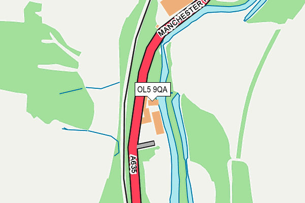
OL5 9QA is located in the Mossley electoral ward, within the metropolitan district of Tameside and the English Parliamentary constituency of Stalybridge and Hyde. The Sub Integrated Care Board (ICB) Location is NHS Greater Manchester ICB - 01Y and the police force is Greater Manchester. This postcode has been in use since January 1980.


GetTheData
Source: OS OpenMap – Local (Ordnance Survey)
Source: OS VectorMap District (Ordnance Survey)
Licence: Open Government Licence (requires attribution)
| Easting | 397284 |
| Northing | 401003 |
| Latitude | 53.505709 |
| Longitude | -2.042419 |
GetTheData
Source: Open Postcode Geo
Licence: Open Government Licence
| Country | England |
| Postcode District | OL5 |
➜ See where OL5 is on a map | |
GetTheData
Source: Land Registry Price Paid Data
Licence: Open Government Licence
Elevation or altitude of OL5 9QA as distance above sea level:
| Metres | Feet | |
|---|---|---|
| Elevation | 130m | 427ft |
Elevation is measured from the approximate centre of the postcode, to the nearest point on an OS contour line from OS Terrain 50, which has contour spacing of ten vertical metres.
➜ How high above sea level am I? Find the elevation of your current position using your device's GPS.
GetTheData
Source: Open Postcode Elevation
Licence: Open Government Licence
| Ward | Mossley |
| Constituency | Stalybridge And Hyde |
GetTheData
Source: ONS Postcode Database
Licence: Open Government Licence
| Manchester Rd/Weir Mill (Manchester Rd) | Mossley | 81m |
| Manchester Rd/New Scout Mill (Manchester Rd) | Mossley | 205m |
| Manchester Rd/New Scout Mill (Manchester Rd) | Mossley | 236m |
| Manchester Rd/Boundary Cl (Manchester Rd) | Heyrod | 325m |
| Manchester Rd/Boundary Cl (Manchester Rd) | Heyrod | 346m |
| Mossley (Manchester) Station | 1km |
| Stalybridge Station | 2.7km |
| Ashton-under-Lyne Station | 3.8km |
GetTheData
Source: NaPTAN
Licence: Open Government Licence
GetTheData
Source: ONS Postcode Database
Licence: Open Government Licence


➜ Get more ratings from the Food Standards Agency
GetTheData
Source: Food Standards Agency
Licence: FSA terms & conditions
| Last Collection | |||
|---|---|---|---|
| Location | Mon-Fri | Sat | Distance |
| Mossley P.o. | 17:30 | 11:30 | 979m |
| Heyhead | 16:30 | 11:30 | 1,014m |
| Buckton Drive | 17:00 | 11:30 | 1,099m |
GetTheData
Source: Dracos
Licence: Creative Commons Attribution-ShareAlike
The below table lists the International Territorial Level (ITL) codes (formerly Nomenclature of Territorial Units for Statistics (NUTS) codes) and Local Administrative Units (LAU) codes for OL5 9QA:
| ITL 1 Code | Name |
|---|---|
| TLD | North West (England) |
| ITL 2 Code | Name |
| TLD3 | Greater Manchester |
| ITL 3 Code | Name |
| TLD35 | Greater Manchester South East |
| LAU 1 Code | Name |
| E08000008 | Tameside |
GetTheData
Source: ONS Postcode Directory
Licence: Open Government Licence
The below table lists the Census Output Area (OA), Lower Layer Super Output Area (LSOA), and Middle Layer Super Output Area (MSOA) for OL5 9QA:
| Code | Name | |
|---|---|---|
| OA | E00030694 | |
| LSOA | E01006059 | Tameside 001F |
| MSOA | E02001229 | Tameside 001 |
GetTheData
Source: ONS Postcode Directory
Licence: Open Government Licence
| OL5 9QN | Manchester Road | 230m |
| OL5 9QF | Lower Beestow | 292m |
| OL6 9AJ | Luzley Road | 343m |
| OL5 9QD | Rock Terrace | 358m |
| OL5 9QE | Boundary Close | 418m |
| OL5 9NA | Manchester Road | 510m |
| OL6 9AL | Luzley Road | 520m |
| OL5 0DL | Andrew Street | 582m |
| OL5 9LZ | Manchester Road | 597m |
| OL5 9PP | Miller Hey | 609m |
GetTheData
Source: Open Postcode Geo; Land Registry Price Paid Data
Licence: Open Government Licence