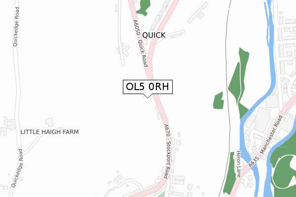
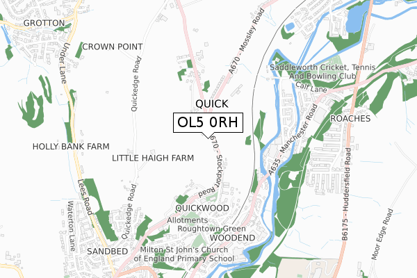
OL5 0RH is located in the Mossley electoral ward, within the metropolitan district of Tameside and the English Parliamentary constituency of Stalybridge and Hyde. The Sub Integrated Care Board (ICB) Location is NHS Greater Manchester ICB - 01Y and the police force is Greater Manchester. This postcode has been in use since October 2019.


GetTheData
Source: OS Open Zoomstack (Ordnance Survey)
Licence: Open Government Licence (requires attribution)
Attribution: Contains OS data © Crown copyright and database right 2025
Source: Open Postcode Geo
Licence: Open Government Licence (requires attribution)
Attribution: Contains OS data © Crown copyright and database right 2025; Contains Royal Mail data © Royal Mail copyright and database right 2025; Source: Office for National Statistics licensed under the Open Government Licence v.3.0
| Easting | 397588 |
| Northing | 403350 |
| Latitude | 53.526824 |
| Longitude | -2.037852 |
GetTheData
Source: Open Postcode Geo
Licence: Open Government Licence
| Country | England |
| Postcode District | OL5 |
➜ See where OL5 is on a map | |
GetTheData
Source: Land Registry Price Paid Data
Licence: Open Government Licence
| Ward | Mossley |
| Constituency | Stalybridge And Hyde |
GetTheData
Source: ONS Postcode Database
Licence: Open Government Licence
| Stockport Rd/Quick Rd (Stockport Rd) | Quick | 175m |
| Stockport Rd/Quick Rd (Stockport Rd) | Quick | 196m |
| Stockport Rd/Carrhill Rd (Stockport Rd) | Top Mossley | 201m |
| Stockport Rd/Carrhill Rd (Stockport Rd) | Top Mossley | 242m |
| Carrhill Rd/Dane St (Carrhill Rd) | Top Mossley | 344m |
| Mossley (Manchester) Station | 1.3km |
| Greenfield Station | 2.1km |
| Stalybridge Station | 5km |
GetTheData
Source: NaPTAN
Licence: Open Government Licence
GetTheData
Source: ONS Postcode Database
Licence: Open Government Licence


➜ Get more ratings from the Food Standards Agency
GetTheData
Source: Food Standards Agency
Licence: FSA terms & conditions
| Last Collection | |||
|---|---|---|---|
| Location | Mon-Fri | Sat | Distance |
| Upper Mosley P.o. | 17:15 | 11:35 | 1,018m |
| Mossley P.o. | 17:30 | 11:30 | 1,388m |
| 60 Shaw Hall Bank Road | 17:45 | 12:00 | 1,730m |
GetTheData
Source: Dracos
Licence: Creative Commons Attribution-ShareAlike
The below table lists the International Territorial Level (ITL) codes (formerly Nomenclature of Territorial Units for Statistics (NUTS) codes) and Local Administrative Units (LAU) codes for OL5 0RH:
| ITL 1 Code | Name |
|---|---|
| TLD | North West (England) |
| ITL 2 Code | Name |
| TLD3 | Greater Manchester |
| ITL 3 Code | Name |
| TLD35 | Greater Manchester South East |
| LAU 1 Code | Name |
| E08000008 | Tameside |
GetTheData
Source: ONS Postcode Directory
Licence: Open Government Licence
The below table lists the Census Output Area (OA), Lower Layer Super Output Area (LSOA), and Middle Layer Super Output Area (MSOA) for OL5 0RH:
| Code | Name | |
|---|---|---|
| OA | E00030696 | |
| LSOA | E01006053 | Tameside 001A |
| MSOA | E02001229 | Tameside 001 |
GetTheData
Source: ONS Postcode Directory
Licence: Open Government Licence
| OL5 0RJ | Strawberry Lane | 204m |
| OL5 0RQ | Stockport Road | 205m |
| OL5 0RT | Midge Hill | 243m |
| OL5 0RG | Rock Terrace | 273m |
| OL5 0RX | Roman Street | 289m |
| OL5 0RY | Saxon Street | 305m |
| OL5 0RS | Stockport Road | 309m |
| OL5 0RF | Stockport Road | 314m |
| OL5 0SA | Carrhill Road | 332m |
| OL5 0RZ | Dane Street | 339m |
GetTheData
Source: Open Postcode Geo; Land Registry Price Paid Data
Licence: Open Government Licence