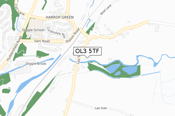
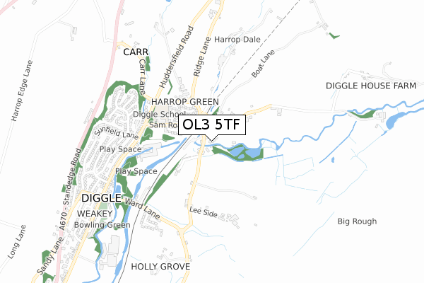
OL3 5TF is located in the Saddleworth North electoral ward, within the metropolitan district of Oldham and the English Parliamentary constituency of Oldham East and Saddleworth. The Sub Integrated Care Board (ICB) Location is NHS Greater Manchester ICB - 00Y and the police force is Greater Manchester. This postcode has been in use since January 2018.


GetTheData
Source: OS Open Zoomstack (Ordnance Survey)
Licence: Open Government Licence (requires attribution)
Attribution: Contains OS data © Crown copyright and database right 2025
Source: Open Postcode Geo
Licence: Open Government Licence (requires attribution)
Attribution: Contains OS data © Crown copyright and database right 2025; Contains Royal Mail data © Royal Mail copyright and database right 2025; Source: Office for National Statistics licensed under the Open Government Licence v.3.0
| Easting | 400752 |
| Northing | 407905 |
| Latitude | 53.567770 |
| Longitude | -1.990115 |
GetTheData
Source: Open Postcode Geo
Licence: Open Government Licence
| Country | England |
| Postcode District | OL3 |
➜ See where OL3 is on a map ➜ Where is Diggle? | |
GetTheData
Source: Land Registry Price Paid Data
Licence: Open Government Licence
| Ward | Saddleworth North |
| Constituency | Oldham East And Saddleworth |
GetTheData
Source: ONS Postcode Database
Licence: Open Government Licence
1, CHURCH GROVE, KILN GREEN, OLDHAM, OL3 5TF 2022 25 NOV £995,000 |
5, CHURCH GROVE, KILN GREEN, OLDHAM, OL3 5TF 2019 6 MAR £565,000 |
7, CHURCH GROVE, KILN GREEN, OLDHAM, OL3 5TF 2018 10 SEP £600,000 |
3, CHURCH GROVE, KILN GREEN, OLDHAM, OL3 5TF 2018 3 SEP £250,000 |
1, CHURCH GROVE, KILN GREEN, OLDHAM, OL3 5TF 2018 31 MAY £285,000 |
4, CHURCH GROVE, DIGGLE, OLDHAM, OL3 5TF 2017 6 OCT £249,000 |
2, CHURCH GROVE, DIGGLE, OLDHAM, OL3 5TF 2017 1 AUG £280,000 |
GetTheData
Source: HM Land Registry Price Paid Data
Licence: Contains HM Land Registry data © Crown copyright and database right 2025. This data is licensed under the Open Government Licence v3.0.
| Lee Side/Old Stn Terminus (Lee Side) | Diggle | 88m |
| Lee Side/Diggle Hotel (Lee Side) | Diggle | 97m |
| Station Rd/Sam Rd (Station Rd) | Diggle | 160m |
| Station Rd/Sam Rd (Station Rd) | Diggle | 173m |
| Sam Rd/Diggle Sch (Sam Rad) | Diggle | 303m |
| Greenfield Station | 3.6km |
| Marsden Station | 5.6km |
GetTheData
Source: NaPTAN
Licence: Open Government Licence
| Percentage of properties with Next Generation Access | 100.0% |
| Percentage of properties with Superfast Broadband | 100.0% |
| Percentage of properties with Ultrafast Broadband | 0.0% |
| Percentage of properties with Full Fibre Broadband | 0.0% |
Superfast Broadband is between 30Mbps and 300Mbps
Ultrafast Broadband is > 300Mbps
| Percentage of properties unable to receive 2Mbps | 0.0% |
| Percentage of properties unable to receive 5Mbps | 0.0% |
| Percentage of properties unable to receive 10Mbps | 0.0% |
| Percentage of properties unable to receive 30Mbps | 0.0% |
GetTheData
Source: Ofcom
Licence: Ofcom Terms of Use (requires attribution)
GetTheData
Source: ONS Postcode Database
Licence: Open Government Licence


➜ Get more ratings from the Food Standards Agency
GetTheData
Source: Food Standards Agency
Licence: FSA terms & conditions
| Last Collection | |||
|---|---|---|---|
| Location | Mon-Fri | Sat | Distance |
| Bleaky Nook | 10:30 | 10:30 | 1,498m |
| Delph Lane | 17:30 | 12:05 | 2,007m |
| New Delph | 16:15 | 11:15 | 2,108m |
GetTheData
Source: Dracos
Licence: Creative Commons Attribution-ShareAlike
The below table lists the International Territorial Level (ITL) codes (formerly Nomenclature of Territorial Units for Statistics (NUTS) codes) and Local Administrative Units (LAU) codes for OL3 5TF:
| ITL 1 Code | Name |
|---|---|
| TLD | North West (England) |
| ITL 2 Code | Name |
| TLD3 | Greater Manchester |
| ITL 3 Code | Name |
| TLD37 | Greater Manchester North East |
| LAU 1 Code | Name |
| E08000004 | Oldham |
GetTheData
Source: ONS Postcode Directory
Licence: Open Government Licence
The below table lists the Census Output Area (OA), Lower Layer Super Output Area (LSOA), and Middle Layer Super Output Area (MSOA) for OL3 5TF:
| Code | Name | |
|---|---|---|
| OA | E00027396 | |
| LSOA | E01005410 | Oldham 006A |
| MSOA | E02001103 | Oldham 006 |
GetTheData
Source: ONS Postcode Directory
Licence: Open Government Licence
| OL3 5JZ | Station Houses | 98m |
| OL3 5JY | Kiln Green | 134m |
| OL3 5LA | Diglea | 167m |
| OL3 5PZ | Heather Way | 226m |
| OL3 5PU | Sam Road | 227m |
| OL3 5LJ | Ainsbrook Terrace | 229m |
| OL3 5PY | Fatherford Close | 234m |
| OL3 5PX | Clydesdale Rise | 240m |
| OL3 5LW | Harrop Green | 316m |
| OL3 5JX | Lee Cross | 432m |
GetTheData
Source: Open Postcode Geo; Land Registry Price Paid Data
Licence: Open Government Licence