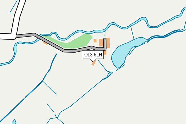
OL3 5LH lies on Diggle Mill Cottages in Diggle, Oldham. OL3 5LH is located in the Saddleworth North electoral ward, within the metropolitan district of Oldham and the English Parliamentary constituency of Oldham East and Saddleworth. The Sub Integrated Care Board (ICB) Location is NHS Greater Manchester ICB - 00Y and the police force is Greater Manchester. This postcode has been in use since January 1980.


GetTheData
Source: OS OpenMap – Local (Ordnance Survey)
Source: OS VectorMap District (Ordnance Survey)
Licence: Open Government Licence (requires attribution)
| Easting | 401724 |
| Northing | 408001 |
| Latitude | 53.568631 |
| Longitude | -1.975438 |
GetTheData
Source: Open Postcode Geo
Licence: Open Government Licence
| Street | Diggle Mill Cottages |
| Locality | Diggle |
| Town/City | Oldham |
| Country | England |
| Postcode District | OL3 |
➜ See where OL3 is on a map | |
GetTheData
Source: Land Registry Price Paid Data
Licence: Open Government Licence
Elevation or altitude of OL3 5LH as distance above sea level:
| Metres | Feet | |
|---|---|---|
| Elevation | 240m | 787ft |
Elevation is measured from the approximate centre of the postcode, to the nearest point on an OS contour line from OS Terrain 50, which has contour spacing of ten vertical metres.
➜ How high above sea level am I? Find the elevation of your current position using your device's GPS.
GetTheData
Source: Open Postcode Elevation
Licence: Open Government Licence
| Ward | Saddleworth North |
| Constituency | Oldham East And Saddleworth |
GetTheData
Source: ONS Postcode Database
Licence: Open Government Licence
| Lee Side/Diggle Hotel (Lee Side) | Diggle | 967m |
| Lee Side/Old Stn Terminus (Lee Side) | Diggle | 1,023m |
| Station Rd/Sam Rd (Station Rd) | Diggle | 1,032m |
| Station Rd/Sam Rd (Station Rd) | Diggle | 1,035m |
| Sam Rd/Diggle Sch (Sam Rad) | Diggle | 1,257m |
| Greenfield Station | 4.2km |
| Marsden Station | 4.9km |
GetTheData
Source: NaPTAN
Licence: Open Government Licence
GetTheData
Source: ONS Postcode Database
Licence: Open Government Licence


➜ Get more ratings from the Food Standards Agency
GetTheData
Source: Food Standards Agency
Licence: FSA terms & conditions
| Last Collection | |||
|---|---|---|---|
| Location | Mon-Fri | Sat | Distance |
| Bleaky Nook | 10:30 | 10:30 | 1,838m |
| Brownhill Vale | 17:00 | 11:00 | 2,813m |
| Delph Lane | 17:30 | 12:05 | 2,957m |
GetTheData
Source: Dracos
Licence: Creative Commons Attribution-ShareAlike
The below table lists the International Territorial Level (ITL) codes (formerly Nomenclature of Territorial Units for Statistics (NUTS) codes) and Local Administrative Units (LAU) codes for OL3 5LH:
| ITL 1 Code | Name |
|---|---|
| TLD | North West (England) |
| ITL 2 Code | Name |
| TLD3 | Greater Manchester |
| ITL 3 Code | Name |
| TLD37 | Greater Manchester North East |
| LAU 1 Code | Name |
| E08000004 | Oldham |
GetTheData
Source: ONS Postcode Directory
Licence: Open Government Licence
The below table lists the Census Output Area (OA), Lower Layer Super Output Area (LSOA), and Middle Layer Super Output Area (MSOA) for OL3 5LH:
| Code | Name | |
|---|---|---|
| OA | E00027401 | |
| LSOA | E01005410 | Oldham 006A |
| MSOA | E02001103 | Oldham 006 |
GetTheData
Source: ONS Postcode Directory
Licence: Open Government Licence
| OL3 5LB | 63m | |
| OL3 5LA | Diglea | 863m |
| OL3 5LL | Harrop Court Road | 959m |
| OL3 5LN | Harrop Court Road | 991m |
| OL3 5JZ | Station Houses | 997m |
| OL3 5LJ | Ainsbrook Terrace | 1008m |
| OL3 5JX | Lee Cross | 1052m |
| OL3 5LS | Huddersfield Road | 1060m |
| OL3 5JY | Kiln Green | 1089m |
| OL3 5PY | Fatherford Close | 1111m |
GetTheData
Source: Open Postcode Geo; Land Registry Price Paid Data
Licence: Open Government Licence