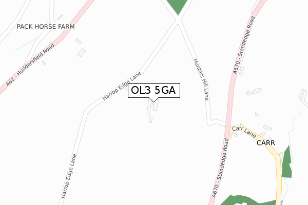
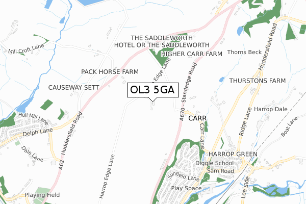
OL3 5GA is located in the Saddleworth North electoral ward, within the metropolitan district of Oldham and the English Parliamentary constituency of Oldham East and Saddleworth. The Sub Integrated Care Board (ICB) Location is NHS Greater Manchester ICB - 00Y and the police force is Greater Manchester. This postcode has been in use since September 2008.


GetTheData
Source: OS Open Zoomstack (Ordnance Survey)
Licence: Open Government Licence (requires attribution)
Attribution: Contains OS data © Crown copyright and database right 2025
Source: Open Postcode Geo
Licence: Open Government Licence (requires attribution)
Attribution: Contains OS data © Crown copyright and database right 2025; Contains Royal Mail data © Royal Mail copyright and database right 2025; Source: Office for National Statistics licensed under the Open Government Licence v.3.0
| Easting | 399939 |
| Northing | 408565 |
| Latitude | 53.573703 |
| Longitude | -2.002391 |
GetTheData
Source: Open Postcode Geo
Licence: Open Government Licence
| Country | England |
| Postcode District | OL3 |
➜ See where OL3 is on a map | |
GetTheData
Source: Land Registry Price Paid Data
Licence: Open Government Licence
Elevation or altitude of OL3 5GA as distance above sea level:
| Metres | Feet | |
|---|---|---|
| Elevation | 340m | 1,115ft |
Elevation is measured from the approximate centre of the postcode, to the nearest point on an OS contour line from OS Terrain 50, which has contour spacing of ten vertical metres.
➜ How high above sea level am I? Find the elevation of your current position using your device's GPS.
GetTheData
Source: Open Postcode Elevation
Licence: Open Government Licence
| Ward | Saddleworth North |
| Constituency | Oldham East And Saddleworth |
GetTheData
Source: ONS Postcode Database
Licence: Open Government Licence
| Standedge Rd/Carr Ln (Standedge Rd) | Diggle | 258m |
| Standedge Rd/Carr Ln (Standedge Rd) | Diggle | 265m |
| Standedge Rd/Shires Cottage (Standedge Rd) | Diggle | 513m |
| Standedge Rd/Shires Cottage (Standedge Rd) | Diggle | 518m |
| Standedge Rd/Higher Carr Farm (Standedge Rd) | Diggle | 567m |
| Greenfield Station | 3.9km |
| Marsden Station | 5.8km |
GetTheData
Source: NaPTAN
Licence: Open Government Licence
GetTheData
Source: ONS Postcode Database
Licence: Open Government Licence


➜ Get more ratings from the Food Standards Agency
GetTheData
Source: Food Standards Agency
Licence: FSA terms & conditions
| Last Collection | |||
|---|---|---|---|
| Location | Mon-Fri | Sat | Distance |
| Bleaky Nook | 10:30 | 10:30 | 1,001m |
| Delph Lane | 17:30 | 12:05 | 1,196m |
| Delph P.o. | 17:00 | 12:00 | 1,553m |
GetTheData
Source: Dracos
Licence: Creative Commons Attribution-ShareAlike
The below table lists the International Territorial Level (ITL) codes (formerly Nomenclature of Territorial Units for Statistics (NUTS) codes) and Local Administrative Units (LAU) codes for OL3 5GA:
| ITL 1 Code | Name |
|---|---|
| TLD | North West (England) |
| ITL 2 Code | Name |
| TLD3 | Greater Manchester |
| ITL 3 Code | Name |
| TLD37 | Greater Manchester North East |
| LAU 1 Code | Name |
| E08000004 | Oldham |
GetTheData
Source: ONS Postcode Directory
Licence: Open Government Licence
The below table lists the Census Output Area (OA), Lower Layer Super Output Area (LSOA), and Middle Layer Super Output Area (MSOA) for OL3 5GA:
| Code | Name | |
|---|---|---|
| OA | E00027397 | |
| LSOA | E01005410 | Oldham 006A |
| MSOA | E02001103 | Oldham 006 |
GetTheData
Source: ONS Postcode Directory
Licence: Open Government Licence
| OL3 5NB | Standedge Road | 275m |
| OL3 5ND | Carr Lane | 377m |
| OL3 5NH | Brookhill Close | 461m |
| OL3 5LX | Huddersfield Road | 495m |
| OL3 5NE | Buckton Close | 514m |
| OL3 5NQ | Elderberry Close | 534m |
| OL3 5PE | Slades View Close | 585m |
| OL3 5PD | Lower Knoll Road | 601m |
| OL3 5PH | Turnpike Close | 616m |
| OL3 5NF | Thorns Clough | 625m |
GetTheData
Source: Open Postcode Geo; Land Registry Price Paid Data
Licence: Open Government Licence