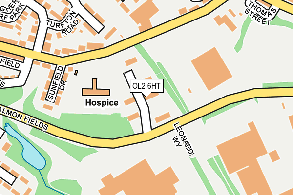
OL2 6HT is located in the Royton South electoral ward, within the metropolitan district of Oldham and the English Parliamentary constituency of Oldham West and Royton. The Sub Integrated Care Board (ICB) Location is NHS Greater Manchester ICB - 00Y and the police force is Greater Manchester. This postcode has been in use since May 2004.


GetTheData
Source: OS OpenMap – Local (Ordnance Survey)
Source: OS VectorMap District (Ordnance Survey)
Licence: Open Government Licence (requires attribution)
| Easting | 392758 |
| Northing | 407133 |
| Latitude | 53.560764 |
| Longitude | -2.110802 |
GetTheData
Source: Open Postcode Geo
Licence: Open Government Licence
| Country | England |
| Postcode District | OL2 |
➜ See where OL2 is on a map ➜ Where is Royton? | |
GetTheData
Source: Land Registry Price Paid Data
Licence: Open Government Licence
Elevation or altitude of OL2 6HT as distance above sea level:
| Metres | Feet | |
|---|---|---|
| Elevation | 170m | 558ft |
Elevation is measured from the approximate centre of the postcode, to the nearest point on an OS contour line from OS Terrain 50, which has contour spacing of ten vertical metres.
➜ How high above sea level am I? Find the elevation of your current position using your device's GPS.
GetTheData
Source: Open Postcode Elevation
Licence: Open Government Licence
| Ward | Royton South |
| Constituency | Oldham West And Royton |
GetTheData
Source: ONS Postcode Database
Licence: Open Government Licence
| Turf Ln/Cornish Way (Turf Ln) | Heyside | 307m |
| Salmon Fields/Higginshaw Ln (Salmon Fields) | Higginshaw | 399m |
| Higginshaw Ln/Turf Ln (Higginshaw Ln) | Higginshaw | 467m |
| Shaw Rd/Edge Lane St (Shaw Rd) | Royton | 468m |
| Salmon Fields | Royton | 469m |
| Derker (Manchester Metrolink) (Yates Street) | Derker | 1,362m |
| Mills Hill (Manchester) Station | 4.2km |
| Castleton (Manchester) Station | 5.6km |
| Moston Station | 5.8km |
GetTheData
Source: NaPTAN
Licence: Open Government Licence
| Median download speed | 67.0Mbps |
| Average download speed | 60.9Mbps |
| Maximum download speed | 80.00Mbps |
| Median upload speed | 20.0Mbps |
| Average upload speed | 19.6Mbps |
| Maximum upload speed | 20.00Mbps |
GetTheData
Source: Ofcom
Licence: Ofcom Terms of Use (requires attribution)
GetTheData
Source: ONS Postcode Database
Licence: Open Government Licence


➜ Get more ratings from the Food Standards Agency
GetTheData
Source: Food Standards Agency
Licence: FSA terms & conditions
| Last Collection | |||
|---|---|---|---|
| Location | Mon-Fri | Sat | Distance |
| Sheepfoot Lane | 17:30 | 11:15 | 987m |
| 625 Ripponden Road | 17:00 | 11:25 | 1,472m |
| Haggate Old Post Office | 17:00 | 11:20 | 1,605m |
GetTheData
Source: Dracos
Licence: Creative Commons Attribution-ShareAlike
The below table lists the International Territorial Level (ITL) codes (formerly Nomenclature of Territorial Units for Statistics (NUTS) codes) and Local Administrative Units (LAU) codes for OL2 6HT:
| ITL 1 Code | Name |
|---|---|
| TLD | North West (England) |
| ITL 2 Code | Name |
| TLD3 | Greater Manchester |
| ITL 3 Code | Name |
| TLD37 | Greater Manchester North East |
| LAU 1 Code | Name |
| E08000004 | Oldham |
GetTheData
Source: ONS Postcode Directory
Licence: Open Government Licence
The below table lists the Census Output Area (OA), Lower Layer Super Output Area (LSOA), and Middle Layer Super Output Area (MSOA) for OL2 6HT:
| Code | Name | |
|---|---|---|
| OA | E00027340 | |
| LSOA | E01005400 | Oldham 009C |
| MSOA | E02001106 | Oldham 009 |
GetTheData
Source: ONS Postcode Directory
Licence: Open Government Licence
| OL2 6EN | Turfland Avenue | 186m |
| OL2 6EU | Turf Lane | 187m |
| OL2 6EX | Sunfield Drive | 207m |
| OL2 6EW | Turfton Road | 209m |
| OL2 6JH | Turf Lane | 237m |
| OL2 6JL | Penthorpe Drive | 257m |
| OL2 6JJ | Penryn Avenue | 283m |
| OL2 6EP | Turf Park Road | 290m |
| OL2 6JR | Penryn Avenue | 298m |
| OL2 6EY | Sunfield Crescent | 318m |
GetTheData
Source: Open Postcode Geo; Land Registry Price Paid Data
Licence: Open Government Licence