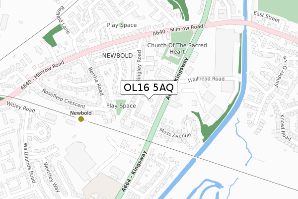
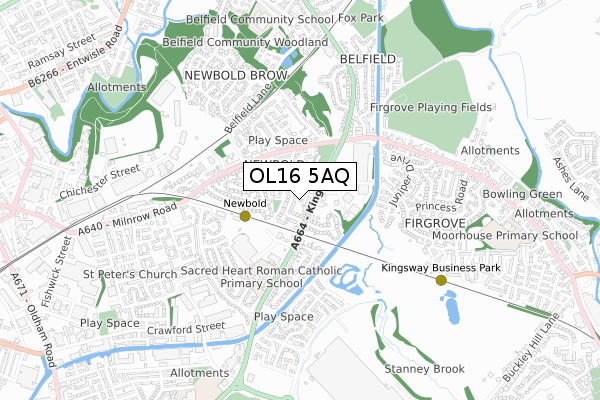
OL16 5AQ is located in the Kingsway electoral ward, within the metropolitan district of Rochdale and the English Parliamentary constituency of Rochdale. The Sub Integrated Care Board (ICB) Location is NHS Greater Manchester ICB - 01D and the police force is Greater Manchester. This postcode has been in use since August 2018.


GetTheData
Source: OS Open Zoomstack (Ordnance Survey)
Licence: Open Government Licence (requires attribution)
Attribution: Contains OS data © Crown copyright and database right 2025
Source: Open Postcode Geo
Licence: Open Government Licence (requires attribution)
Attribution: Contains OS data © Crown copyright and database right 2025; Contains Royal Mail data © Royal Mail copyright and database right 2025; Source: Office for National Statistics licensed under the Open Government Licence v.3.0
| Easting | 391360 |
| Northing | 413057 |
| Latitude | 53.614005 |
| Longitude | -2.132072 |
GetTheData
Source: Open Postcode Geo
Licence: Open Government Licence
| Country | England |
| Postcode District | OL16 |
➜ See where OL16 is on a map ➜ Where is Rochdale? | |
GetTheData
Source: Land Registry Price Paid Data
Licence: Open Government Licence
| Ward | Kingsway |
| Constituency | Rochdale |
GetTheData
Source: ONS Postcode Database
Licence: Open Government Licence
| Kingsway/Moss Ave (Kingsway) | Firgrove | 68m |
| Kingsway/Moss Ave (Kingsway) | Firgrove | 130m |
| Kingsway/Morrisons (Kingsway) | Firgrove | 202m |
| Kingsway/Milnrow Rd (Kingsway) | Firgrove | 225m |
| Milnrow Rd/Palatine St (Milnrow Rd) | Newbold | 233m |
| Newbold (Manchester Metrolink) (Kingsway) | Newbold | 238m |
| Kingsway Business Park (Manchester Metrolink) (Leyfield Road) | Milnrow | 631m |
| Milnrow (Manchester Metrolink) (Station Road) | Milnrow | 1,476m |
| Rochdale Railway Station (Manchester Metrolink) (Maclure Rd) | Rochdale | 1,517m |
| Rochdale Station | 1.5km |
| Smithy Bridge Station | 2.5km |
| Castleton (Manchester) Station | 3.9km |
GetTheData
Source: NaPTAN
Licence: Open Government Licence
GetTheData
Source: ONS Postcode Database
Licence: Open Government Licence


➜ Get more ratings from the Food Standards Agency
GetTheData
Source: Food Standards Agency
Licence: FSA terms & conditions
| Last Collection | |||
|---|---|---|---|
| Location | Mon-Fri | Sat | Distance |
| Belfield P.o. | 18:15 | 11:30 | 846m |
| Rochdale Delivery Office | 1,100m | ||
| Rochdale Delivery Office | 19:00 | 11:45 | 1,107m |
GetTheData
Source: Dracos
Licence: Creative Commons Attribution-ShareAlike
The below table lists the International Territorial Level (ITL) codes (formerly Nomenclature of Territorial Units for Statistics (NUTS) codes) and Local Administrative Units (LAU) codes for OL16 5AQ:
| ITL 1 Code | Name |
|---|---|
| TLD | North West (England) |
| ITL 2 Code | Name |
| TLD3 | Greater Manchester |
| ITL 3 Code | Name |
| TLD37 | Greater Manchester North East |
| LAU 1 Code | Name |
| E08000005 | Rochdale |
GetTheData
Source: ONS Postcode Directory
Licence: Open Government Licence
The below table lists the Census Output Area (OA), Lower Layer Super Output Area (LSOA), and Middle Layer Super Output Area (MSOA) for OL16 5AQ:
| Code | Name | |
|---|---|---|
| OA | E00028181 | |
| LSOA | E01005566 | Rochdale 012D |
| MSOA | E02001143 | Rochdale 012 |
GetTheData
Source: ONS Postcode Directory
Licence: Open Government Licence
| OL16 5BX | Kingsway | 41m |
| OL16 5BP | Bingley Terrace | 55m |
| OL16 5BW | Nigher Moss Avenue | 61m |
| OL16 5BL | Bingley Road | 87m |
| OL16 5BN | Adrian Terrace | 89m |
| OL16 4AB | Kingsway | 91m |
| OL16 5BY | Merinall Close | 120m |
| OL16 5BS | Bingley Square | 126m |
| OL16 5BJ | Palatine Street | 137m |
| OL16 4AA | Moss Avenue | 148m |
GetTheData
Source: Open Postcode Geo; Land Registry Price Paid Data
Licence: Open Government Licence