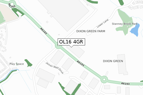
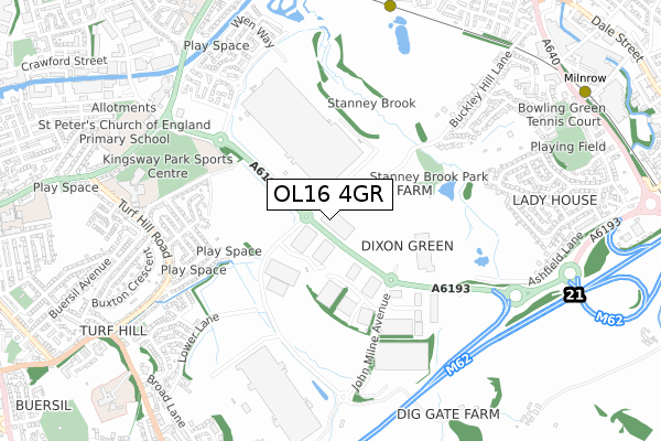
OL16 4GR is located in the Kingsway electoral ward, within the metropolitan district of Rochdale and the English Parliamentary constituency of Rochdale. The Sub Integrated Care Board (ICB) Location is NHS Greater Manchester ICB - 01D and the police force is Greater Manchester. This postcode has been in use since June 2019.


GetTheData
Source: OS Open Zoomstack (Ordnance Survey)
Licence: Open Government Licence (requires attribution)
Attribution: Contains OS data © Crown copyright and database right 2024
Source: Open Postcode Geo
Licence: Open Government Licence (requires attribution)
Attribution: Contains OS data © Crown copyright and database right 2024; Contains Royal Mail data © Royal Mail copyright and database right 2024; Source: Office for National Statistics licensed under the Open Government Licence v.3.0
| Easting | 391724 |
| Northing | 411909 |
| Latitude | 53.603693 |
| Longitude | -2.126538 |
GetTheData
Source: Open Postcode Geo
Licence: Open Government Licence
| Country | England |
| Postcode District | OL16 |
➜ See where OL16 is on a map | |
GetTheData
Source: Land Registry Price Paid Data
Licence: Open Government Licence
| Ward | Kingsway |
| Constituency | Rochdale |
GetTheData
Source: ONS Postcode Database
Licence: Open Government Licence
| Turf Hill Rd/Birkdale Rd (Turf Hill Rd) | Turf Hill | 624m |
| Woodlands Rd (Ne Bnd) (Woodlands Road) | Milnrow | 651m |
| Turf Hill Rd/Ansdell Rd (Turf Hill Rd) | Turf Hill | 686m |
| Egremont Rd (Se Bnd) (Egremont Rd) | Milnrow | 693m |
| Turf Hill Rd/Neston Rd (Turf Hill Rd) | Turf Hill | 704m |
| Kingsway Business Park (Manchester Metrolink) (Leyfield Road) | Milnrow | 845m |
| Milnrow (Manchester Metrolink) (Station Road) | Milnrow | 1,075m |
| Newbold (Manchester Metrolink) (Kingsway) | Newbold | 1,231m |
| Rochdale Station | 1.9km |
| Smithy Bridge Station | 3.4km |
| Castleton (Manchester) Station | 3.7km |
GetTheData
Source: NaPTAN
Licence: Open Government Licence
GetTheData
Source: ONS Postcode Database
Licence: Open Government Licence


➜ Get more ratings from the Food Standards Agency
GetTheData
Source: Food Standards Agency
Licence: FSA terms & conditions
| Last Collection | |||
|---|---|---|---|
| Location | Mon-Fri | Sat | Distance |
| Kingsway | 17:00 | 11:00 | 1,037m |
| Lowerplace P.o. | 18:30 | 11:30 | 1,249m |
| Rochdale Delivery Office | 19:00 | 11:45 | 1,608m |
GetTheData
Source: Dracos
Licence: Creative Commons Attribution-ShareAlike
The below table lists the International Territorial Level (ITL) codes (formerly Nomenclature of Territorial Units for Statistics (NUTS) codes) and Local Administrative Units (LAU) codes for OL16 4GR:
| ITL 1 Code | Name |
|---|---|
| TLD | North West (England) |
| ITL 2 Code | Name |
| TLD3 | Greater Manchester |
| ITL 3 Code | Name |
| TLD37 | Greater Manchester North East |
| LAU 1 Code | Name |
| E08000005 | Rochdale |
GetTheData
Source: ONS Postcode Directory
Licence: Open Government Licence
The below table lists the Census Output Area (OA), Lower Layer Super Output Area (LSOA), and Middle Layer Super Output Area (MSOA) for OL16 4GR:
| Code | Name | |
|---|---|---|
| OA | E00028179 | |
| LSOA | E01005567 | Rochdale 013D |
| MSOA | E02001144 | Rochdale 013 |
GetTheData
Source: ONS Postcode Directory
Licence: Open Government Licence
| OL16 4FW | Michael Faraday Avenue | 432m |
| OL16 4NW | 482m | |
| OL16 4XL | Lichfield Terrace | 499m |
| OL16 4XN | Delamere Road | 510m |
| OL16 4XE | Birkdale Road | 554m |
| OL16 4XJ | Lomond Terrace | 558m |
| OL16 4BP | Whitfield Drive | 566m |
| OL16 4XW | Neston Road | 573m |
| OL16 4XB | Stiups Lane | 588m |
| OL16 4XD | Delamere Road | 591m |
GetTheData
Source: Open Postcode Geo; Land Registry Price Paid Data
Licence: Open Government Licence