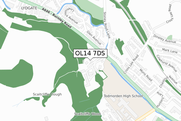
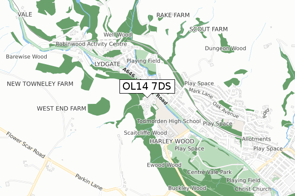
OL14 7DS is located in the Todmorden electoral ward, within the metropolitan district of Calderdale and the English Parliamentary constituency of Calder Valley. The Sub Integrated Care Board (ICB) Location is NHS West Yorkshire ICB - 02T and the police force is West Yorkshire. This postcode has been in use since July 2018.


GetTheData
Source: OS Open Zoomstack (Ordnance Survey)
Licence: Open Government Licence (requires attribution)
Attribution: Contains OS data © Crown copyright and database right 2024
Source: Open Postcode Geo
Licence: Open Government Licence (requires attribution)
Attribution: Contains OS data © Crown copyright and database right 2024; Contains Royal Mail data © Royal Mail copyright and database right 2024; Source: Office for National Statistics licensed under the Open Government Licence v.3.0
| Easting | 392611 |
| Northing | 425212 |
| Latitude | 53.723274 |
| Longitude | -2.113459 |
GetTheData
Source: Open Postcode Geo
Licence: Open Government Licence
| Country | England |
| Postcode District | OL14 |
➜ See where OL14 is on a map ➜ Where is Todmorden? | |
GetTheData
Source: Land Registry Price Paid Data
Licence: Open Government Licence
| Ward | Todmorden |
| Constituency | Calder Valley |
GetTheData
Source: ONS Postcode Database
Licence: Open Government Licence
| Burnley Rd Orchard Rd (Burnley Road) | Lydgate | 110m |
| Burnley Rd Orchard Rd (Burnley Road) | Lydgate | 132m |
| Scaitcliffe Hall (Burnley Road) | Lydgate | 136m |
| Scaitcliffe Hall (Burnley Road) | Lydgate | 155m |
| Todmorden High School (Burnley Road) | Lydgate | 355m |
| Todmorden Station | 1.4km |
| Walsden Station | 3.1km |
GetTheData
Source: NaPTAN
Licence: Open Government Licence
| Percentage of properties with Next Generation Access | 100.0% |
| Percentage of properties with Superfast Broadband | 100.0% |
| Percentage of properties with Ultrafast Broadband | 0.0% |
| Percentage of properties with Full Fibre Broadband | 0.0% |
Superfast Broadband is between 30Mbps and 300Mbps
Ultrafast Broadband is > 300Mbps
| Percentage of properties unable to receive 2Mbps | 0.0% |
| Percentage of properties unable to receive 5Mbps | 0.0% |
| Percentage of properties unable to receive 10Mbps | 0.0% |
| Percentage of properties unable to receive 30Mbps | 0.0% |
GetTheData
Source: Ofcom
Licence: Ofcom Terms of Use (requires attribution)
GetTheData
Source: ONS Postcode Database
Licence: Open Government Licence


➜ Get more ratings from the Food Standards Agency
GetTheData
Source: Food Standards Agency
Licence: FSA terms & conditions
| Last Collection | |||
|---|---|---|---|
| Location | Mon-Fri | Sat | Distance |
| Lydgate P.o. | 17:15 | 11:30 | 592m |
| Ashenhurst | 17:15 | 11:30 | 678m |
| Rise Lane | 18:00 | 12:00 | 1,390m |
GetTheData
Source: Dracos
Licence: Creative Commons Attribution-ShareAlike
The below table lists the International Territorial Level (ITL) codes (formerly Nomenclature of Territorial Units for Statistics (NUTS) codes) and Local Administrative Units (LAU) codes for OL14 7DS:
| ITL 1 Code | Name |
|---|---|
| TLE | Yorkshire and The Humber |
| ITL 2 Code | Name |
| TLE4 | West Yorkshire |
| ITL 3 Code | Name |
| TLE44 | Calderdale and Kirklees |
| LAU 1 Code | Name |
| E08000033 | Calderdale |
GetTheData
Source: ONS Postcode Directory
Licence: Open Government Licence
The below table lists the Census Output Area (OA), Lower Layer Super Output Area (LSOA), and Middle Layer Super Output Area (MSOA) for OL14 7DS:
| Code | Name | |
|---|---|---|
| OA | E00055364 | |
| LSOA | E01010987 | Calderdale 013E |
| MSOA | E02002256 | Calderdale 013 |
GetTheData
Source: ONS Postcode Directory
Licence: Open Government Licence
| OL14 7DQ | Scaitcliffe | 25m |
| OL14 8ER | Glen Avenue | 108m |
| OL14 8EW | Burnley Road | 159m |
| OL14 8ES | The Glen | 175m |
| OL14 8EN | Cross Lee Gate | 204m |
| OL14 8ET | Orchan Road | 210m |
| OL14 8EL | Scaitcliffe View | 213m |
| OL14 8LG | Burnley Road | 219m |
| OL14 8EP | Stoney Royd Lane | 228m |
| OL14 8EQ | Newton Grove | 260m |
GetTheData
Source: Open Postcode Geo; Land Registry Price Paid Data
Licence: Open Government Licence