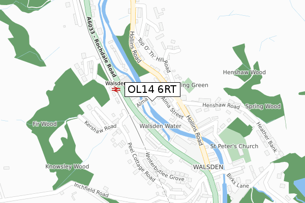
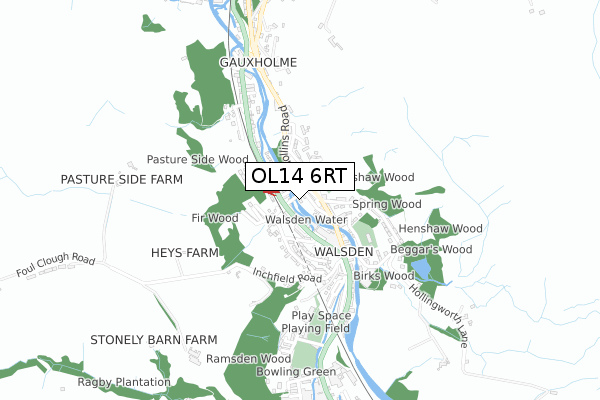
OL14 6RT is located in the Todmorden electoral ward, within the metropolitan district of Calderdale and the English Parliamentary constituency of Calder Valley. The Sub Integrated Care Board (ICB) Location is NHS West Yorkshire ICB - 02T and the police force is West Yorkshire. This postcode has been in use since January 2019.


GetTheData
Source: OS Open Zoomstack (Ordnance Survey)
Licence: Open Government Licence (requires attribution)
Attribution: Contains OS data © Crown copyright and database right 2024
Source: Open Postcode Geo
Licence: Open Government Licence (requires attribution)
Attribution: Contains OS data © Crown copyright and database right 2024; Contains Royal Mail data © Royal Mail copyright and database right 2024; Source: Office for National Statistics licensed under the Open Government Licence v.3.0
| Easting | 393298 |
| Northing | 422208 |
| Latitude | 53.696284 |
| Longitude | -2.102980 |
GetTheData
Source: Open Postcode Geo
Licence: Open Government Licence
| Country | England |
| Postcode District | OL14 |
➜ See where OL14 is on a map ➜ Where is Todmorden? | |
GetTheData
Source: Land Registry Price Paid Data
Licence: Open Government Licence
| Ward | Todmorden |
| Constituency | Calder Valley |
GetTheData
Source: ONS Postcode Database
Licence: Open Government Licence
2, WEAVERS MOORINGS, TODMORDEN, OL14 6RT 2020 31 JAN £325,000 |
GetTheData
Source: HM Land Registry Price Paid Data
Licence: Contains HM Land Registry data © Crown copyright and database right 2024. This data is licensed under the Open Government Licence v3.0.
| Rochdale Road Walsden Station (Rochdale Road) | Walsden | 82m |
| Rochdale Road Walsden Station (Rochdale Road) | Walsden | 90m |
| Rochdale Rd Winterbutlee Road (Rochdale Road) | Walsden | 177m |
| Hollins Road Works (Hollins Road) | Walsden | 209m |
| Hollins Road Works (Hollins Road) | Walsden | 214m |
| Walsden Station | 0.1km |
| Todmorden Station | 2km |
GetTheData
Source: NaPTAN
Licence: Open Government Licence
| Percentage of properties with Next Generation Access | 100.0% |
| Percentage of properties with Superfast Broadband | 100.0% |
| Percentage of properties with Ultrafast Broadband | 0.0% |
| Percentage of properties with Full Fibre Broadband | 0.0% |
Superfast Broadband is between 30Mbps and 300Mbps
Ultrafast Broadband is > 300Mbps
| Percentage of properties unable to receive 2Mbps | 0.0% |
| Percentage of properties unable to receive 5Mbps | 0.0% |
| Percentage of properties unable to receive 10Mbps | 0.0% |
| Percentage of properties unable to receive 30Mbps | 0.0% |
GetTheData
Source: Ofcom
Licence: Ofcom Terms of Use (requires attribution)
GetTheData
Source: ONS Postcode Database
Licence: Open Government Licence


➜ Get more ratings from the Food Standards Agency
GetTheData
Source: Food Standards Agency
Licence: FSA terms & conditions
| Last Collection | |||
|---|---|---|---|
| Location | Mon-Fri | Sat | Distance |
| Walsden Station | 17:15 | 11:30 | 106m |
| Walsden P.o. | 17:15 | 11:30 | 316m |
| Copperas | 17:15 | 11:30 | 648m |
GetTheData
Source: Dracos
Licence: Creative Commons Attribution-ShareAlike
The below table lists the International Territorial Level (ITL) codes (formerly Nomenclature of Territorial Units for Statistics (NUTS) codes) and Local Administrative Units (LAU) codes for OL14 6RT:
| ITL 1 Code | Name |
|---|---|
| TLE | Yorkshire and The Humber |
| ITL 2 Code | Name |
| TLE4 | West Yorkshire |
| ITL 3 Code | Name |
| TLE44 | Calderdale and Kirklees |
| LAU 1 Code | Name |
| E08000033 | Calderdale |
GetTheData
Source: ONS Postcode Directory
Licence: Open Government Licence
The below table lists the Census Output Area (OA), Lower Layer Super Output Area (LSOA), and Middle Layer Super Output Area (MSOA) for OL14 6RT:
| Code | Name | |
|---|---|---|
| OA | E00054874 | |
| LSOA | E01010885 | Calderdale 022B |
| MSOA | E02002265 | Calderdale 022 |
GetTheData
Source: ONS Postcode Directory
Licence: Open Government Licence
| OL14 6QJ | Alma Street | 44m |
| OL14 6SF | Saxon Street | 47m |
| OL14 6SE | Montreal Street | 48m |
| OL14 6SG | Vulcan Street | 55m |
| OL14 6QP | Hollins Place | 58m |
| OL14 6QH | Lord Street | 73m |
| OL14 6RS | Industry Street | 74m |
| OL14 6RR | Regent Street | 78m |
| OL14 6QW | Wharf Street | 79m |
| OL14 6SA | Rochdale Road | 86m |
GetTheData
Source: Open Postcode Geo; Land Registry Price Paid Data
Licence: Open Government Licence