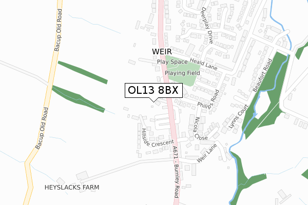
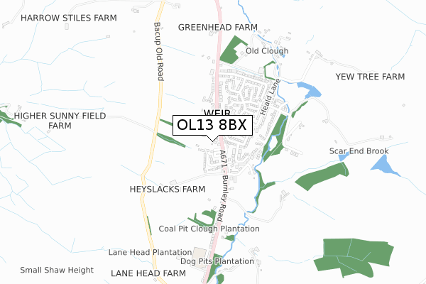
OL13 8BX is located in the Greensclough electoral ward, within the local authority district of Rossendale and the English Parliamentary constituency of Rossendale and Darwen. The Sub Integrated Care Board (ICB) Location is NHS Lancashire and South Cumbria ICB - 01A and the police force is Lancashire. This postcode has been in use since March 2018.


GetTheData
Source: OS Open Zoomstack (Ordnance Survey)
Licence: Open Government Licence (requires attribution)
Attribution: Contains OS data © Crown copyright and database right 2024
Source: Open Postcode Geo
Licence: Open Government Licence (requires attribution)
Attribution: Contains OS data © Crown copyright and database right 2024; Contains Royal Mail data © Royal Mail copyright and database right 2024; Source: Office for National Statistics licensed under the Open Government Licence v.3.0
| Easting | 386984 |
| Northing | 425376 |
| Latitude | 53.724637 |
| Longitude | -2.198740 |
GetTheData
Source: Open Postcode Geo
Licence: Open Government Licence
| Country | England |
| Postcode District | OL13 |
➜ See where OL13 is on a map ➜ Where is Weir? | |
GetTheData
Source: Land Registry Price Paid Data
Licence: Open Government Licence
| Ward | Greensclough |
| Constituency | Rossendale And Darwen |
GetTheData
Source: ONS Postcode Database
Licence: Open Government Licence
| Late Shop (Burnley Road) | Weir | 46m |
| Late Shop (Richard Street) | Weir | 55m |
| Heald Lane (Burnley Road) | Weir | 132m |
| Heald Lane (Burnley Road) | Weir | 146m |
| Weir Hotel (Burnley Road) | Weir | 192m |
GetTheData
Source: NaPTAN
Licence: Open Government Licence
GetTheData
Source: ONS Postcode Database
Licence: Open Government Licence


➜ Get more ratings from the Food Standards Agency
GetTheData
Source: Food Standards Agency
Licence: FSA terms & conditions
| Last Collection | |||
|---|---|---|---|
| Location | Mon-Fri | Sat | Distance |
| Bacup Bo | 17:45 | 12:00 | 2,318m |
| South Street | 17:30 | 11:30 | 2,375m |
| 37 Market Street | 17:15 | 11:30 | 2,508m |
GetTheData
Source: Dracos
Licence: Creative Commons Attribution-ShareAlike
The below table lists the International Territorial Level (ITL) codes (formerly Nomenclature of Territorial Units for Statistics (NUTS) codes) and Local Administrative Units (LAU) codes for OL13 8BX:
| ITL 1 Code | Name |
|---|---|
| TLD | North West (England) |
| ITL 2 Code | Name |
| TLD4 | Lancashire |
| ITL 3 Code | Name |
| TLD46 | East Lancashire |
| LAU 1 Code | Name |
| E07000125 | Rossendale |
GetTheData
Source: ONS Postcode Directory
Licence: Open Government Licence
The below table lists the Census Output Area (OA), Lower Layer Super Output Area (LSOA), and Middle Layer Super Output Area (MSOA) for OL13 8BX:
| Code | Name | |
|---|---|---|
| OA | E00128749 | |
| LSOA | E01025367 | Rossendale 003A |
| MSOA | E02005280 | Rossendale 003 |
GetTheData
Source: ONS Postcode Directory
Licence: Open Government Licence
| OL13 8QW | Deer Street | 29m |
| OL13 8QJ | Richard Street | 53m |
| OL13 8QH | Comet Street | 59m |
| OL13 8RX | Hillside Crescent | 67m |
| OL13 8QQ | Wright Street | 78m |
| OL13 8QG | Captain Street | 80m |
| OL13 8QE | Burnley Road | 102m |
| OL13 8QL | Hillside Crescent | 119m |
| OL13 8RH | Philips Road | 131m |
| OL13 8QF | Halley Street | 133m |
GetTheData
Source: Open Postcode Geo; Land Registry Price Paid Data
Licence: Open Government Licence