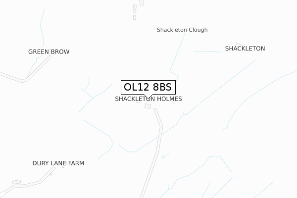
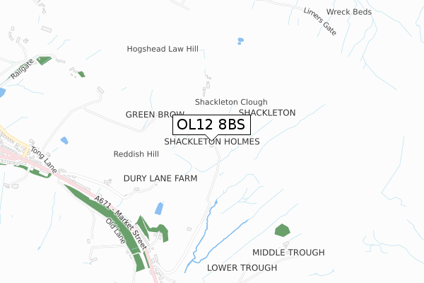
OL12 8BS is located in the Facit and Shawforth electoral ward, within the local authority district of Rossendale and the English Parliamentary constituency of Rossendale and Darwen. The Sub Integrated Care Board (ICB) Location is NHS Lancashire and South Cumbria ICB - 01A and the police force is Lancashire. This postcode has been in use since August 2019.


GetTheData
Source: OS Open Zoomstack (Ordnance Survey)
Licence: Open Government Licence (requires attribution)
Attribution: Contains OS data © Crown copyright and database right 2024
Source: Open Postcode Geo
Licence: Open Government Licence (requires attribution)
Attribution: Contains OS data © Crown copyright and database right 2024; Contains Royal Mail data © Royal Mail copyright and database right 2024; Source: Office for National Statistics licensed under the Open Government Licence v.3.0
| Easting | 389479 |
| Northing | 421645 |
| Latitude | 53.691160 |
| Longitude | -2.160800 |
GetTheData
Source: Open Postcode Geo
Licence: Open Government Licence
| Country | England |
| Postcode District | OL12 |
➜ See where OL12 is on a map | |
GetTheData
Source: Land Registry Price Paid Data
Licence: Open Government Licence
| Ward | Facit And Shawforth |
| Constituency | Rossendale And Darwen |
GetTheData
Source: ONS Postcode Database
Licence: Open Government Licence
| Peel Terrace (Market Street) | Shawforth | 726m |
| Shore Service Station (Market Street) | Newline | 785m |
| Shore Service Station (Market Street) | Newline | 817m |
| Shanter Close (Market Street) | Shawforth | 892m |
| Shanter Close (Market Street) | Shawforth | 898m |
| Walsden Station | 3.8km |
| Todmorden Station | 4.8km |
GetTheData
Source: NaPTAN
Licence: Open Government Licence
| Percentage of properties with Next Generation Access | 100.0% |
| Percentage of properties with Superfast Broadband | 0.0% |
| Percentage of properties with Ultrafast Broadband | 0.0% |
| Percentage of properties with Full Fibre Broadband | 0.0% |
Superfast Broadband is between 30Mbps and 300Mbps
Ultrafast Broadband is > 300Mbps
| Percentage of properties unable to receive 2Mbps | 0.0% |
| Percentage of properties unable to receive 5Mbps | 33.3% |
| Percentage of properties unable to receive 10Mbps | 33.3% |
| Percentage of properties unable to receive 30Mbps | 100.0% |
GetTheData
Source: Ofcom
Licence: Ofcom Terms of Use (requires attribution)
GetTheData
Source: ONS Postcode Database
Licence: Open Government Licence


➜ Get more ratings from the Food Standards Agency
GetTheData
Source: Food Standards Agency
Licence: FSA terms & conditions
| Last Collection | |||
|---|---|---|---|
| Location | Mon-Fri | Sat | Distance |
| Britannia Tso | 17:15 | 11:30 | 1,409m |
| South Street | 17:30 | 11:30 | 2,749m |
| 37 Market Street | 17:15 | 11:30 | 2,935m |
GetTheData
Source: Dracos
Licence: Creative Commons Attribution-ShareAlike
The below table lists the International Territorial Level (ITL) codes (formerly Nomenclature of Territorial Units for Statistics (NUTS) codes) and Local Administrative Units (LAU) codes for OL12 8BS:
| ITL 1 Code | Name |
|---|---|
| TLD | North West (England) |
| ITL 2 Code | Name |
| TLD4 | Lancashire |
| ITL 3 Code | Name |
| TLD46 | East Lancashire |
| LAU 1 Code | Name |
| E07000125 | Rossendale |
GetTheData
Source: ONS Postcode Directory
Licence: Open Government Licence
The below table lists the Census Output Area (OA), Lower Layer Super Output Area (LSOA), and Middle Layer Super Output Area (MSOA) for OL12 8BS:
| Code | Name | |
|---|---|---|
| OA | E00128713 | |
| LSOA | E01025359 | Rossendale 009A |
| MSOA | E02005286 | Rossendale 009 |
GetTheData
Source: ONS Postcode Directory
Licence: Open Government Licence
| OL12 8XD | Market Street | 530m |
| OL12 8JD | Rock View | 640m |
| OL12 8JB | Market Street | 690m |
| OL12 8XE | Eagley Bank | 763m |
| OL12 8HN | Market Street | 847m |
| OL13 9SL | Market Street | 848m |
| OL13 9SN | Prince Street | 866m |
| OL12 8HW | Freehold Road | 866m |
| OL13 9XF | Rochdale Road | 902m |
| OL12 8HJ | Yew Tree Terrace | 953m |
GetTheData
Source: Open Postcode Geo; Land Registry Price Paid Data
Licence: Open Government Licence