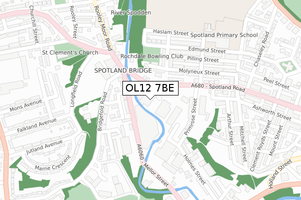
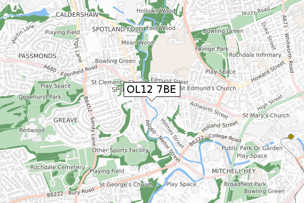
OL12 7BE is located in the Spotland & Falinge electoral ward, within the metropolitan district of Rochdale and the English Parliamentary constituency of Rochdale. The Sub Integrated Care Board (ICB) Location is NHS Greater Manchester ICB - 01D and the police force is Greater Manchester. This postcode has been in use since December 2018.


GetTheData
Source: OS Open Zoomstack (Ordnance Survey)
Licence: Open Government Licence (requires attribution)
Attribution: Contains OS data © Crown copyright and database right 2024
Source: Open Postcode Geo
Licence: Open Government Licence (requires attribution)
Attribution: Contains OS data © Crown copyright and database right 2024; Contains Royal Mail data © Royal Mail copyright and database right 2024; Source: Office for National Statistics licensed under the Open Government Licence v.3.0
| Easting | 388673 |
| Northing | 413723 |
| Latitude | 53.619940 |
| Longitude | -2.172712 |
GetTheData
Source: Open Postcode Geo
Licence: Open Government Licence
| Country | England |
| Postcode District | OL12 |
➜ See where OL12 is on a map | |
GetTheData
Source: Land Registry Price Paid Data
Licence: Open Government Licence
| Ward | Spotland & Falinge |
| Constituency | Rochdale |
GetTheData
Source: ONS Postcode Database
Licence: Open Government Licence
| Spotland Rd/Spotland Bridge (Spotland Rd) | Spotland | 81m |
| Mellor St/Spotland Rd (Mellor St) | Spotland | 91m |
| Mellor St/Old Bus Depot (Mellor St) | Rochdale | 114m |
| Spotland Rd/Primrose St (Spotland Rd) | Spotland | 127m |
| Spotland Rd/Primrose St (Spotland Rd) | Spotland | 153m |
| Rochdale Interchange (Manchester Metrolink) (Smith Street) | Rochdale | 1,187m |
| Rochdale Railway Station (Manchester Metrolink) (Maclure Rd) | Rochdale | 1,563m |
| Rochdale Station | 1.7km |
| Castleton (Manchester) Station | 3.1km |
| Smithy Bridge Station | 4.2km |
GetTheData
Source: NaPTAN
Licence: Open Government Licence
GetTheData
Source: ONS Postcode Database
Licence: Open Government Licence


➜ Get more ratings from the Food Standards Agency
GetTheData
Source: Food Standards Agency
Licence: FSA terms & conditions
| Last Collection | |||
|---|---|---|---|
| Location | Mon-Fri | Sat | Distance |
| Newbold P.o. | 18:15 | 11:30 | 211m |
| Collagebank | 17:45 | 11:00 | 829m |
| Toad Lane | 17:45 | 11:00 | 949m |
GetTheData
Source: Dracos
Licence: Creative Commons Attribution-ShareAlike
The below table lists the International Territorial Level (ITL) codes (formerly Nomenclature of Territorial Units for Statistics (NUTS) codes) and Local Administrative Units (LAU) codes for OL12 7BE:
| ITL 1 Code | Name |
|---|---|
| TLD | North West (England) |
| ITL 2 Code | Name |
| TLD3 | Greater Manchester |
| ITL 3 Code | Name |
| TLD37 | Greater Manchester North East |
| LAU 1 Code | Name |
| E08000005 | Rochdale |
GetTheData
Source: ONS Postcode Directory
Licence: Open Government Licence
The below table lists the Census Output Area (OA), Lower Layer Super Output Area (LSOA), and Middle Layer Super Output Area (MSOA) for OL12 7BE:
| Code | Name | |
|---|---|---|
| OA | E00028292 | |
| LSOA | E01005589 | Rochdale 009B |
| MSOA | E02001140 | Rochdale 009 |
GetTheData
Source: ONS Postcode Directory
Licence: Open Government Licence
| OL12 7AG | Spotland Road | 68m |
| OL11 5BT | Mellor Street | 83m |
| OL12 7AF | Spotland Road | 85m |
| OL12 6QD | Spotland Road | 88m |
| OL11 5BL | Drew Avenue | 113m |
| OL12 6QB | Cinnamon Street | 136m |
| OL12 6AW | Primrose Street | 150m |
| OL11 5BP | Bridgefold Road | 165m |
| OL12 6QA | Molyneux Street | 195m |
| OL12 6PZ | Molyneux Street | 209m |
GetTheData
Source: Open Postcode Geo; Land Registry Price Paid Data
Licence: Open Government Licence