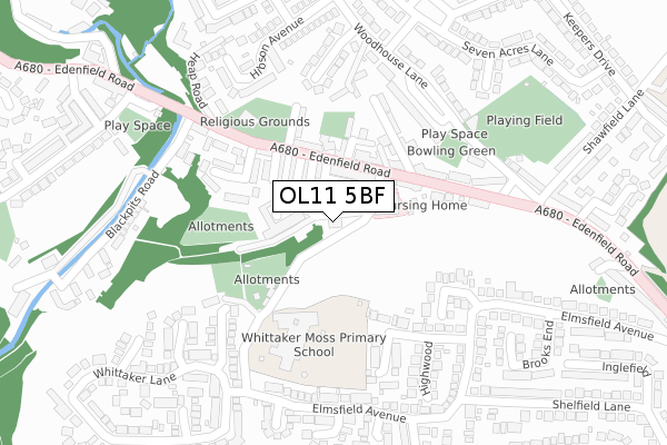
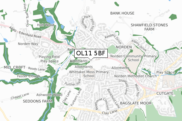
OL11 5BF is located in the Norden electoral ward, within the metropolitan district of Rochdale and the English Parliamentary constituency of Heywood and Middleton. The Sub Integrated Care Board (ICB) Location is NHS Greater Manchester ICB - 01D and the police force is Greater Manchester. This postcode has been in use since September 2019.


GetTheData
Source: OS Open Zoomstack (Ordnance Survey)
Licence: Open Government Licence (requires attribution)
Attribution: Contains OS data © Crown copyright and database right 2025
Source: Open Postcode Geo
Licence: Open Government Licence (requires attribution)
Attribution: Contains OS data © Crown copyright and database right 2025; Contains Royal Mail data © Royal Mail copyright and database right 2025; Source: Office for National Statistics licensed under the Open Government Licence v.3.0
| Easting | 386122 |
| Northing | 414414 |
| Latitude | 53.626088 |
| Longitude | -2.211308 |
GetTheData
Source: Open Postcode Geo
Licence: Open Government Licence
| Country | England |
| Postcode District | OL11 |
➜ See where OL11 is on a map ➜ Where is Rochdale? | |
GetTheData
Source: Land Registry Price Paid Data
Licence: Open Government Licence
| Ward | Norden |
| Constituency | Heywood And Middleton |
GetTheData
Source: ONS Postcode Database
Licence: Open Government Licence
| Edenfield Rd/Norden Village (Edenfield Rd) | Norden | 107m |
| Edenfield Rd/Norden Village (Edenfield Rd) | Norden | 121m |
| Woodhouse Lane (Se Bnd) (Woodhouse Lane) | Shawfield | 257m |
| Edenfield Rd/Shawfield Ln (Edenfield Rd) | Shawfield | 260m |
| Woodhouse Lane (Ne Bnd) (Woodhouse Lane) | Shawfield | 262m |
| Rochdale Station | 4.2km |
| Castleton (Manchester) Station | 4.4km |
GetTheData
Source: NaPTAN
Licence: Open Government Licence
GetTheData
Source: ONS Postcode Database
Licence: Open Government Licence


➜ Get more ratings from the Food Standards Agency
GetTheData
Source: Food Standards Agency
Licence: FSA terms & conditions
| Last Collection | |||
|---|---|---|---|
| Location | Mon-Fri | Sat | Distance |
| Caldershaw Road | 17:30 | 11:00 | 77m |
| Shelfield Lane | 17:30 | 11:00 | 1,084m |
| Bamford Precinct | 17:30 | 11:00 | 1,299m |
GetTheData
Source: Dracos
Licence: Creative Commons Attribution-ShareAlike
The below table lists the International Territorial Level (ITL) codes (formerly Nomenclature of Territorial Units for Statistics (NUTS) codes) and Local Administrative Units (LAU) codes for OL11 5BF:
| ITL 1 Code | Name |
|---|---|
| TLD | North West (England) |
| ITL 2 Code | Name |
| TLD3 | Greater Manchester |
| ITL 3 Code | Name |
| TLD37 | Greater Manchester North East |
| LAU 1 Code | Name |
| E08000005 | Rochdale |
GetTheData
Source: ONS Postcode Directory
Licence: Open Government Licence
The below table lists the Census Output Area (OA), Lower Layer Super Output Area (LSOA), and Middle Layer Super Output Area (MSOA) for OL11 5BF:
| Code | Name | |
|---|---|---|
| OA | E00028227 | |
| LSOA | E01005573 | Rochdale 007C |
| MSOA | E02001138 | Rochdale 007 |
GetTheData
Source: ONS Postcode Directory
Licence: Open Government Licence
| OL11 5SW | Ashbourne Street | 31m |
| OL11 5XF | Ashbourne Street | 53m |
| OL11 5SN | Clapgate Road | 59m |
| OL11 5SR | Store Street | 61m |
| OL11 5SS | Industry Street | 97m |
| OL11 5XE | Edenfield Road | 101m |
| OL11 5ST | Wingate Street | 113m |
| OL12 7RE | Zion Terrace | 117m |
| OL12 7RD | Trinity Street | 122m |
| OL12 7SL | Edenfield Road | 127m |
GetTheData
Source: Open Postcode Geo; Land Registry Price Paid Data
Licence: Open Government Licence