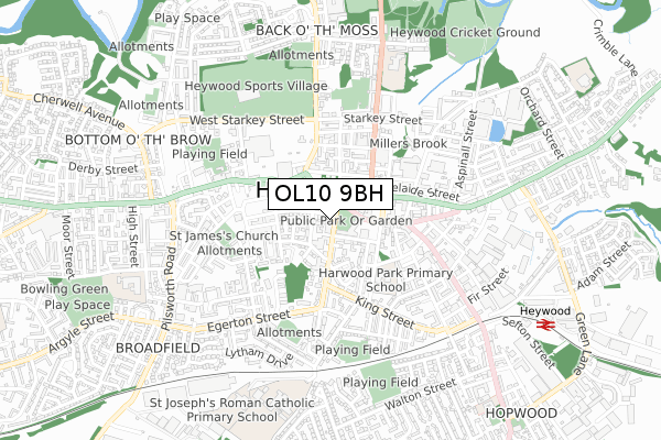
OL10 9BH is located in the North Heywood electoral ward, within the metropolitan district of Rochdale and the English Parliamentary constituency of Heywood and Middleton. The Sub Integrated Care Board (ICB) Location is NHS Greater Manchester ICB - 01D and the police force is Greater Manchester. This postcode has been in use since December 2019.


GetTheData
Source: OS Open Zoomstack (Ordnance Survey)
Licence: Open Government Licence (requires attribution)
Attribution: Contains OS data © Crown copyright and database right 2024
Source: Open Postcode Geo
Licence: Open Government Licence (requires attribution)
Attribution: Contains OS data © Crown copyright and database right 2024; Contains Royal Mail data © Royal Mail copyright and database right 2024; Source: Office for National Statistics licensed under the Open Government Licence v.3.0
| Easting | 385557 |
| Northing | 410695 |
| Latitude | 53.592646 |
| Longitude | -2.219677 |
GetTheData
Source: Open Postcode Geo
Licence: Open Government Licence
| Country | England |
| Postcode District | OL10 |
➜ See where OL10 is on a map ➜ Where is Heywood? | |
GetTheData
Source: Land Registry Price Paid Data
Licence: Open Government Licence
| Ward | North Heywood |
| Constituency | Heywood And Middleton |
GetTheData
Source: ONS Postcode Database
Licence: Open Government Licence
| L/Cpl Shaw Mc Way/Heywood Library (L/Cpl Shaw Mc) | Heywood | 76m |
| L/Cpl Shaw Mc Way/Heywood Library (L/Cpl Shaw Mc) | Heywood | 89m |
| L/Cpl Shaw Mc Way/Heywood Library (L/Cpl Shaw Mc) | Heywood | 90m |
| L/Cpl Shaw Mc Way/Heywood Library (L/Cpl Shaw Mc) | Heywood | 100m |
| Bamford Rd/Market St (Bamford Rd) | Heywood | 174m |
| Heywood (East Lancashire Railway) | Heywood | 926m |
| Castleton (Manchester) Station | 2.7km |
| Rochdale Station | 4.8km |
| Mills Hill (Manchester) Station | 5.6km |
GetTheData
Source: NaPTAN
Licence: Open Government Licence
GetTheData
Source: ONS Postcode Database
Licence: Open Government Licence


➜ Get more ratings from the Food Standards Agency
GetTheData
Source: Food Standards Agency
Licence: FSA terms & conditions
| Last Collection | |||
|---|---|---|---|
| Location | Mon-Fri | Sat | Distance |
| Heywood Post Office | 193m | ||
| Morrison's | 17:45 | 11:30 | 308m |
| Market Place | 18:25 | 11:15 | 643m |
GetTheData
Source: Dracos
Licence: Creative Commons Attribution-ShareAlike
The below table lists the International Territorial Level (ITL) codes (formerly Nomenclature of Territorial Units for Statistics (NUTS) codes) and Local Administrative Units (LAU) codes for OL10 9BH:
| ITL 1 Code | Name |
|---|---|
| TLD | North West (England) |
| ITL 2 Code | Name |
| TLD3 | Greater Manchester |
| ITL 3 Code | Name |
| TLD37 | Greater Manchester North East |
| LAU 1 Code | Name |
| E08000005 | Rochdale |
GetTheData
Source: ONS Postcode Directory
Licence: Open Government Licence
The below table lists the Census Output Area (OA), Lower Layer Super Output Area (LSOA), and Middle Layer Super Output Area (MSOA) for OL10 9BH:
| Code | Name | |
|---|---|---|
| OA | E00027858 | |
| LSOA | E01005504 | Rochdale 018D |
| MSOA | E02001149 | Rochdale 018 |
GetTheData
Source: ONS Postcode Directory
Licence: Open Government Licence
| OL10 1JZ | Hind Hill Street | 28m |
| OL10 1LA | Market Place | 85m |
| OL10 1EF | Taylor Street | 86m |
| OL10 1AL | Caxton Street | 93m |
| OL10 1FN | Pine Street | 107m |
| OL10 1AQ | Hind Hill Street | 108m |
| OL10 1FJ | Pine Street | 111m |
| OL10 4NL | Market Place | 115m |
| OL10 1DT | Pine Street | 125m |
| OL10 1HT | Market Street | 126m |
GetTheData
Source: Open Postcode Geo; Land Registry Price Paid Data
Licence: Open Government Licence