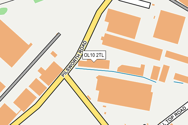
OL10 2TL is located in the Hopwood Hall electoral ward, within the metropolitan district of Rochdale and the English Parliamentary constituency of Heywood and Middleton. The Sub Integrated Care Board (ICB) Location is NHS Greater Manchester ICB - 01D and the police force is Greater Manchester. This postcode has been in use since January 1992.


GetTheData
Source: OS OpenMap – Local (Ordnance Survey)
Source: OS VectorMap District (Ordnance Survey)
Licence: Open Government Licence (requires attribution)
| Easting | 384748 |
| Northing | 409688 |
| Latitude | 53.583572 |
| Longitude | -2.231849 |
GetTheData
Source: Open Postcode Geo
Licence: Open Government Licence
| Country | England |
| Postcode District | OL10 |
➜ See where OL10 is on a map ➜ Where is Heywood? | |
GetTheData
Source: Land Registry Price Paid Data
Licence: Open Government Licence
Elevation or altitude of OL10 2TL as distance above sea level:
| Metres | Feet | |
|---|---|---|
| Elevation | 120m | 394ft |
Elevation is measured from the approximate centre of the postcode, to the nearest point on an OS contour line from OS Terrain 50, which has contour spacing of ten vertical metres.
➜ How high above sea level am I? Find the elevation of your current position using your device's GPS.
GetTheData
Source: Open Postcode Elevation
Licence: Open Government Licence
| Ward | Hopwood Hall |
| Constituency | Heywood And Middleton |
GetTheData
Source: ONS Postcode Database
Licence: Open Government Licence
| Argyle St/Balmoral Dr (Argyle Street) | Heywood | 568m |
| Argyle St/Balmoral Dr (Argyle St) | Heywood | 594m |
| Argyle St/Unity St (Argyle St) | Heywood | 634m |
| Argyle St/Argyle Cres (Argyle St) | Heywood | 638m |
| Egerton St/Belgrave St (Egerton St) | Heywood | 639m |
| Castleton (Manchester) Station | 3.7km |
| Mills Hill (Manchester) Station | 5.4km |
GetTheData
Source: NaPTAN
Licence: Open Government Licence
GetTheData
Source: ONS Postcode Database
Licence: Open Government Licence


➜ Get more ratings from the Food Standards Agency
GetTheData
Source: Food Standards Agency
Licence: FSA terms & conditions
| Last Collection | |||
|---|---|---|---|
| Location | Mon-Fri | Sat | Distance |
| Broadfield | 17:30 | 11:15 | 816m |
| Bader Drive | 16:45 | 08:00 | 1,220m |
| Morrison's | 17:45 | 11:30 | 1,388m |
GetTheData
Source: Dracos
Licence: Creative Commons Attribution-ShareAlike
The below table lists the International Territorial Level (ITL) codes (formerly Nomenclature of Territorial Units for Statistics (NUTS) codes) and Local Administrative Units (LAU) codes for OL10 2TL:
| ITL 1 Code | Name |
|---|---|
| TLD | North West (England) |
| ITL 2 Code | Name |
| TLD3 | Greater Manchester |
| ITL 3 Code | Name |
| TLD37 | Greater Manchester North East |
| LAU 1 Code | Name |
| E08000005 | Rochdale |
GetTheData
Source: ONS Postcode Directory
Licence: Open Government Licence
The below table lists the Census Output Area (OA), Lower Layer Super Output Area (LSOA), and Middle Layer Super Output Area (MSOA) for OL10 2TL:
| Code | Name | |
|---|---|---|
| OA | E00027867 | |
| LSOA | E01005505 | Rochdale 018E |
| MSOA | E02001149 | Rochdale 018 |
GetTheData
Source: ONS Postcode Directory
Licence: Open Government Licence
| OL10 2RQ | Hill Top Road | 193m |
| OL10 3FN | Fustian Avenue | 349m |
| OL10 3FL | Fustian Avenue | 376m |
| OL10 3FJ | Shuttle Drive | 400m |
| OL10 3FG | Trippear Way | 413m |
| OL10 3DS | Melton Close | 423m |
| OL10 3FP | North Light Way | 425m |
| OL10 3DR | Melton Street | 460m |
| OL10 3DY | Pilsworth Road | 466m |
| OL10 3DZ | Pasture Close | 477m |
GetTheData
Source: Open Postcode Geo; Land Registry Price Paid Data
Licence: Open Government Licence