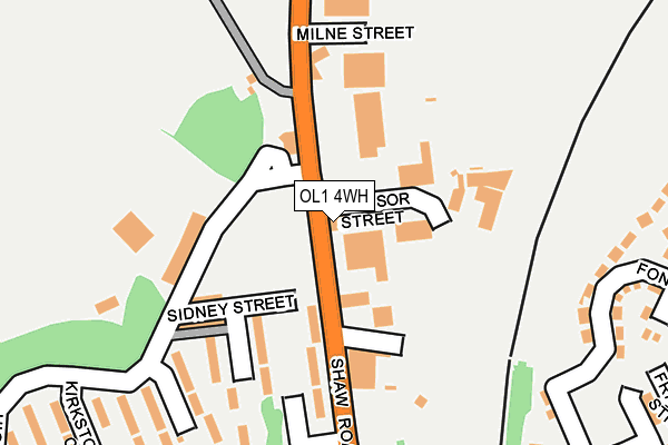
OL1 4WH is located in the Royton South electoral ward, within the metropolitan district of Oldham and the English Parliamentary constituency of Oldham East and Saddleworth. The Sub Integrated Care Board (ICB) Location is NHS Greater Manchester ICB - 00Y and the police force is Greater Manchester. This postcode has been in use since January 2004.


GetTheData
Source: OS OpenMap – Local (Ordnance Survey)
Source: OS VectorMap District (Ordnance Survey)
Licence: Open Government Licence (requires attribution)
| Easting | 393199 |
| Northing | 406381 |
| Latitude | 53.554011 |
| Longitude | -2.104128 |
GetTheData
Source: Open Postcode Geo
Licence: Open Government Licence
| Country | England |
| Postcode District | OL1 |
➜ See where OL1 is on a map ➜ Where is Oldham? | |
GetTheData
Source: Land Registry Price Paid Data
Licence: Open Government Licence
Elevation or altitude of OL1 4WH as distance above sea level:
| Metres | Feet | |
|---|---|---|
| Elevation | 200m | 656ft |
Elevation is measured from the approximate centre of the postcode, to the nearest point on an OS contour line from OS Terrain 50, which has contour spacing of ten vertical metres.
➜ How high above sea level am I? Find the elevation of your current position using your device's GPS.
GetTheData
Source: Open Postcode Elevation
Licence: Open Government Licence
| Ward | Royton South |
| Constituency | Oldham East And Saddleworth |
GetTheData
Source: ONS Postcode Database
Licence: Open Government Licence
| Higginshaw Rd/Boundary Inn (Higginshaw Rd) | Higginshaw | 93m |
| Shaw Rd/Boundary Inn (Shaw Rd) | Higginshaw | 96m |
| Higginshaw Ln/Milne St (Higginshaw Ln) | Higginshaw | 158m |
| Derker Tram Stop (Shaw Rd) | Derker | 256m |
| Higginshaw Rd/Kirsktone Cl (Higginshaw Rd) | Oldham Edge | 260m |
| Derker (Manchester Metrolink) (Yates Street) | Derker | 496m |
| Oldham Mumps (Manchester Metrolink) (Mumps) | Oldham Mumps | 1,294m |
| Westwood (Manchester Metrolink) (Middleton Road) | Westwood | 1,942m |
| Mills Hill (Manchester) Station | 4.5km |
| Moston Station | 5.6km |
| Mossley (Manchester) Station | 6km |
GetTheData
Source: NaPTAN
Licence: Open Government Licence
GetTheData
Source: ONS Postcode Database
Licence: Open Government Licence


➜ Get more ratings from the Food Standards Agency
GetTheData
Source: Food Standards Agency
Licence: FSA terms & conditions
| Last Collection | |||
|---|---|---|---|
| Location | Mon-Fri | Sat | Distance |
| 625 Ripponden Road | 17:00 | 11:25 | 651m |
| Sheepfoot Lane | 17:30 | 11:15 | 1,122m |
| John Street | 16:45 | 11:20 | 1,204m |
GetTheData
Source: Dracos
Licence: Creative Commons Attribution-ShareAlike
The below table lists the International Territorial Level (ITL) codes (formerly Nomenclature of Territorial Units for Statistics (NUTS) codes) and Local Administrative Units (LAU) codes for OL1 4WH:
| ITL 1 Code | Name |
|---|---|
| TLD | North West (England) |
| ITL 2 Code | Name |
| TLD3 | Greater Manchester |
| ITL 3 Code | Name |
| TLD37 | Greater Manchester North East |
| LAU 1 Code | Name |
| E08000004 | Oldham |
GetTheData
Source: ONS Postcode Directory
Licence: Open Government Licence
The below table lists the Census Output Area (OA), Lower Layer Super Output Area (LSOA), and Middle Layer Super Output Area (MSOA) for OL1 4WH:
| Code | Name | |
|---|---|---|
| OA | E00027504 | |
| LSOA | E01005432 | Oldham 014C |
| MSOA | E02001111 | Oldham 014 |
GetTheData
Source: ONS Postcode Directory
Licence: Open Government Licence
| OL1 4AH | Shaw Road | 136m |
| OL1 3JY | Higginshaw Road | 144m |
| OL1 3JZ | Shaw Road | 144m |
| OL1 3JX | Sidney Street | 146m |
| OL1 3JU | Glenridding Close | 204m |
| OL1 3JT | Striding Edge Walk | 222m |
| OL1 3JS | Patterdale Close | 249m |
| OL1 4TE | Fontwell Lane | 278m |
| OL1 4TD | Gosforth Close | 282m |
| OL1 4TA | Sandown Close | 290m |
GetTheData
Source: Open Postcode Geo; Land Registry Price Paid Data
Licence: Open Government Licence