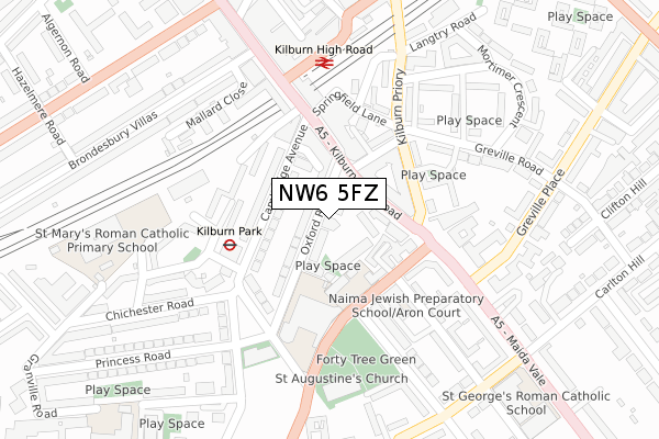
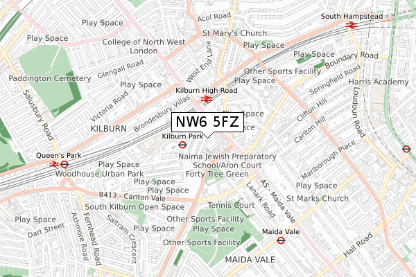
NW6 5FZ is located in the Maida Vale electoral ward, within the London borough of Westminster and the English Parliamentary constituency of Westminster North. The Sub Integrated Care Board (ICB) Location is NHS North West London ICB - W2U3Z and the police force is Metropolitan Police. This postcode has been in use since December 2019.


GetTheData
Source: OS Open Zoomstack (Ordnance Survey)
Licence: Open Government Licence (requires attribution)
Attribution: Contains OS data © Crown copyright and database right 2025
Source: Open Postcode Geo
Licence: Open Government Licence (requires attribution)
Attribution: Contains OS data © Crown copyright and database right 2025; Contains Royal Mail data © Royal Mail copyright and database right 2025; Source: Office for National Statistics licensed under the Open Government Licence v.3.0
| Easting | 525513 |
| Northing | 183388 |
| Latitude | 51.535454 |
| Longitude | -0.191737 |
GetTheData
Source: Open Postcode Geo
Licence: Open Government Licence
| Country | England |
| Postcode District | NW6 |
➜ See where NW6 is on a map ➜ Where is London? | |
GetTheData
Source: Land Registry Price Paid Data
Licence: Open Government Licence
| Ward | Maida Vale |
| Constituency | Westminster North |
GetTheData
Source: ONS Postcode Database
Licence: Open Government Licence
| Kilburn Park (Cambridge Avenue) | Kilburn Park | 105m |
| Kilburn High Road Station (Kilburn High Road) | Kilburn | 112m |
| Kilburn High Road Station | Kilburn | 115m |
| Kilburn High Road Station | Kilburn | 115m |
| Kilburn High Rd Cambridge Ave | Kilburn | 127m |
| Kilburn Park Underground Station | Kilburn Park | 179m |
| Maida Vale Underground Station | Maida Vale | 756m |
| Queen's Park Underground Station | Queen's Park | 900m |
| St. John's Wood Underground Station | St Johns Wood | 1,240m |
| West Hampstead Underground Station | West Hampstead | 1,245m |
| Kilburn High Road Station | 0.2km |
| Queens Park (London) Station | 0.9km |
| South Hampstead Station | 1.1km |
GetTheData
Source: NaPTAN
Licence: Open Government Licence
GetTheData
Source: ONS Postcode Database
Licence: Open Government Licence


➜ Get more ratings from the Food Standards Agency
GetTheData
Source: Food Standards Agency
Licence: FSA terms & conditions
| Last Collection | |||
|---|---|---|---|
| Location | Mon-Fri | Sat | Distance |
| High Road | 18:30 | 12:00 | 89m |
| Kilburn Delivery Office | 18:30 | 12:00 | 161m |
| Cambridge Gardens | 17:30 | 12:00 | 166m |
GetTheData
Source: Dracos
Licence: Creative Commons Attribution-ShareAlike
The below table lists the International Territorial Level (ITL) codes (formerly Nomenclature of Territorial Units for Statistics (NUTS) codes) and Local Administrative Units (LAU) codes for NW6 5FZ:
| ITL 1 Code | Name |
|---|---|
| TLI | London |
| ITL 2 Code | Name |
| TLI3 | Inner London - West |
| ITL 3 Code | Name |
| TLI32 | Westminster |
| LAU 1 Code | Name |
| E09000033 | Westminster |
GetTheData
Source: ONS Postcode Directory
Licence: Open Government Licence
The below table lists the Census Output Area (OA), Lower Layer Super Output Area (LSOA), and Middle Layer Super Output Area (MSOA) for NW6 5FZ:
| Code | Name | |
|---|---|---|
| OA | E00023791 | |
| LSOA | E01004710 | Westminster 002D |
| MSOA | E02000961 | Westminster 002 |
GetTheData
Source: ONS Postcode Directory
Licence: Open Government Licence
| NW6 5SL | Oxford Road | 54m |
| NW6 5SG | Tollgate Gardens | 64m |
| NW6 5BA | Cambridge Avenue | 80m |
| NW6 5UZ | Maple Mews | 84m |
| NW6 5HT | Greville Road | 95m |
| NW6 5SB | Kilburn High Road | 103m |
| NW6 5SD | Kilburn High Road | 109m |
| NW6 5AA | Cambridge Avenue | 110m |
| NW6 5UY | Kilburn Park Road | 111m |
| NW6 5UA | Kilburn High Road | 129m |
GetTheData
Source: Open Postcode Geo; Land Registry Price Paid Data
Licence: Open Government Licence