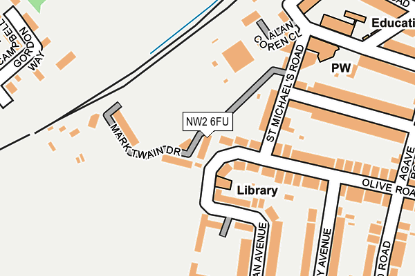
NW2 6FU is located in the Cricklewood & Mapesbury electoral ward, within the London borough of Brent and the English Parliamentary constituency of Brent Central. The Sub Integrated Care Board (ICB) Location is NHS North West London ICB - W2U3Z and the police force is Metropolitan Police. This postcode has been in use since June 2017.


GetTheData
Source: OS OpenMap – Local (Ordnance Survey)
Source: OS VectorMap District (Ordnance Survey)
Licence: Open Government Licence (requires attribution)
| Easting | 522957 |
| Northing | 185773 |
| Latitude | 51.557451 |
| Longitude | -0.227737 |
GetTheData
Source: Open Postcode Geo
Licence: Open Government Licence
| Country | England |
| Postcode District | NW2 |
➜ See where NW2 is on a map ➜ Where is London? | |
GetTheData
Source: Land Registry Price Paid Data
Licence: Open Government Licence
| Ward | Cricklewood & Mapesbury |
| Constituency | Brent Central |
GetTheData
Source: ONS Postcode Database
Licence: Open Government Licence
2023 18 JUL £815,000 |
2018 29 MAR £780,000 |
GetTheData
Source: HM Land Registry Price Paid Data
Licence: Contains HM Land Registry data © Crown copyright and database right 2025. This data is licensed under the Open Government Licence v3.0.
| The Gladstone Centre (Anson Road) | Dudden Hill | 284m |
| The Gladstone Centre (Anson Road) | Dudden Hill | 293m |
| Henson Avenue (Anson Road) | Dudden Hill | 337m |
| Henson Avenue (Anson Road) | Dudden Hill | 361m |
| Cullingworth Road (Kendal Road) | Dudden Hill | 433m |
| Dollis Hill Underground Station | Dudden Hill | 994m |
| Willesden Green Underground Station | Willesden Green | 1,020m |
| Cricklewood Station | 1.1km |
| Brondesbury Park Station | 2.2km |
| Brondesbury Station | 2.2km |
GetTheData
Source: NaPTAN
Licence: Open Government Licence
| Percentage of properties with Next Generation Access | 100.0% |
| Percentage of properties with Superfast Broadband | 100.0% |
| Percentage of properties with Ultrafast Broadband | 0.0% |
| Percentage of properties with Full Fibre Broadband | 0.0% |
Superfast Broadband is between 30Mbps and 300Mbps
Ultrafast Broadband is > 300Mbps
| Median download speed | 28.2Mbps |
| Average download speed | 29.3Mbps |
| Maximum download speed | 73.75Mbps |
| Median upload speed | 4.7Mbps |
| Average upload speed | 5.1Mbps |
| Maximum upload speed | 15.48Mbps |
| Percentage of properties unable to receive 2Mbps | 0.0% |
| Percentage of properties unable to receive 5Mbps | 0.0% |
| Percentage of properties unable to receive 10Mbps | 0.0% |
| Percentage of properties unable to receive 30Mbps | 0.0% |
GetTheData
Source: Ofcom
Licence: Ofcom Terms of Use (requires attribution)
GetTheData
Source: ONS Postcode Database
Licence: Open Government Licence


➜ Get more ratings from the Food Standards Agency
GetTheData
Source: Food Standards Agency
Licence: FSA terms & conditions
| Last Collection | |||
|---|---|---|---|
| Location | Mon-Fri | Sat | Distance |
| 160 Anson Road | 17:30 | 12:00 | 280m |
| Olive Road | 17:30 | 12:00 | 294m |
| Cambell Gordon Way | 17:30 | 12:00 | 338m |
GetTheData
Source: Dracos
Licence: Creative Commons Attribution-ShareAlike
The below table lists the International Territorial Level (ITL) codes (formerly Nomenclature of Territorial Units for Statistics (NUTS) codes) and Local Administrative Units (LAU) codes for NW2 6FU:
| ITL 1 Code | Name |
|---|---|
| TLI | London |
| ITL 2 Code | Name |
| TLI7 | Outer London - West and North West |
| ITL 3 Code | Name |
| TLI72 | Brent |
| LAU 1 Code | Name |
| E09000005 | Brent |
GetTheData
Source: ONS Postcode Directory
Licence: Open Government Licence
The below table lists the Census Output Area (OA), Lower Layer Super Output Area (LSOA), and Middle Layer Super Output Area (MSOA) for NW2 6FU:
| Code | Name | |
|---|---|---|
| OA | E00002697 | |
| LSOA | E01000554 | Brent 015B |
| MSOA | E02000107 | Brent 015 |
GetTheData
Source: ONS Postcode Directory
Licence: Open Government Licence
| NW2 6XA | Olive Road | 24m |
| NW2 6UX | Olive Road | 61m |
| NW2 6XB | Olive Road | 65m |
| NW2 6UY | Olive Road | 70m |
| NW2 6AY | Oman Avenue | 86m |
| NW2 6XE | St Michaels Road | 110m |
| NW2 6BD | Oman Avenue | 136m |
| NW2 6BE | Oman Avenue | 136m |
| NW2 6UU | Olive Road | 139m |
| NW2 6UT | Olive Road | 144m |
GetTheData
Source: Open Postcode Geo; Land Registry Price Paid Data
Licence: Open Government Licence