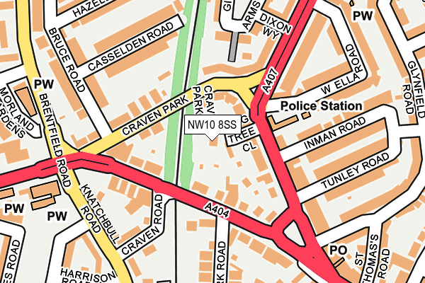
NW10 8SS lies on Craven Park Mews in London. NW10 8SS is located in the Roundwood electoral ward, within the London borough of Brent and the English Parliamentary constituency of Brent Central. The Sub Integrated Care Board (ICB) Location is NHS North West London ICB - W2U3Z and the police force is Metropolitan Police. This postcode has been in use since January 1980.


GetTheData
Source: OS OpenMap – Local (Ordnance Survey)
Source: OS VectorMap District (Ordnance Survey)
Licence: Open Government Licence (requires attribution)
| Easting | 521053 |
| Northing | 183973 |
| Latitude | 51.541683 |
| Longitude | -0.255832 |
GetTheData
Source: Open Postcode Geo
Licence: Open Government Licence
| Street | Craven Park Mews |
| Town/City | London |
| Country | England |
| Postcode District | NW10 |
➜ See where NW10 is on a map ➜ Where is London? | |
GetTheData
Source: Land Registry Price Paid Data
Licence: Open Government Licence
Elevation or altitude of NW10 8SS as distance above sea level:
| Metres | Feet | |
|---|---|---|
| Elevation | 40m | 131ft |
Elevation is measured from the approximate centre of the postcode, to the nearest point on an OS contour line from OS Terrain 50, which has contour spacing of ten vertical metres.
➜ How high above sea level am I? Find the elevation of your current position using your device's GPS.
GetTheData
Source: Open Postcode Elevation
Licence: Open Government Licence
| Ward | Roundwood |
| Constituency | Brent Central |
GetTheData
Source: ONS Postcode Database
Licence: Open Government Licence
12, CRAVEN PARK MEWS, LONDON, NW10 8SS 2015 12 MAR £270,855 |
GetTheData
Source: HM Land Registry Price Paid Data
Licence: Contains HM Land Registry data © Crown copyright and database right 2025. This data is licensed under the Open Government Licence v3.0.
| Craven Park | Stonebridge | 98m |
| Harlesden Police Station (Craven Park) | Stonebridge | 120m |
| Harlesden Police Station (Craven Park) | Stonebridge | 130m |
| Knatchbull Road (Craven Park) | Stonebridge | 136m |
| Knatchbull Road | Stonebridge | 137m |
| Harlesden Underground Station | Harlesden | 614m |
| Willesden Junction Underground Station | Willesden Junction | 1,320m |
| Stonebridge Park Underground Station | Stonebridge Park | 1,414m |
| Neasden Underground Station | Neasden | 1,430m |
| Dollis Hill Underground Station | Dudden Hill | 1,630m |
| Harlesden Station | 0.6km |
| Willesden Junction Station | 1.3km |
| Stonebridge Park Station | 1.4km |
GetTheData
Source: NaPTAN
Licence: Open Government Licence
GetTheData
Source: ONS Postcode Database
Licence: Open Government Licence


➜ Get more ratings from the Food Standards Agency
GetTheData
Source: Food Standards Agency
Licence: FSA terms & conditions
| Last Collection | |||
|---|---|---|---|
| Location | Mon-Fri | Sat | Distance |
| Craven Park Road | 17:30 | 12:00 | 81m |
| 50 Church Road | 17:30 | 12:00 | 248m |
| Craven Park Road Post Office | 18:30 | 12:00 | 251m |
GetTheData
Source: Dracos
Licence: Creative Commons Attribution-ShareAlike
The below table lists the International Territorial Level (ITL) codes (formerly Nomenclature of Territorial Units for Statistics (NUTS) codes) and Local Administrative Units (LAU) codes for NW10 8SS:
| ITL 1 Code | Name |
|---|---|
| TLI | London |
| ITL 2 Code | Name |
| TLI7 | Outer London - West and North West |
| ITL 3 Code | Name |
| TLI72 | Brent |
| LAU 1 Code | Name |
| E09000005 | Brent |
GetTheData
Source: ONS Postcode Directory
Licence: Open Government Licence
The below table lists the Census Output Area (OA), Lower Layer Super Output Area (LSOA), and Middle Layer Super Output Area (MSOA) for NW10 8SS:
| Code | Name | |
|---|---|---|
| OA | E00002536 | |
| LSOA | E01000528 | Brent 025F |
| MSOA | E02000117 | Brent 025 |
GetTheData
Source: ONS Postcode Directory
Licence: Open Government Licence
| NW10 8SR | Craven Park | 51m |
| NW10 8SU | Craven Park | 68m |
| NW10 8ST | Craven Park | 86m |
| NW10 8QJ | Craven Park | 94m |
| NW10 9AZ | Craven Park | 103m |
| NW10 8QH | Craven Park | 111m |
| NW10 8QL | Craven Park | 118m |
| NW10 8TD | Craven Park | 121m |
| NW10 8GJ | Craven Park | 132m |
| NW10 9BA | Church Road | 138m |
GetTheData
Source: Open Postcode Geo; Land Registry Price Paid Data
Licence: Open Government Licence