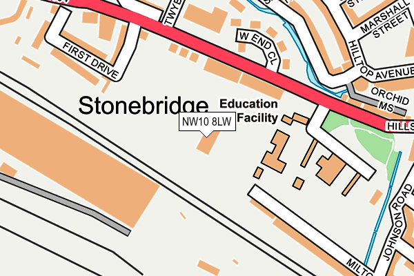
NW10 8LW is located in the Stonebridge electoral ward, within the London borough of Brent and the English Parliamentary constituency of Brent Central. The Sub Integrated Care Board (ICB) Location is NHS North West London ICB - W2U3Z and the police force is Metropolitan Police. This postcode has been in use since April 2007.


GetTheData
Source: OS OpenMap – Local (Ordnance Survey)
Source: OS VectorMap District (Ordnance Survey)
Licence: Open Government Licence (requires attribution)
| Easting | 520329 |
| Northing | 183887 |
| Latitude | 51.541064 |
| Longitude | -0.266296 |
GetTheData
Source: Open Postcode Geo
Licence: Open Government Licence
| Country | England |
| Postcode District | NW10 |
➜ See where NW10 is on a map ➜ Where is London? | |
GetTheData
Source: Land Registry Price Paid Data
Licence: Open Government Licence
Elevation or altitude of NW10 8LW as distance above sea level:
| Metres | Feet | |
|---|---|---|
| Elevation | 30m | 98ft |
Elevation is measured from the approximate centre of the postcode, to the nearest point on an OS contour line from OS Terrain 50, which has contour spacing of ten vertical metres.
➜ How high above sea level am I? Find the elevation of your current position using your device's GPS.
GetTheData
Source: Open Postcode Elevation
Licence: Open Government Licence
| Ward | Stonebridge |
| Constituency | Brent Central |
GetTheData
Source: ONS Postcode Database
Licence: Open Government Licence
| West End Close (Hillside) | Stonebridge | 129m |
| First Drive | Stonebridge | 182m |
| Sunny Crescent (Brentfield) | Stonebridge | 311m |
| Shakespeare Rd Stonebridge (Hillside) | Stonebridge | 324m |
| Shakespeare Rd Stonebridge (Hillside) | Stonebridge | 409m |
| Stonebridge Park Underground Station | Stonebridge Park | 739m |
| Harlesden Underground Station | Harlesden | 788m |
| Neasden Underground Station | Neasden | 1,835m |
| Stonebridge Park Station | 0.7km |
| Harlesden Station | 0.8km |
| Willesden Junction Station | 1.8km |
GetTheData
Source: NaPTAN
Licence: Open Government Licence
GetTheData
Source: ONS Postcode Database
Licence: Open Government Licence


➜ Get more ratings from the Food Standards Agency
GetTheData
Source: Food Standards Agency
Licence: FSA terms & conditions
| Last Collection | |||
|---|---|---|---|
| Location | Mon-Fri | Sat | Distance |
| Hillside/Barry Road | 17:30 | 12:00 | 151m |
| Fawood Avenue | 17:30 | 12:00 | 429m |
| Gloucester Close | 17:30 | 12:00 | 532m |
GetTheData
Source: Dracos
Licence: Creative Commons Attribution-ShareAlike
| Risk of NW10 8LW flooding from rivers and sea | Low |
| ➜ NW10 8LW flood map | |
GetTheData
Source: Open Flood Risk by Postcode
Licence: Open Government Licence
The below table lists the International Territorial Level (ITL) codes (formerly Nomenclature of Territorial Units for Statistics (NUTS) codes) and Local Administrative Units (LAU) codes for NW10 8LW:
| ITL 1 Code | Name |
|---|---|
| TLI | London |
| ITL 2 Code | Name |
| TLI7 | Outer London - West and North West |
| ITL 3 Code | Name |
| TLI72 | Brent |
| LAU 1 Code | Name |
| E09000005 | Brent |
GetTheData
Source: ONS Postcode Directory
Licence: Open Government Licence
The below table lists the Census Output Area (OA), Lower Layer Super Output Area (LSOA), and Middle Layer Super Output Area (MSOA) for NW10 8LW:
| Code | Name | |
|---|---|---|
| OA | E00002922 | |
| LSOA | E01033456 | Brent 027F |
| MSOA | E02000119 | Brent 027 |
GetTheData
Source: ONS Postcode Directory
Licence: Open Government Licence
| NW10 8LJ | Hillside | 101m |
| NW10 8LE | Hillside | 139m |
| NW10 8LP | West End Close | 179m |
| NW10 8PN | Albert Terrace | 203m |
| NW10 8LG | First Drive | 207m |
| NW10 8LQ | First Drive | 235m |
| NW10 8RY | Hilltop Avenue | 244m |
| NW10 0TA | Foxholt Gardens | 256m |
| NW10 0SX | Field Way | 294m |
| NW10 8RZ | Hilltop Avenue | 302m |
GetTheData
Source: Open Postcode Geo; Land Registry Price Paid Data
Licence: Open Government Licence