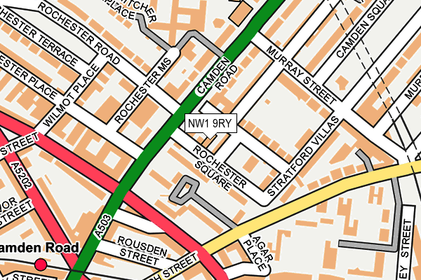
NW1 9RY is located in the Camden Square electoral ward, within the London borough of Camden and the English Parliamentary constituency of Holborn and St Pancras. The Sub Integrated Care Board (ICB) Location is NHS North Central London ICB - 93C and the police force is Metropolitan Police. This postcode has been in use since January 1980.


GetTheData
Source: OS OpenMap – Local (Ordnance Survey)
Source: OS VectorMap District (Ordnance Survey)
Licence: Open Government Licence (requires attribution)
| Easting | 529385 |
| Northing | 184374 |
| Latitude | 51.543440 |
| Longitude | -0.135605 |
GetTheData
Source: Open Postcode Geo
Licence: Open Government Licence
| Country | England |
| Postcode District | NW1 |
➜ See where NW1 is on a map ➜ Where is London? | |
GetTheData
Source: Land Registry Price Paid Data
Licence: Open Government Licence
Elevation or altitude of NW1 9RY as distance above sea level:
| Metres | Feet | |
|---|---|---|
| Elevation | 30m | 98ft |
Elevation is measured from the approximate centre of the postcode, to the nearest point on an OS contour line from OS Terrain 50, which has contour spacing of ten vertical metres.
➜ How high above sea level am I? Find the elevation of your current position using your device's GPS.
GetTheData
Source: Open Postcode Elevation
Licence: Open Government Licence
| Ward | Camden Square |
| Constituency | Holborn And St Pancras |
GetTheData
Source: ONS Postcode Database
Licence: Open Government Licence
| Murray Street | Camden Town | 77m |
| Murray Street | Camden Town | 92m |
| St Pancras Way (Camden Road) | Camden Town | 113m |
| St Pancras Way | Camden Town | 138m |
| Agar Grove Estate (Agar Grove) | Camden Town | 141m |
| Camden Town Underground Station | Camden Town | 677m |
| Kentish Town Underground Station | Kentish Town | 843m |
| Mornington Crescent Underground Station | Mornington Crescent | 999m |
| Chalk Farm Underground Station | Chalk Farm | 1,236m |
| Caledonian Road Underground Station | Caledonian Road | 1,314m |
| Camden Road Station | 0.3km |
| Kentish Town West Station | 0.8km |
| Kentish Town Station | 0.9km |
GetTheData
Source: NaPTAN
Licence: Open Government Licence
GetTheData
Source: ONS Postcode Database
Licence: Open Government Licence


➜ Get more ratings from the Food Standards Agency
GetTheData
Source: Food Standards Agency
Licence: FSA terms & conditions
| Last Collection | |||
|---|---|---|---|
| Location | Mon-Fri | Sat | Distance |
| Agar Grove (Manston Flats) | 19:00 | 13:00 | 142m |
| Royal College Street | 19:00 | 13:00 | 269m |
| St. Pancras Way | 19:00 | 13:00 | 314m |
GetTheData
Source: Dracos
Licence: Creative Commons Attribution-ShareAlike
The below table lists the International Territorial Level (ITL) codes (formerly Nomenclature of Territorial Units for Statistics (NUTS) codes) and Local Administrative Units (LAU) codes for NW1 9RY:
| ITL 1 Code | Name |
|---|---|
| TLI | London |
| ITL 2 Code | Name |
| TLI3 | Inner London - West |
| ITL 3 Code | Name |
| TLI31 | Camden and City of London |
| LAU 1 Code | Name |
| E09000007 | Camden |
GetTheData
Source: ONS Postcode Directory
Licence: Open Government Licence
The below table lists the Census Output Area (OA), Lower Layer Super Output Area (LSOA), and Middle Layer Super Output Area (MSOA) for NW1 9RY:
| Code | Name | |
|---|---|---|
| OA | E00004250 | |
| LSOA | E01000865 | Camden 015B |
| MSOA | E02000180 | Camden 015 |
GetTheData
Source: ONS Postcode Directory
Licence: Open Government Licence
| NW1 9RZ | Rochester Square | 18m |
| NW1 9HP | Camden Road | 38m |
| NW1 9HU | Camden Road | 38m |
| NW1 9EL | Rochester Square | 50m |
| NW1 9EJ | Rochester Square | 53m |
| NW1 9HS | Rochester Square | 61m |
| NW1 9SD | Rochester Square | 63m |
| NW1 9SA | Rochester Square | 73m |
| NW1 9EH | St Pancras Way | 90m |
| NW1 9EX | Camden Road | 96m |
GetTheData
Source: Open Postcode Geo; Land Registry Price Paid Data
Licence: Open Government Licence