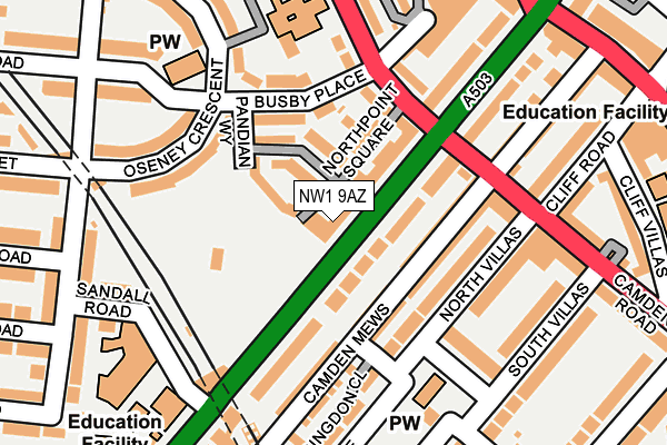
NW1 9AZ is located in the Kentish Town South electoral ward, within the London borough of Camden and the English Parliamentary constituency of Holborn and St Pancras. The Sub Integrated Care Board (ICB) Location is NHS North Central London ICB - 93C and the police force is Metropolitan Police. This postcode has been in use since February 2005.


GetTheData
Source: OS OpenMap – Local (Ordnance Survey)
Source: OS VectorMap District (Ordnance Survey)
Licence: Open Government Licence (requires attribution)
| Easting | 529630 |
| Northing | 184790 |
| Latitude | 51.547122 |
| Longitude | -0.131921 |
GetTheData
Source: Open Postcode Geo
Licence: Open Government Licence
| Country | England |
| Postcode District | NW1 |
➜ See where NW1 is on a map ➜ Where is London? | |
GetTheData
Source: Land Registry Price Paid Data
Licence: Open Government Licence
Elevation or altitude of NW1 9AZ as distance above sea level:
| Metres | Feet | |
|---|---|---|
| Elevation | 40m | 131ft |
Elevation is measured from the approximate centre of the postcode, to the nearest point on an OS contour line from OS Terrain 50, which has contour spacing of ten vertical metres.
➜ How high above sea level am I? Find the elevation of your current position using your device's GPS.
GetTheData
Source: Open Postcode Elevation
Licence: Open Government Licence
| Ward | Kentish Town South |
| Constituency | Holborn And St Pancras |
GetTheData
Source: ONS Postcode Database
Licence: Open Government Licence
| Camden Park Road | Kentish Town | 32m |
| Torriano Avenue | Kentish Town | 47m |
| Sandall Road | Kentish Town | 147m |
| Camden Road Kentish Town (Camden Park Road) | Kentish Town | 151m |
| Torriano Primary School (Torriano Avenue) | Kentish Town | 203m |
| Kentish Town Underground Station | Kentish Town | 707m |
| Caledonian Road Underground Station | Caledonian Road | 944m |
| Camden Town Underground Station | Camden Town | 1,150m |
| Tufnell Park Underground Station | Tufnell Park | 1,170m |
| Holloway Road Underground Station | Holloway Road | 1,436m |
| Kentish Town Station | 0.7km |
| Camden Road Station | 0.8km |
| Kentish Town West Station | 1km |
GetTheData
Source: NaPTAN
Licence: Open Government Licence
| Percentage of properties with Next Generation Access | 100.0% |
| Percentage of properties with Superfast Broadband | 100.0% |
| Percentage of properties with Ultrafast Broadband | 0.0% |
| Percentage of properties with Full Fibre Broadband | 0.0% |
Superfast Broadband is between 30Mbps and 300Mbps
Ultrafast Broadband is > 300Mbps
| Percentage of properties unable to receive 2Mbps | 0.0% |
| Percentage of properties unable to receive 5Mbps | 0.0% |
| Percentage of properties unable to receive 10Mbps | 0.0% |
| Percentage of properties unable to receive 30Mbps | 0.0% |
GetTheData
Source: Ofcom
Licence: Ofcom Terms of Use (requires attribution)
Estimated total energy consumption in NW1 9AZ by fuel type, 2015.
| Consumption (kWh) | 23,991 |
|---|---|
| Meter count | 6 |
| Mean (kWh/meter) | 3,999 |
| Median (kWh/meter) | 3,134 |
GetTheData
Source: Postcode level gas estimates: 2015 (experimental)
Source: Postcode level electricity estimates: 2015 (experimental)
Licence: Open Government Licence
GetTheData
Source: ONS Postcode Database
Licence: Open Government Licence


➜ Get more ratings from the Food Standards Agency
GetTheData
Source: Food Standards Agency
Licence: FSA terms & conditions
| Last Collection | |||
|---|---|---|---|
| Location | Mon-Fri | Sat | Distance |
| Oseney Crescent | 17:30 | 12:00 | 153m |
| Camden Terrace | 19:00 | 13:00 | 177m |
| Burghley Road Junction | 17:30 | 12:00 | 259m |
GetTheData
Source: Dracos
Licence: Creative Commons Attribution-ShareAlike
The below table lists the International Territorial Level (ITL) codes (formerly Nomenclature of Territorial Units for Statistics (NUTS) codes) and Local Administrative Units (LAU) codes for NW1 9AZ:
| ITL 1 Code | Name |
|---|---|
| TLI | London |
| ITL 2 Code | Name |
| TLI3 | Inner London - West |
| ITL 3 Code | Name |
| TLI31 | Camden and City of London |
| LAU 1 Code | Name |
| E09000007 | Camden |
GetTheData
Source: ONS Postcode Directory
Licence: Open Government Licence
The below table lists the Census Output Area (OA), Lower Layer Super Output Area (LSOA), and Middle Layer Super Output Area (MSOA) for NW1 9AZ:
| Code | Name | |
|---|---|---|
| OA | E00174657 | |
| LSOA | E01000869 | Camden 015E |
| MSOA | E02000180 | Camden 015 |
GetTheData
Source: ONS Postcode Directory
Licence: Open Government Licence
| NW1 9BD | Caledonian Square | 18m |
| NW1 9HE | Camden Road | 45m |
| NW1 9AQ | Canal Boulevard | 59m |
| NW1 9BU | Camden Mews | 75m |
| NW1 9AW | Northpoint Square | 77m |
| NW5 2SQ | Busby Mews | 91m |
| NW1 9AD | Lock Mews | 92m |
| NW1 9BX | Camden Mews | 96m |
| NW5 2SR | Busby Place | 105m |
| NW1 9BJ | North Villas | 110m |
GetTheData
Source: Open Postcode Geo; Land Registry Price Paid Data
Licence: Open Government Licence