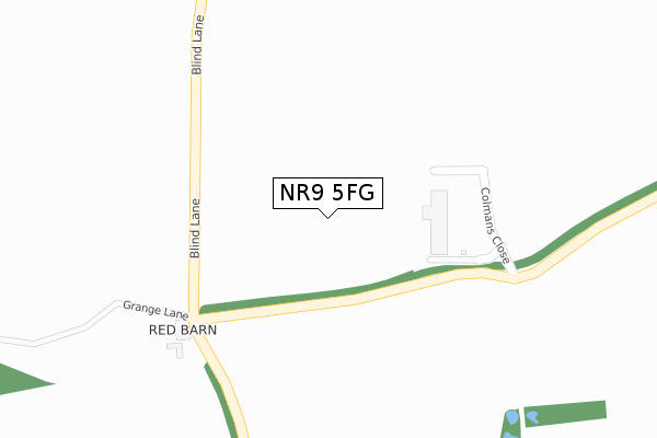
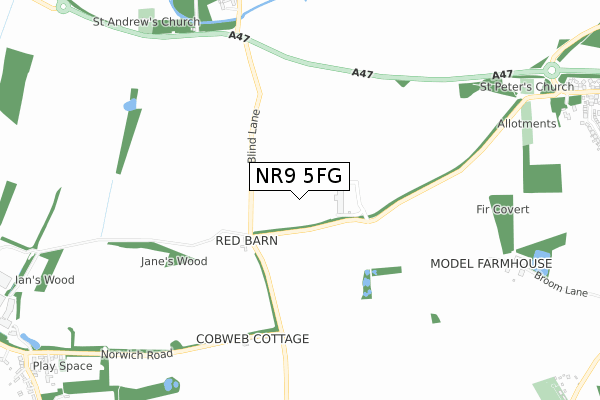
NR9 5FG is located in the Great Witchingham electoral ward, within the local authority district of Broadland and the English Parliamentary constituency of Broadland. The Sub Integrated Care Board (ICB) Location is NHS Norfolk and Waveney ICB - 26A and the police force is Norfolk. This postcode has been in use since April 2020.


GetTheData
Source: OS Open Zoomstack (Ordnance Survey)
Licence: Open Government Licence (requires attribution)
Attribution: Contains OS data © Crown copyright and database right 2025
Source: Open Postcode Geo
Licence: Open Government Licence (requires attribution)
Attribution: Contains OS data © Crown copyright and database right 2025; Contains Royal Mail data © Royal Mail copyright and database right 2025; Source: Office for National Statistics licensed under the Open Government Licence v.3.0
| Easting | 612230 |
| Northing | 310488 |
| Latitude | 52.650602 |
| Longitude | 1.136042 |
GetTheData
Source: Open Postcode Geo
Licence: Open Government Licence
| Country | England |
| Postcode District | NR9 |
➜ See where NR9 is on a map | |
GetTheData
Source: Land Registry Price Paid Data
Licence: Open Government Licence
| Ward | Great Witchingham |
| Constituency | Broadland |
GetTheData
Source: ONS Postcode Database
Licence: Open Government Licence
| Chez Denis (Dereham Road) | Easton | 1,311m |
| Village Hall (Norwich Road) | Colton | 1,328m |
| Village Hall (Norwich Road) | Colton | 1,343m |
| Chez Denis (Dereham Road) | Easton | 1,412m |
| Faircroft (The Street) | Colton | 1,458m |
GetTheData
Source: NaPTAN
Licence: Open Government Licence
GetTheData
Source: ONS Postcode Database
Licence: Open Government Licence


➜ Get more ratings from the Food Standards Agency
GetTheData
Source: Food Standards Agency
Licence: FSA terms & conditions
| Last Collection | |||
|---|---|---|---|
| Location | Mon-Fri | Sat | Distance |
| Norwich Road / Village Hall | 17:15 | 10:45 | 1,328m |
| Marlingford Road (Former Po) | 17:00 | 10:30 | 1,362m |
| Bawburgh Lane | 17:00 | 08:15 | 1,831m |
GetTheData
Source: Dracos
Licence: Creative Commons Attribution-ShareAlike
The below table lists the International Territorial Level (ITL) codes (formerly Nomenclature of Territorial Units for Statistics (NUTS) codes) and Local Administrative Units (LAU) codes for NR9 5FG:
| ITL 1 Code | Name |
|---|---|
| TLH | East |
| ITL 2 Code | Name |
| TLH1 | East Anglia |
| ITL 3 Code | Name |
| TLH15 | Norwich and East Norfolk |
| LAU 1 Code | Name |
| E07000144 | Broadland |
GetTheData
Source: ONS Postcode Directory
Licence: Open Government Licence
The below table lists the Census Output Area (OA), Lower Layer Super Output Area (LSOA), and Middle Layer Super Output Area (MSOA) for NR9 5FG:
| Code | Name | |
|---|---|---|
| OA | E00134783 | |
| LSOA | E01026524 | Broadland 002C |
| MSOA | E02005521 | Broadland 002 |
GetTheData
Source: ONS Postcode Directory
Licence: Open Government Licence
| NR9 5BX | Norwich Road | 677m |
| NR9 5EU | Woodview Road | 1143m |
| NR9 5EZ | Kennedy Close | 1163m |
| NR9 5EY | Kennedy Close | 1179m |
| NR9 5ES | Dereham Road | 1195m |
| NR9 5DF | Dereham Road | 1208m |
| NR9 5HF | St Peters Drive | 1250m |
| NR9 5DW | Buxton Close | 1265m |
| NR9 5DP | John Howes Close | 1305m |
| NR9 5DR | Marlingford Road | 1315m |
GetTheData
Source: Open Postcode Geo; Land Registry Price Paid Data
Licence: Open Government Licence