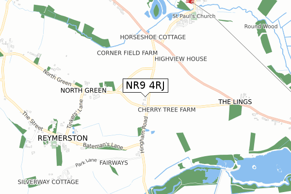
NR9 4RJ is located in the Mattishall electoral ward, within the local authority district of Breckland and the English Parliamentary constituency of Mid Norfolk. The Sub Integrated Care Board (ICB) Location is NHS Norfolk and Waveney ICB - 26A and the police force is Norfolk. This postcode has been in use since September 2018.


GetTheData
Source: OS Open Zoomstack (Ordnance Survey)
Licence: Open Government Licence (requires attribution)
Attribution: Contains OS data © Crown copyright and database right 2024
Source: Open Postcode Geo
Licence: Open Government Licence (requires attribution)
Attribution: Contains OS data © Crown copyright and database right 2024; Contains Royal Mail data © Royal Mail copyright and database right 2024; Source: Office for National Statistics licensed under the Open Government Licence v.3.0
| Easting | 602821 |
| Northing | 306414 |
| Latitude | 52.617624 |
| Longitude | 0.994657 |
GetTheData
Source: Open Postcode Geo
Licence: Open Government Licence
| Country | England |
| Postcode District | NR9 |
➜ See where NR9 is on a map | |
GetTheData
Source: Land Registry Price Paid Data
Licence: Open Government Licence
| Ward | Mattishall |
| Constituency | Mid Norfolk |
GetTheData
Source: ONS Postcode Database
Licence: Open Government Licence
| Thuxton Cottages (Dereham Road) | Garvestone | 517m |
| Tinkers Lane (North Green) | Reymerston | 526m |
| Thuxton Cottages (Dereham Road) | Garvestone | 527m |
| Tinkers Lane (North Green) | Reymerston | 535m |
| Church (The Street) | Reymerston | 839m |
GetTheData
Source: NaPTAN
Licence: Open Government Licence
GetTheData
Source: ONS Postcode Database
Licence: Open Government Licence


➜ Get more ratings from the Food Standards Agency
GetTheData
Source: Food Standards Agency
Licence: FSA terms & conditions
| Last Collection | |||
|---|---|---|---|
| Location | Mon-Fri | Sat | Distance |
| The Station | 16:45 | 09:00 | 889m |
| Norwich Road Post Office | 16:45 | 10:15 | 1,265m |
| Blackwater Crossroads | 16:30 | 08:15 | 1,516m |
GetTheData
Source: Dracos
Licence: Creative Commons Attribution-ShareAlike
The below table lists the International Territorial Level (ITL) codes (formerly Nomenclature of Territorial Units for Statistics (NUTS) codes) and Local Administrative Units (LAU) codes for NR9 4RJ:
| ITL 1 Code | Name |
|---|---|
| TLH | East |
| ITL 2 Code | Name |
| TLH1 | East Anglia |
| ITL 3 Code | Name |
| TLH17 | Breckland and South Norfolk |
| LAU 1 Code | Name |
| E07000143 | Breckland |
GetTheData
Source: ONS Postcode Directory
Licence: Open Government Licence
The below table lists the Census Output Area (OA), Lower Layer Super Output Area (LSOA), and Middle Layer Super Output Area (MSOA) for NR9 4RJ:
| Code | Name | |
|---|---|---|
| OA | E00134587 | |
| LSOA | E01026484 | Breckland 006D |
| MSOA | E02005508 | Breckland 006 |
GetTheData
Source: ONS Postcode Directory
Licence: Open Government Licence
| NR9 4PU | Crabapple Lane | 172m |
| NR9 4QF | Shipdham Road | 214m |
| NR9 4QH | Dereham Road | 439m |
| NR9 4RD | North Green | 804m |
| NR9 4RE | Batemans Lane | 805m |
| NR9 4RB | Silver Street | 808m |
| NR9 4EU | Park Lane | 931m |
| NR9 4AG | The Street | 935m |
| NR9 4QJ | 972m | |
| NR9 4RA | Post Office Lane | 1056m |
GetTheData
Source: Open Postcode Geo; Land Registry Price Paid Data
Licence: Open Government Licence