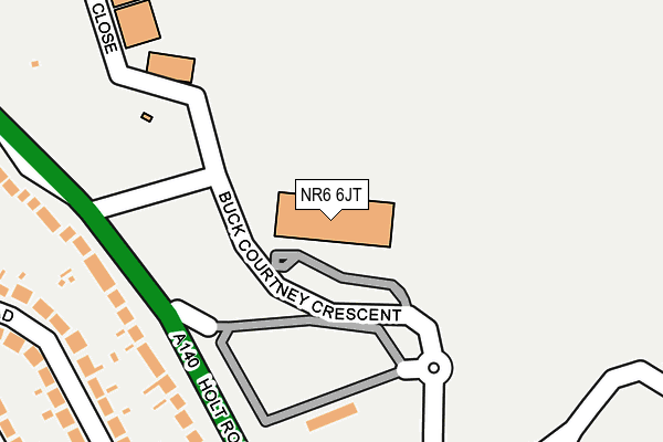
NR6 6JT is located in the Catton Grove electoral ward, within the local authority district of Norwich and the English Parliamentary constituency of Norwich North. The Sub Integrated Care Board (ICB) Location is NHS Norfolk and Waveney ICB - 26A and the police force is Norfolk. This postcode has been in use since December 1998.


GetTheData
Source: OS OpenMap – Local (Ordnance Survey)
Source: OS VectorMap District (Ordnance Survey)
Licence: Open Government Licence (requires attribution)
| Easting | 621321 |
| Northing | 313184 |
| Latitude | 52.671145 |
| Longitude | 1.271988 |
GetTheData
Source: Open Postcode Geo
Licence: Open Government Licence
| Country | England |
| Postcode District | NR6 |
➜ See where NR6 is on a map ➜ Where is Norwich? | |
GetTheData
Source: Land Registry Price Paid Data
Licence: Open Government Licence
Elevation or altitude of NR6 6JT as distance above sea level:
| Metres | Feet | |
|---|---|---|
| Elevation | 30m | 98ft |
Elevation is measured from the approximate centre of the postcode, to the nearest point on an OS contour line from OS Terrain 50, which has contour spacing of ten vertical metres.
➜ How high above sea level am I? Find the elevation of your current position using your device's GPS.
GetTheData
Source: Open Postcode Elevation
Licence: Open Government Licence
| Ward | Catton Grove |
| Constituency | Norwich North |
GetTheData
Source: ONS Postcode Database
Licence: Open Government Licence
| Airport Park & Ride (Amsterdam Way) | Hellesdon | 180m |
| Passenger Terminal (Amsterdam Way) | Norwich International Airport | 335m |
| Dennis Road (Bush Road) | Hellesdon | 338m |
| Gowing Road (Raymond Road) | Hellesdon | 439m |
| Tesco Express (Cromer Road) | Hellesdon | 549m |
| Norwich Station | 5.4km |
GetTheData
Source: NaPTAN
Licence: Open Government Licence
GetTheData
Source: ONS Postcode Database
Licence: Open Government Licence


➜ Get more ratings from the Food Standards Agency
GetTheData
Source: Food Standards Agency
Licence: FSA terms & conditions
| Last Collection | |||
|---|---|---|---|
| Location | Mon-Fri | Sat | Distance |
| Bush Road | 18:30 | 11:00 | 357m |
| Airport Terminal | 18:30 | 11:00 | 394m |
| Gowing Road | 18:30 | 11:00 | 448m |
GetTheData
Source: Dracos
Licence: Creative Commons Attribution-ShareAlike
The below table lists the International Territorial Level (ITL) codes (formerly Nomenclature of Territorial Units for Statistics (NUTS) codes) and Local Administrative Units (LAU) codes for NR6 6JT:
| ITL 1 Code | Name |
|---|---|
| TLH | East |
| ITL 2 Code | Name |
| TLH1 | East Anglia |
| ITL 3 Code | Name |
| TLH15 | Norwich and East Norfolk |
| LAU 1 Code | Name |
| E07000148 | Norwich |
GetTheData
Source: ONS Postcode Directory
Licence: Open Government Licence
The below table lists the Census Output Area (OA), Lower Layer Super Output Area (LSOA), and Middle Layer Super Output Area (MSOA) for NR6 6JT:
| Code | Name | |
|---|---|---|
| OA | E00173834 | |
| LSOA | E01026797 | Norwich 001A |
| MSOA | E02005584 | Norwich 001 |
GetTheData
Source: ONS Postcode Directory
Licence: Open Government Licence
| NR6 6UA | Holt Road | 242m |
| NR6 6UF | Bush Road | 303m |
| NR6 5NE | Middletons Lane | 321m |
| NR6 6UE | Bush Road | 342m |
| NR6 6UB | Dennis Road | 350m |
| NR6 6XS | Holt Road | 409m |
| NR6 6PL | Raymond Road | 423m |
| NR6 6UQ | Gowing Road | 435m |
| NR6 6UD | Bush Road | 440m |
| NR6 6BB | Delft Way | 470m |
GetTheData
Source: Open Postcode Geo; Land Registry Price Paid Data
Licence: Open Government Licence