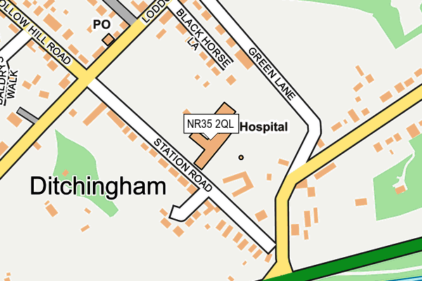
NR35 2QL is located in the Ditchingham & Earsham electoral ward, within the local authority district of South Norfolk and the English Parliamentary constituency of South Norfolk. The Sub Integrated Care Board (ICB) Location is NHS Norfolk and Waveney ICB - 26A and the police force is Norfolk. This postcode has been in use since January 1980.


GetTheData
Source: OS OpenMap – Local (Ordnance Survey)
Source: OS VectorMap District (Ordnance Survey)
Licence: Open Government Licence (requires attribution)
| Easting | 634218 |
| Northing | 291007 |
| Latitude | 52.466749 |
| Longitude | 1.446746 |
GetTheData
Source: Open Postcode Geo
Licence: Open Government Licence
| Country | England |
| Postcode District | NR35 |
➜ See where NR35 is on a map ➜ Where is Ditchingham? | |
GetTheData
Source: Land Registry Price Paid Data
Licence: Open Government Licence
Elevation or altitude of NR35 2QL as distance above sea level:
| Metres | Feet | |
|---|---|---|
| Elevation | 10m | 33ft |
Elevation is measured from the approximate centre of the postcode, to the nearest point on an OS contour line from OS Terrain 50, which has contour spacing of ten vertical metres.
➜ How high above sea level am I? Find the elevation of your current position using your device's GPS.
GetTheData
Source: Open Postcode Elevation
Licence: Open Government Licence
| Ward | Ditchingham & Earsham |
| Constituency | South Norfolk |
GetTheData
Source: ONS Postcode Database
Licence: Open Government Licence
| Stores (Loddon Road) | Ditchingham | 172m |
| Stores (Loddon Road) | Ditchingham | 179m |
| Village Hall (Loddon Road) | Ditchingham | 224m |
| Village Hall (Loddon Road) | Ditchingham | 231m |
| Wood Close (Hollow Hill Road) | Ditchingham | 239m |
GetTheData
Source: NaPTAN
Licence: Open Government Licence
GetTheData
Source: ONS Postcode Database
Licence: Open Government Licence


➜ Get more ratings from the Food Standards Agency
GetTheData
Source: Food Standards Agency
Licence: FSA terms & conditions
| Last Collection | |||
|---|---|---|---|
| Location | Mon-Fri | Sat | Distance |
| Station Road | 17:00 | 07:30 | 198m |
| Hallow Hill Road Post Office | 16:45 | 10:00 | 296m |
| Duke Of York | 17:00 | 10:00 | 402m |
GetTheData
Source: Dracos
Licence: Creative Commons Attribution-ShareAlike
The below table lists the International Territorial Level (ITL) codes (formerly Nomenclature of Territorial Units for Statistics (NUTS) codes) and Local Administrative Units (LAU) codes for NR35 2QL:
| ITL 1 Code | Name |
|---|---|
| TLH | East |
| ITL 2 Code | Name |
| TLH1 | East Anglia |
| ITL 3 Code | Name |
| TLH17 | Breckland and South Norfolk |
| LAU 1 Code | Name |
| E07000149 | South Norfolk |
GetTheData
Source: ONS Postcode Directory
Licence: Open Government Licence
The below table lists the Census Output Area (OA), Lower Layer Super Output Area (LSOA), and Middle Layer Super Output Area (MSOA) for NR35 2QL:
| Code | Name | |
|---|---|---|
| OA | E00136784 | |
| LSOA | E01026893 | South Norfolk 012B |
| MSOA | E02005608 | South Norfolk 012 |
GetTheData
Source: ONS Postcode Directory
Licence: Open Government Licence
| NR35 2RB | Black Horse Lane | 87m |
| NR35 2QW | Station Road | 115m |
| NR35 2RD | Green Lane | 117m |
| NR35 2QB | Lamberts Way | 164m |
| NR35 2QN | Loddon Road | 220m |
| NR35 2RA | Loddon Road | 261m |
| NR35 2QZ | Hollow Hill Road | 288m |
| NR35 2QY | Loddon Road | 294m |
| NR35 2QS | The Loke | 313m |
| NR35 2RT | Alma Cottages | 316m |
GetTheData
Source: Open Postcode Geo; Land Registry Price Paid Data
Licence: Open Government Licence